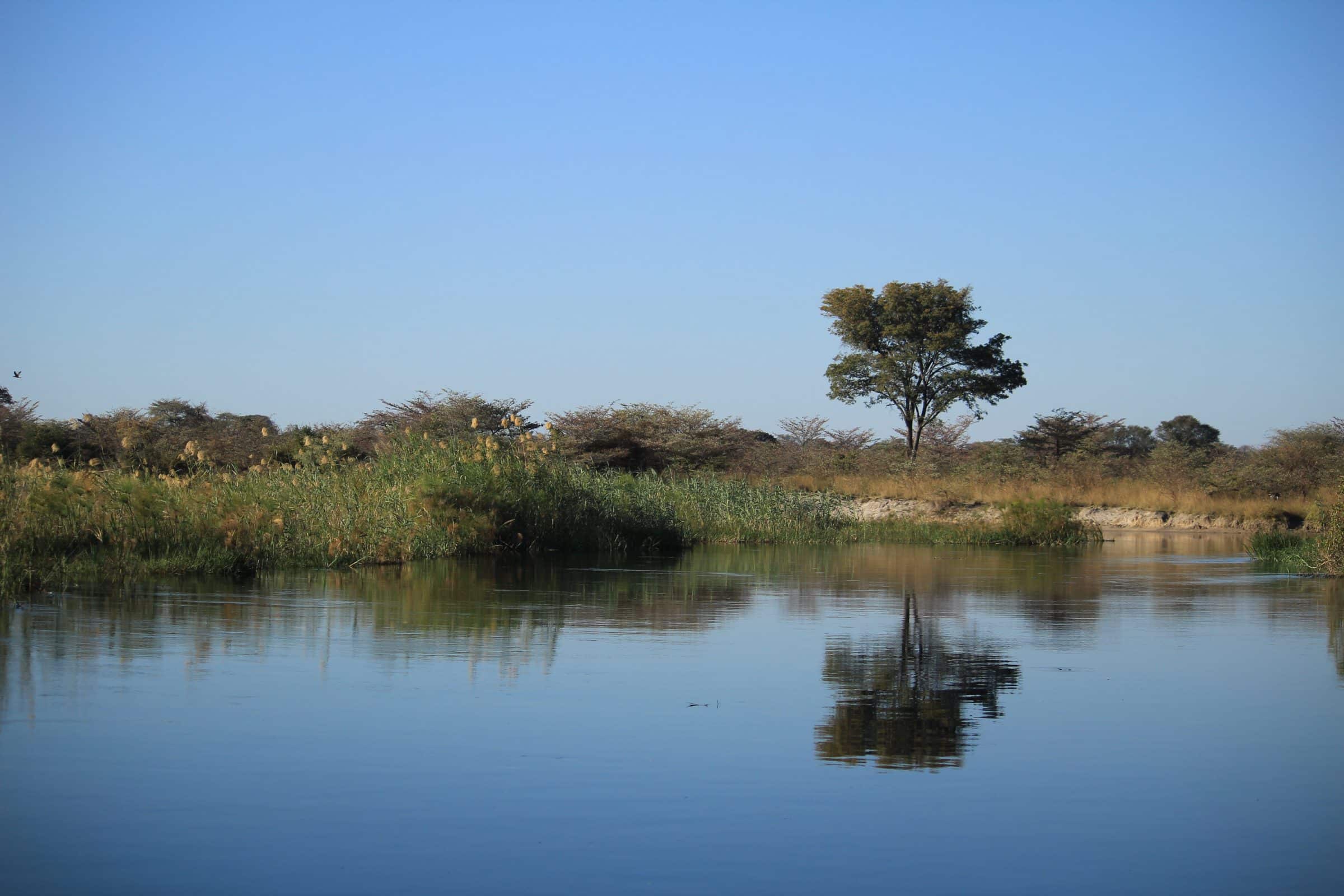
Namibia is mainly known for its large water shortages. Yet this is in the northernmost part of Namibia, the Caprivi Strip, totally different. Here you can find many rivers that always carry water with them. Historically, this piece has not always belonged to Namibia. In this article I will tell you (briefly) the history of this part of Namibia and what you can see and do there.
Also read: Itinerary Namibia in 2, 3, 4 or 5 weeks | Must sees and example routes
Also read: Preparation trip to Namibia | Best travel time, packing list and more
History of the Caprivi Strip
The Caprivi Strip grew out of colonial madness. Namibia used to be a colony of Germany, this was not the only colony because also in East Africa Germany had a colony. In between, she wanted to build a strong base to the east of Africa. In 1890 Zanzibar traded for the Caprivi Strip. The Caprivi Strip had many rivers that flow here compared to the rest of Namibia which is very dry. Since 2013, the Caprivi Strip has been divided into 2 regions, namely Zambezi en Kavango east.
This strange piece of land lies in the north bordering Angola and Zambia, to the south Botswana and only a few miles away from Zimbabwe† This piece of land is very important for the migration of animals that migrate between the different countries. The western picture of Africa (wooden or straw huts, people carrying water on their heads, selling fruit and vegetables along the road and animals hiding along the road between the bushes) can still really be found here. It looks more like the surrounding countries than the rest of Namibia, so this is also a special piece Namibia.
Stopover in Nhoma towards Caprivi Strip
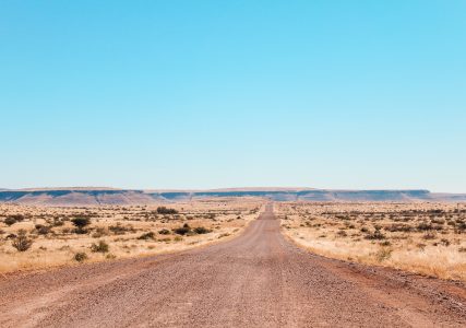
From the capital Windhoek it's a long drive to the Caprivi Strip. The road there is good and asphalted. The distance from Windhoek to Rundu (start of Caprivi Strip) is approximately 800 kilometers. To break this slightly, there is a nice stopover and ultimately more fun route to the Caprivi Strip. The village is located about 600 kilometers from Windhoek in the northeast of Namibia Books, near the larger town Tsumwke.
Also read: Top 10 Things to Do in Windhoek
Tip: refuel in Grootfontein, because petrol or diesel is not always available in Tsumwke.
Wereldreizigers.nl
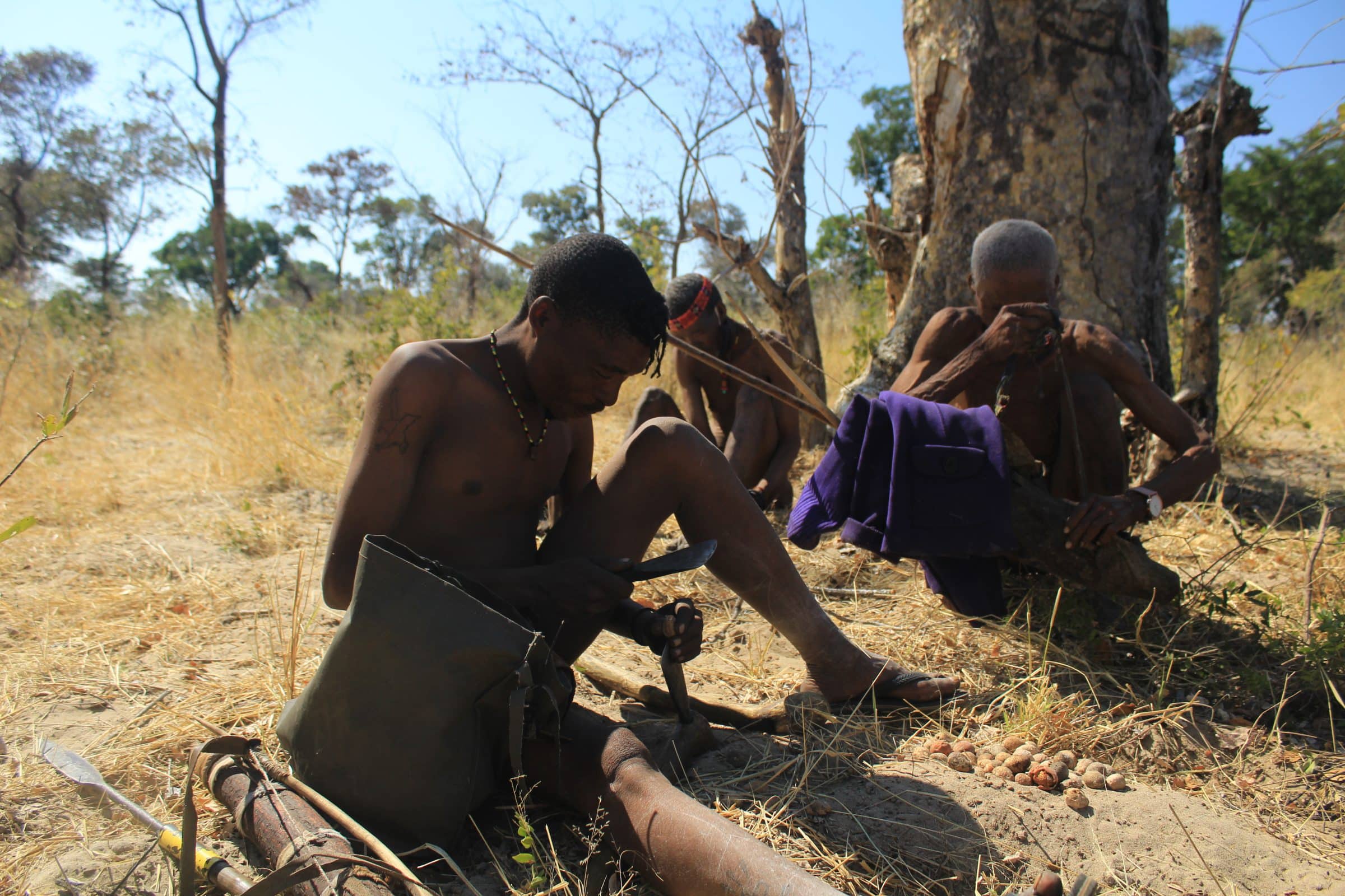
Nhoma Safari Camp and the Bushmen
From time immemorial live here the bushmen also called the San tribe. They still manage all the land in this area and still live fairly traditionally. The camp is located on part of this land: Nhoma Safari Camp† Next to the camp is another village of the San. The activities at this camp are therefore based on the daily life of the San. This includes hunting and making spears for hunting. You will also be introduced to the culture of the San and their customs, norms and values.
Khaudum National Park
North of Tsumwke is the most remote national park of Namibia, Khaudum National Park. You can only enter this park with 4×4 car and you must be together with at least 2 cars so that you can help each other when problems arise. This is because the roads contain a lot of loose sand and you can easily get stuck here. There are 2 campsites in the national park, but be self-sufficient and have more than enough water and food with you. Water and food is scarce in this region…
After this you can drive from south to north and take a good look around you because all the wild animals that occur in Namibia also live here. This will bring you back to the large asphalt road to the Caprivi Strip.
Divundu and surroundings
The next bigger town is Divide† At the moment (July 2021) a new shopping center is being built here, so that Divundu is growing from a village to a town. Since a few years there is also a gas station that is open 24/7. All this ensures that it increasingly attracts tourists not only to drive past but also to stop here and spend the night. Divundu is seen as the start of the Caprivi-Strip as the many rivers flow with water here.
In Divundu there are several sights to see. The town is located between several national parks, which means that the wildlife is very close. To the east is the great Bwabwata National Park where the whole big five lives. The major roads can be driven by yourself. The smaller roads must be visited with a guide. The national park does not have large open plains like Etosha National Park, but is fairly densely vegetated, making the animals sometimes difficult to find. To the south of Divundu is the Mahango National Park† This is a very small national park that you can drive through yourself. This National Park is connected to the Bwabwata National Park through which the animals can cross.
Those who would like to see the Big Five can sign up at Ndhovu Safari Lodge† From here game drives can be made to the Bwabwata National Park, so there is a good chance that the big five will be found.
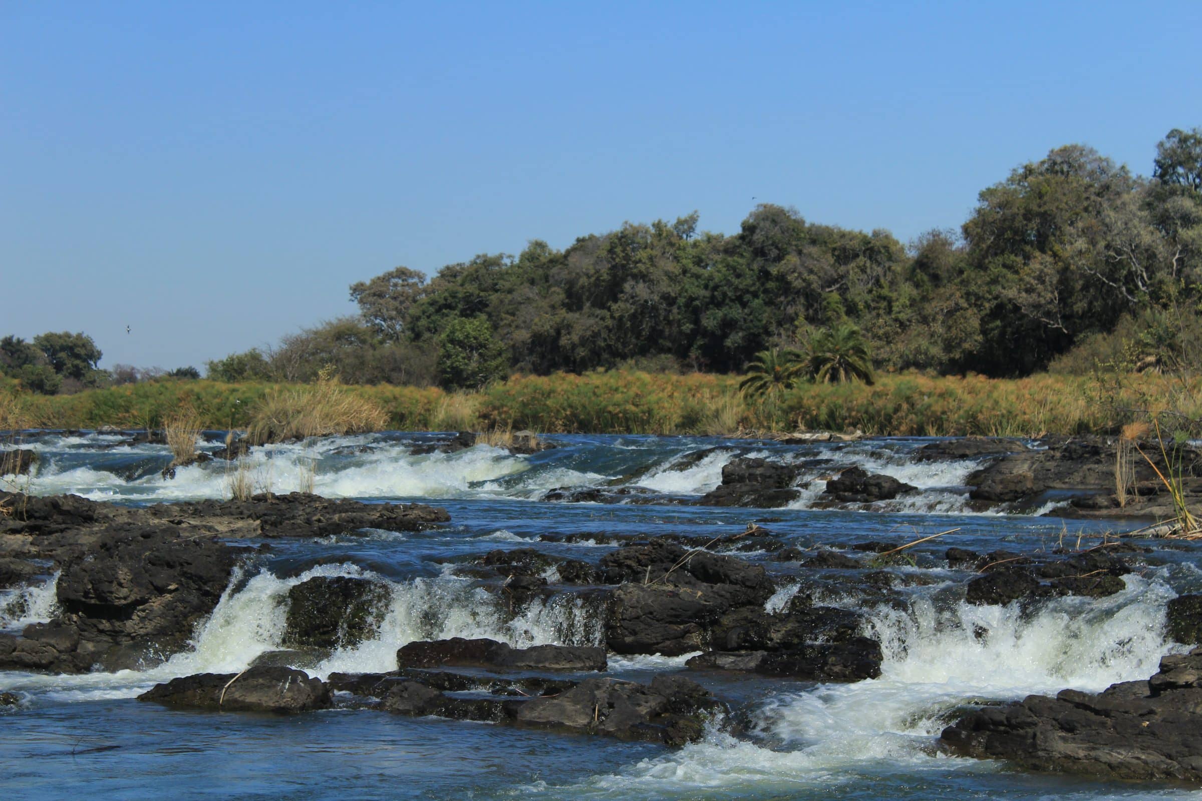
The 2 national parks are separated by the Okavango River. It comes south from Angola and ends in the world famous Okavango Delta† The river runs only 20 kilometers through Namibia. The famous Popa Falls are also located in this part. These are best viewed from White Sands Lodge & Camping† They are now (July 2021) still building a restaurant and the lodge, but as a day visitor you can already go here. You will receive a guide from the parking lot (included in the price) who will explain to you about the origin of the falls and what the consequences of the shortage of water will be in the future.
Congo and surroundings
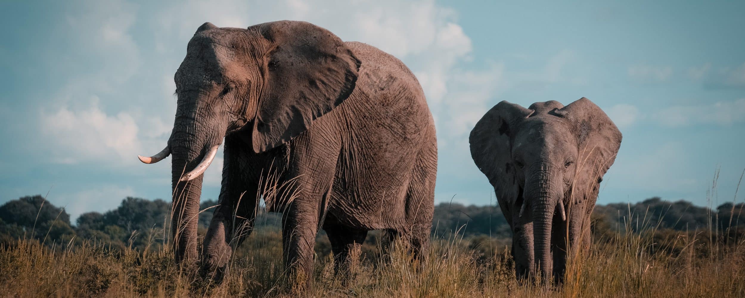
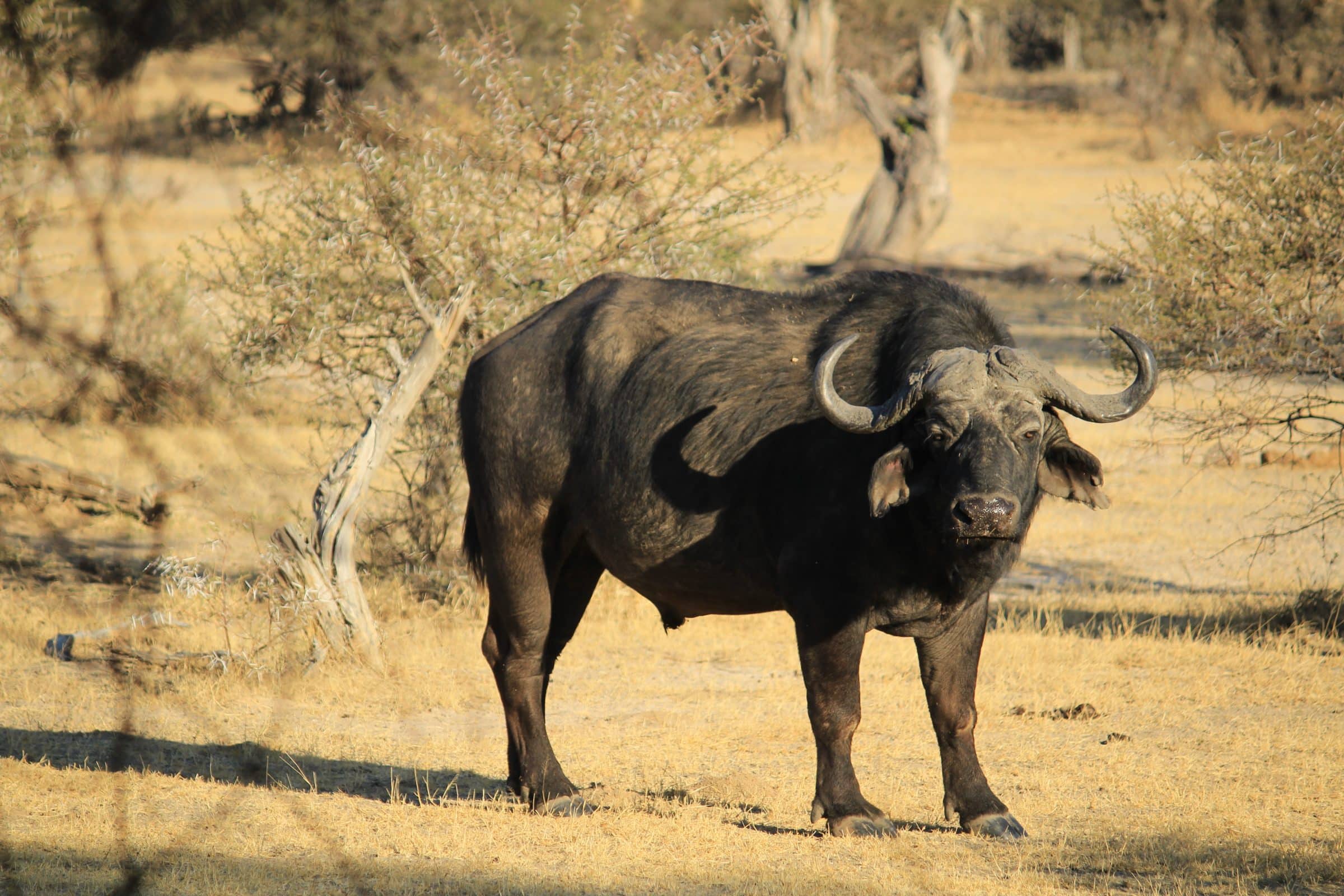
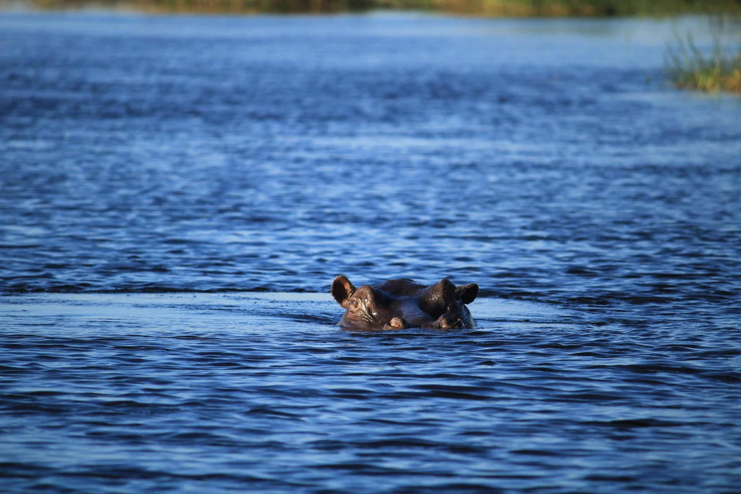
On the other side of the Bwabwata National Park is the town Congo, deeper and deeper into the Caprivi Strip. The town of Kongola consists of a gas station, souvenir shop and 2 small supermarkets (no fresh products). Past the town of Kongola flows the river Kwando which flows through to Botswana. South of the town are many lodges on the edge of the Kwando River. What makes the Kwando River so special is that it is home to many hippos, crocodiles, elephants, buffalo and various impala species. Take a boat trip in the afternoon and hopefully you'll see them all. A game drive into Bwabwata National Park can also be arranged through one of the lodges, which also offers opportunities to spot the large land animals.
Chobe National Park
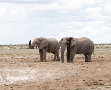
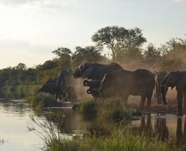
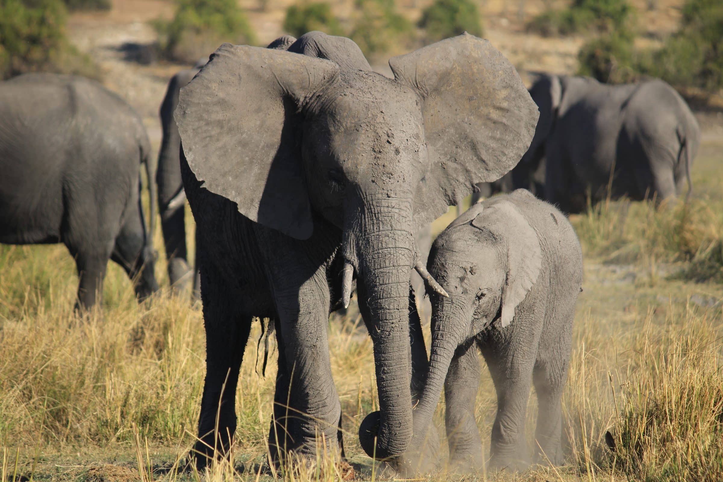
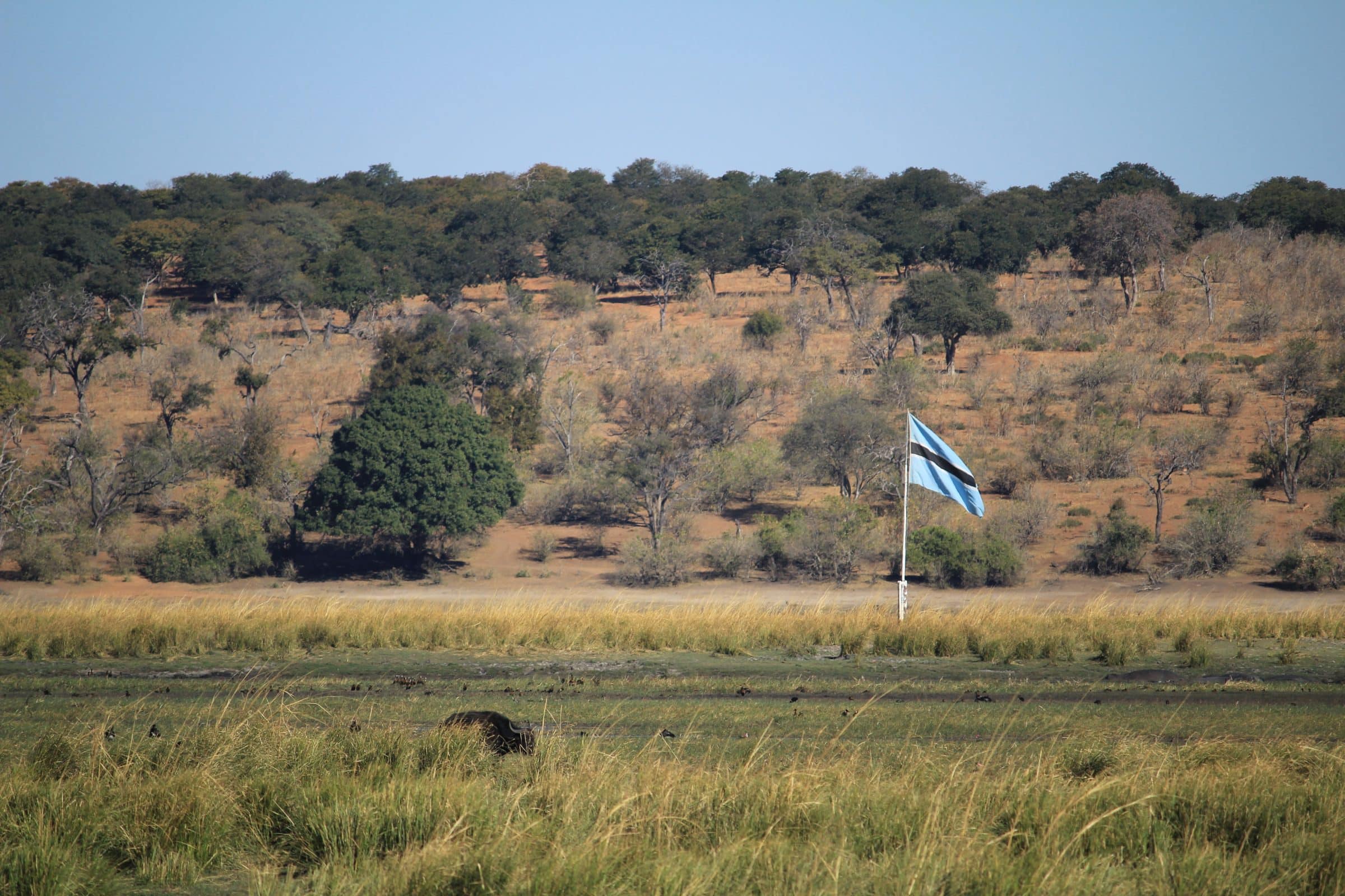
Officially it is Chobe National Park in Botswana but borders Namibia. The Chobe River is the border between Botswana and Namibia. The Chobe National Park is known for its many elephants that come to drink at the river in the afternoon. There are several lodges on the Namibian side that overlook the Chobe River and the National Park. A good example of this is Chobe Water Villas this one overlooks Sedudu Island. To get here you have to be picked up via a boat over the Chobe, or drive off-road with locals who show you the way.
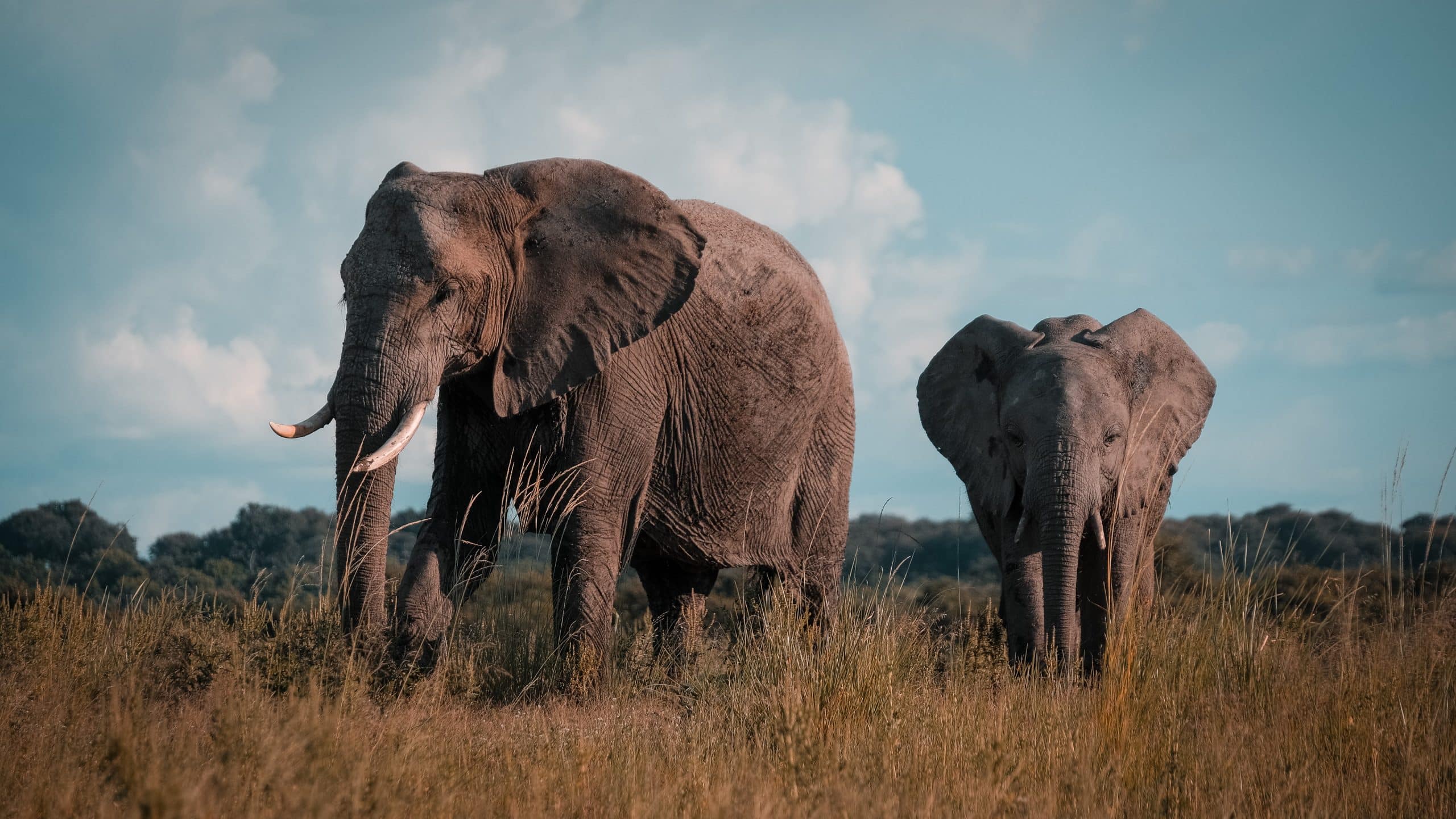
Sedudu Island is the island in the Chobe where many animals graze throughout the day and whole families come to eat elephants in the afternoon. On the other side is kasane the centerpiece of Chobe National Park in Botswana. In the months of August to October, the elephants move from Chobe National Park in Botswana through the Chobe River to Namibia. This is a stopover for the elephants to continue migrating to Zambia.
The four-country point
You are now in the easternmost tip of Namibia. In this corner 4 countries come together: Zambia, Zimbabwe, Botswana en Namibia† This also makes it easy to make a day trip to the Victoria Falls, which is located on the border with Zimbabwe and Zambia. From Kasane there are several providers of day trips to the Victoria Falls on the side of Zimbabwe. On this side the Victoria Falls are the most visible and also the most beautiful. Keep in mind: border crossings in Africa are always time-consuming and patience is required.
Also read: Worldly | How many countries does Africa have? List of countries + number of inatives
Tip: Do you follow our Namibia travel & backpacking Facebook group of?