How exactly are we on the Great Divide Trail (GDT)? Then we have to go back in time, a flashback to June '22.
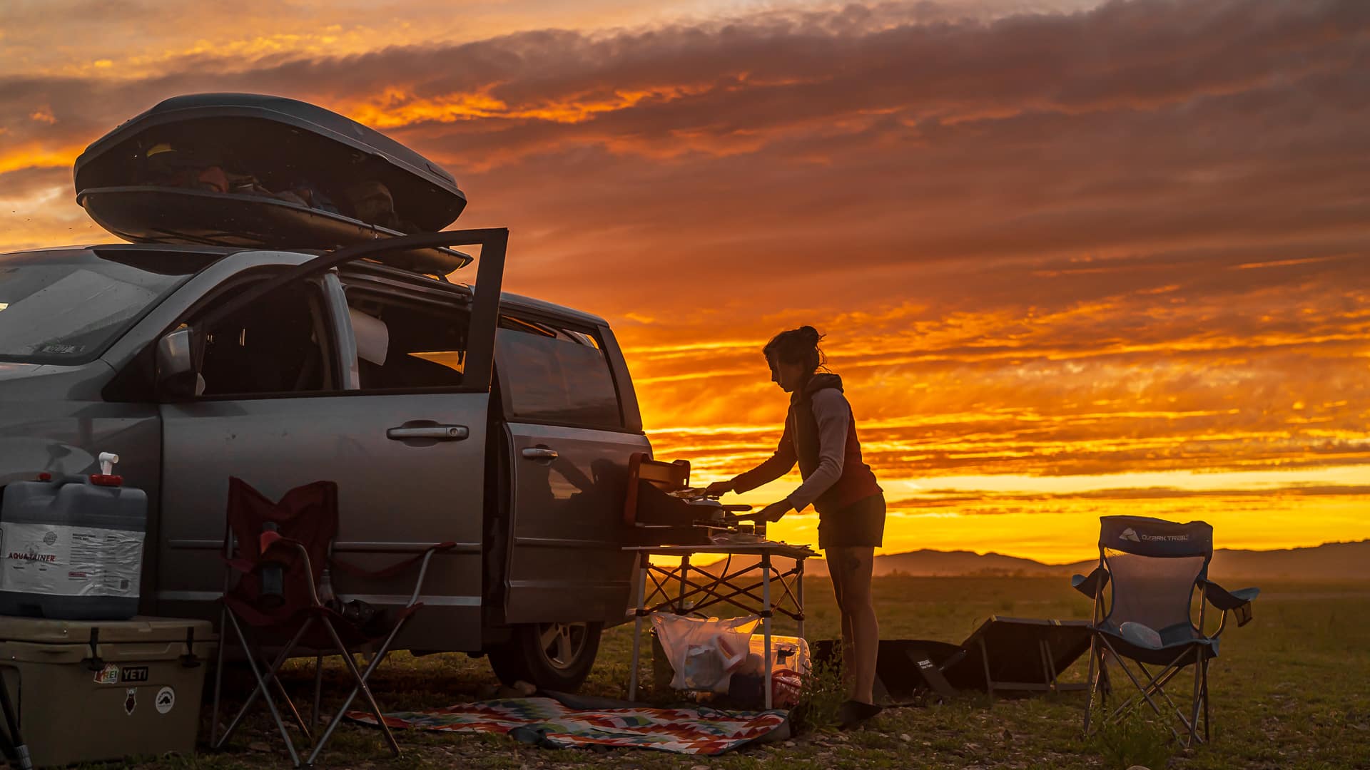
My friend Ryan and I were talking pet sitting on Marnie the Cat in a beautiful villa in Prescott, Arizona. Every few weeks we are happy to look after a house and its pets, for free and for nothing. It's a nice change for us to take a break off road and enjoy showers, washing machines and seats. We have been living together in a Dodge minivan since April '22. Although we have a lot of fun with van life, it feels good to be in a house once in a while.
Also read: Alternative travel | Housesitting: What is it and how does it work?
Summer was about to break out and except for a happy reunion with my dear niece in Glacier National Park in Montana, there wasn't much planned yet… We missed adventure and challenge. So we pulled out the map and caught our eye Canada...
Plan your vacation to Canada here
- Camper trips compare to Travelhome from ANWB.
- Itineraries : TUI, canada plus, sawadee.
- Winter sports in Canada book yourself OAD.nl.
- Flight tickets For Canada you can book via Skyscanner.
- Rental cars : Sunnycars, Alamo en rental cars.
- Tours and Activities in Canada you book through GetYourGuide.
- Campsites in National Parks you book on Park Canada.
- Hotels & Resorts in Canada you book with Booking.com.
- Travel insurance for Canada you close at Allianz.
- SIM cards en e-sims for Canada you buy at International sim.
- Parking at the airport you can arrange via Parkos, Central parking of iParking.
- travel items (you can order suitcases, world plug adapters, etc Bol.com.
Canada and the Continental Divide
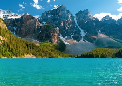
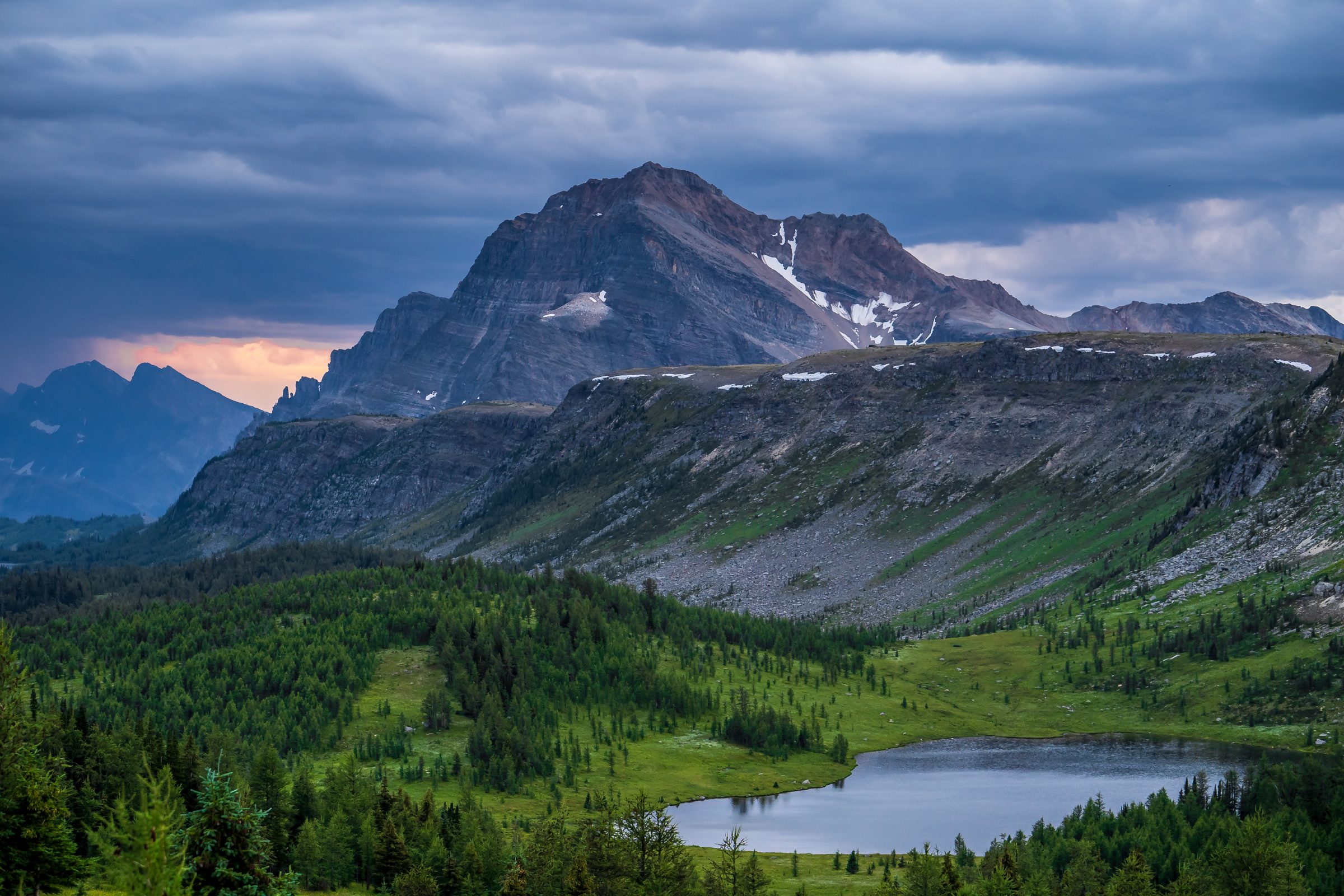
North of Glacier National Park (Location here) is Waterton Lakes National Park (Location here), sister park of Glacier but on the Canadian side. We saw the Rockies before us, the majestic mountain range that North America rich. The high mountains are the continental divide, the well-known watershed between the rivers. Any rain or snow that drains on the east side will flow to the Atlantic Ocean. Water on the west side flows towards Pacific.
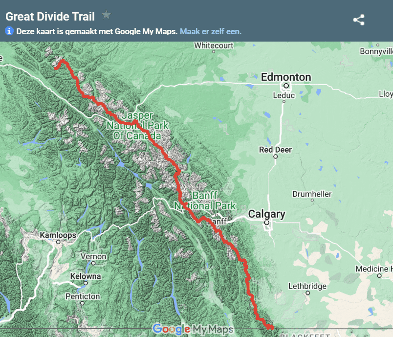
After much research and study of maps, we saw a dotted line that follows the Continental Divide for no less than 1100 km… The dotted line was aptly named “Great Divide Trail”. We fell in love immediately!
What is the Great Divide Trail?
The Great Divide Trail begins in Waterton Lakes National Park, literally on the border with Canada and the USA. Then you walk north. The hike literally follows the backbone of the Rocky Mountains. For 2 months you will hike the high mountains and cross the continental divide no less than 33 times (!) about. You commute back and forth between the provinces Alberta en British Columbia.
Also read: Worldly | How many continents are there? 5, 6, 7 or 8?
After 1100 km the Great Divide Trail ends in Kakwa Provincial Park (Location here), a gem of a wilderness park. You can take that term literally: Kakwa park prohibits motorized vehicles in the summer. You can only follow the 100 km-long path to the entrance of the park on foot, by bicycle or horse. In this way 1100 km become 1200. But what is now? 100 km on a smooth path after trekking 1100 km in the wilderness? “Piece of cake!” we thought… And so we started our preparations for this wilderness adventure.
Challenges and preparations
1. Hiking through the Wilderness: Navigation
The Great Divide Trail is a little different from its peers. Where at the Pacific Crest Trail en Appalachian Trail – almost – there is always a nicely marked trail with many markings to follow, Canada does things a little differently… Canadian hikers prefer it a bit wilder: No or few trails, many bushwhacking (cutting off), alternative routes, climbing, descending, scrambling and crossing wild rivers without a bridge.
Navigation is therefore very important on this trip. You can't have enough cards (both online and offline) with you. The path often disappears, so you have to orientate purely on your environment.
Tip: Download the app Far Out. This app has offline maps of many long distance walks including the Great Divide Trail. The app also tells you where there are sleeping spots, water and obstacles. So very handy.
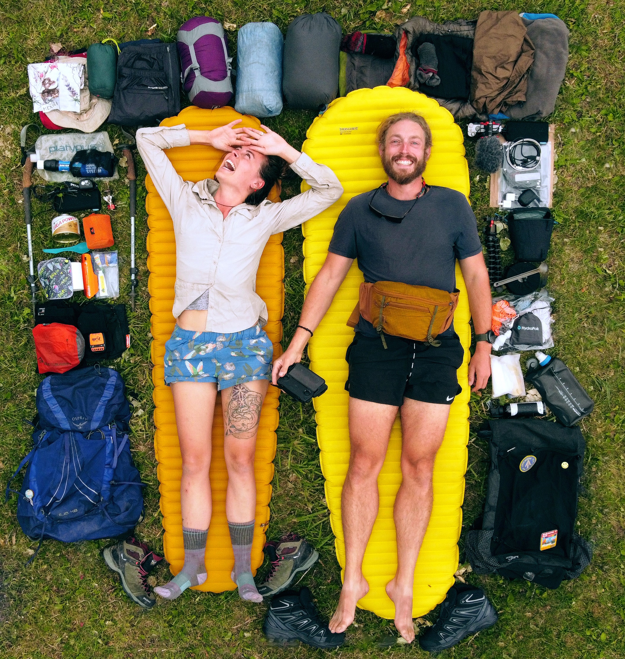
2. Energy consumption and eating strategy
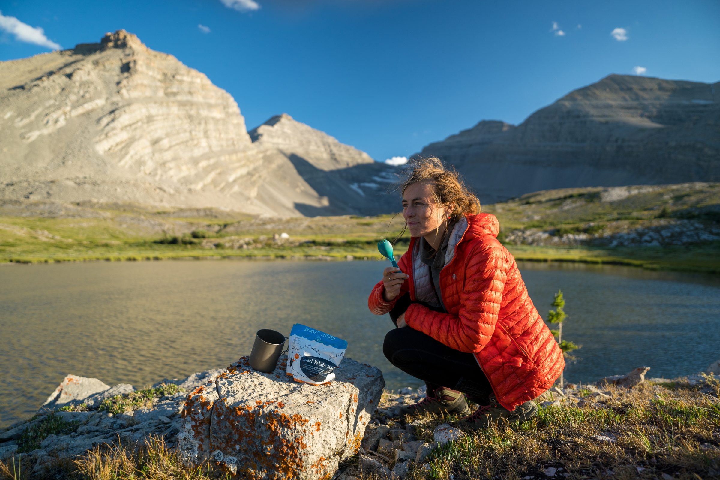
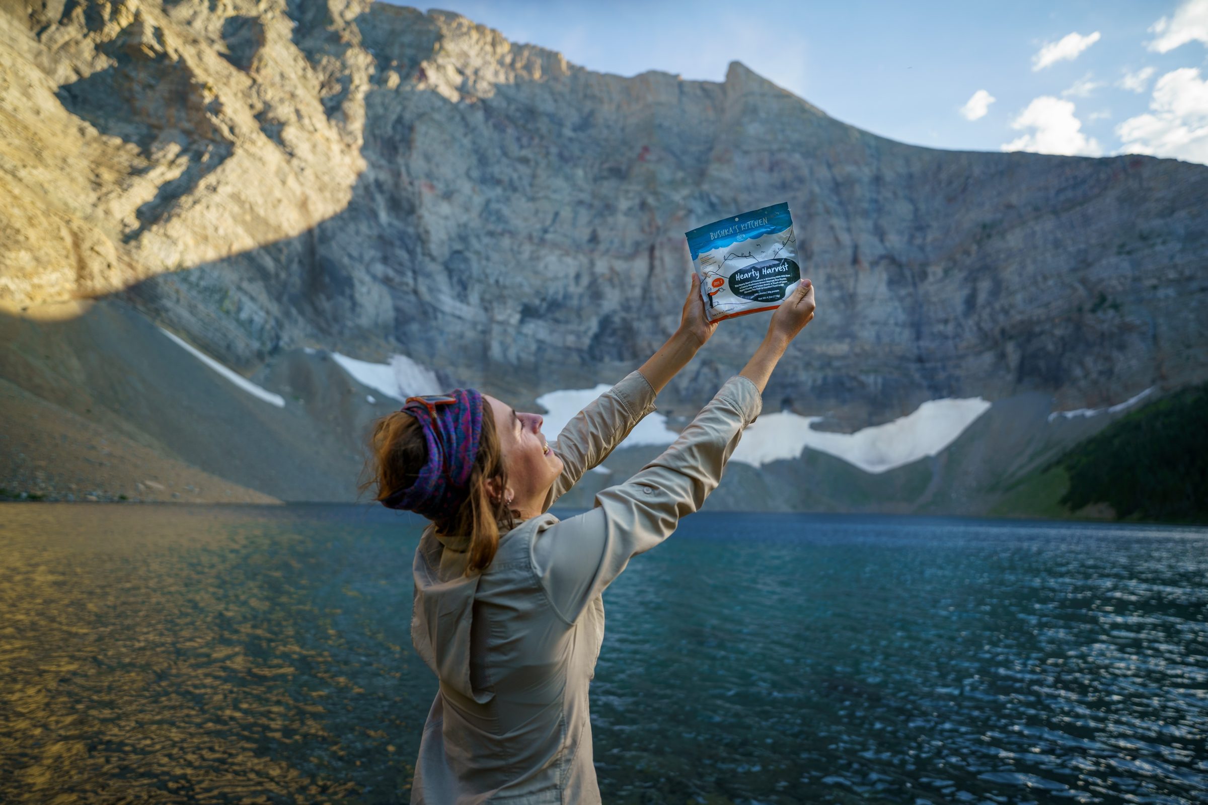
When looking at the maps we quickly knew: This is a walk where we would burn more calories than usual. The high climbs and long descents would cost us a lot of energy and calories. In order to keep walking and not let our bodies be fatally exhausted, we had to find a good eating strategy. Not easy, since you 1) carry everything on your back and 2) the distances between villages are sometimes 2 weeks. That means we should carry food for at least two weeks… Ouch.
Enough calories
It certainly hurt when we lifted our heavily loaded backpacks and continued walking. But it was necessary and every day our backpacks got a little lighter. Our diet consisted mainly of instant noodles (lunch and dinner), peanut butter granola bars (breakfast and snack), instant mashed potatoes, and beef jerky or tuna. These meals are well filled with fat and calories and strengthened us enough for the next kilometers.
The importance of electrolytes
We also diluted our water with electrolytes, both liquid and in powder form. Electrolytes are standard on the menu of all athletes and athletes, and are often found in the diet of hikers and climbers. It's mainly a collection of salts, something you lose to a large extent when you hike in the heat with a heavy backpack… To make up for all your lost sweat – and salt – electrolytes are important to prevent dehydration and exhaustion.
Last but not least ...
A good tip to have in your backpack: Candy! Candy is of course not healthy, but it is full of sugar and can help you through difficult moments. At the end of the day, after about 10 hours of hiking – when the last stretch really weighs heavily – it was always candy that kept us awake.
3. The right clothes and supplies
What do you need to have with you to survive two months? Well, amazingly, you don't need that much. We love the feeling of having everything you need in you backpack to have. It's a kind of freedom that you can hardly match. But as beautiful as the Rocky Mountains are, they can also be a dangerous place. That is why it is necessary to bring the right gear and clothes, so that you can play safely in the mountains.
The unpredictable weather in the mountains
Perhaps you have already traveled through Canada in the summer. Well, then you know that it can be nice and warm here in July and August. There was even talk of a heat wave as we drove into the country! But in the mountains it is a little different. We had beautiful, sun-filled days in August – but it often cooled off at night. A good, warm sleeping bag or quilt is very important to keep your body warm in the tent.
Although Canada is often nice and warm in the summer, the icy rivers, rain showers and snow storms would cool us down. Even in summer it is important to prepare for all possible weather conditions.
Clothing: Warm, wool and little
That's why we brought good rain gear and warm merino wool clothes. Everything still as light and light as possible, but these layers are much needed to keep your body warm in the cold. The rain gear is of course very helpful in case of rain showers, wet leaves and icy winds. The warm merino wool layers, also known as thermal underwear, help keep your body warm and dry.
We also brought three pairs of socks, shorts, a shirt and a fleece sweater as an extra layer. Gloves and hat also came in handy. And even without our buff and sunglasses we would have given up.
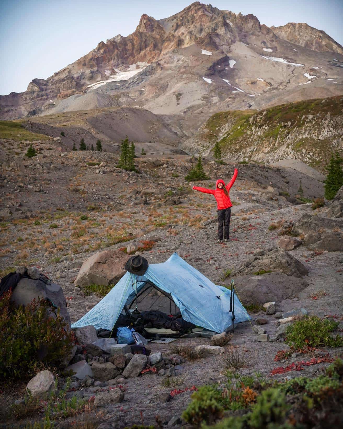
The Big Three
To make your trek as comfortable as possible, it's best a good tent and/or tarp, MEASUREMENTS en sleeping bag select. It is these three that will keep you comfortable and warm at night and recharge your batteries for the next hiking day.
Some prefer the safety of a tent (read: no bugs), others like the freedom of a tarp. In nice weather you can choose to cowboy camping (sleeping under the stars)! Yes, very romantic and fun, but on long hikes you better take a tent or tarp with you to cope with all weather conditions. If it's raining or windy, you're better off with some shelter.
The Great Divide Trail
We contacted other hikers and joined a Facebook group. It was difficult to find much information about this walk, so it is a good idea to do it the "old fashioned way"; send people a message or e-mail, asking for more info and tips. This is how we got to know Melissa from Calgary and we were allowed to park our car in her driveway for 2 months.
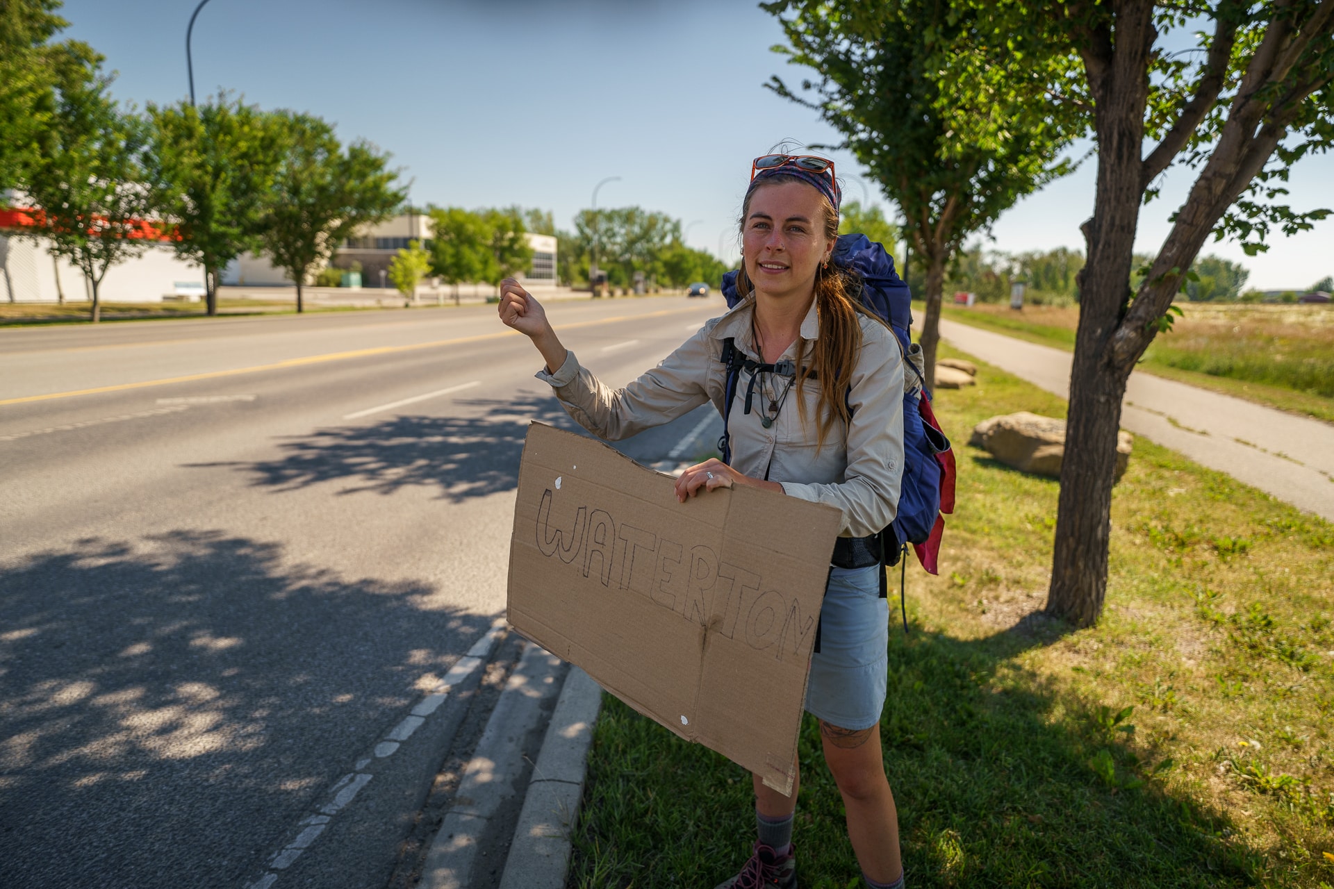
With only our backpacks we hitchhiked from Calgary to Waterton Lakes. 4 long car rides later we arrived in Waterton Lakes NP in the evening. We set up our tent and went to sleep with many butterflies in our stomach.
The start of the GDT
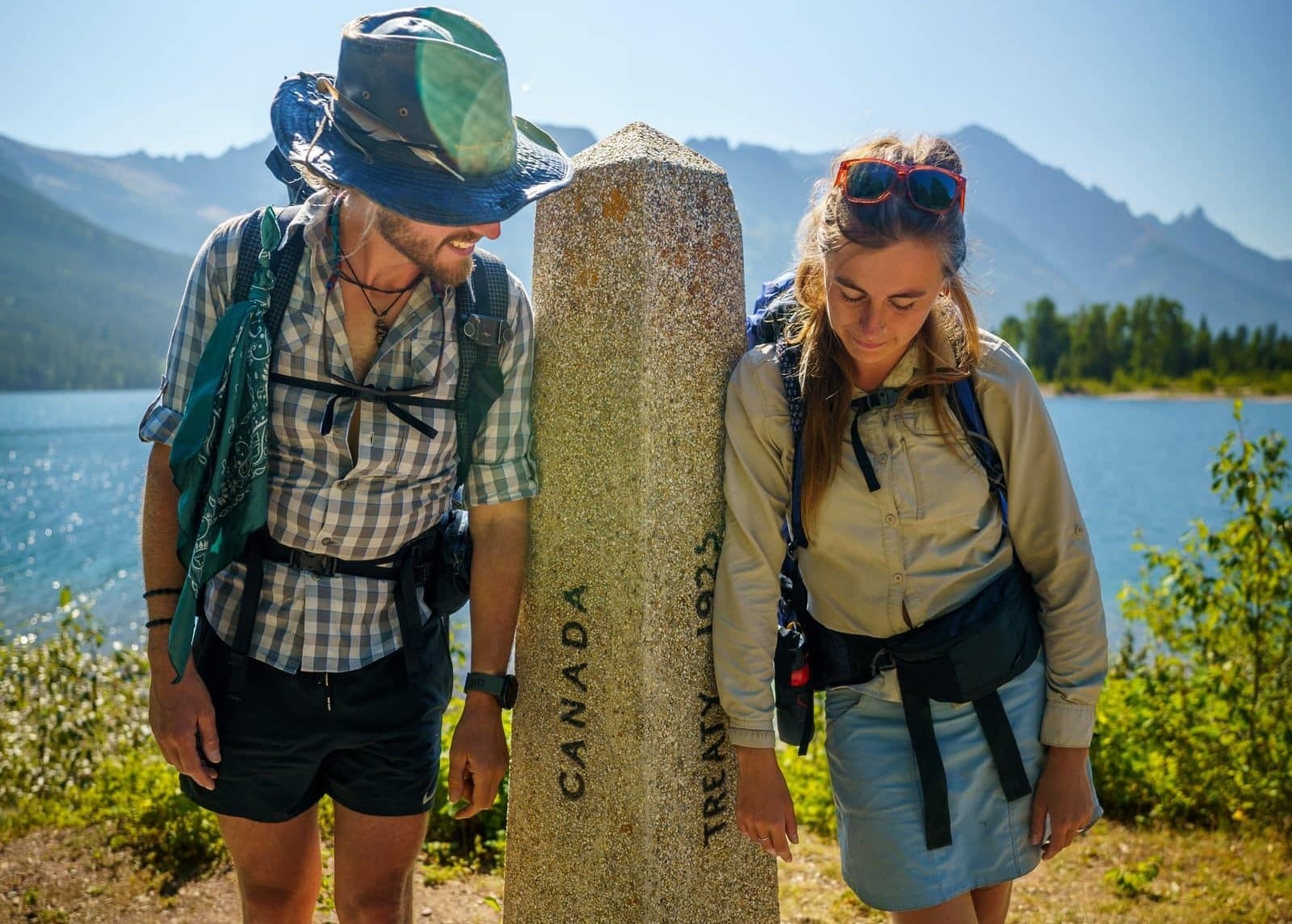
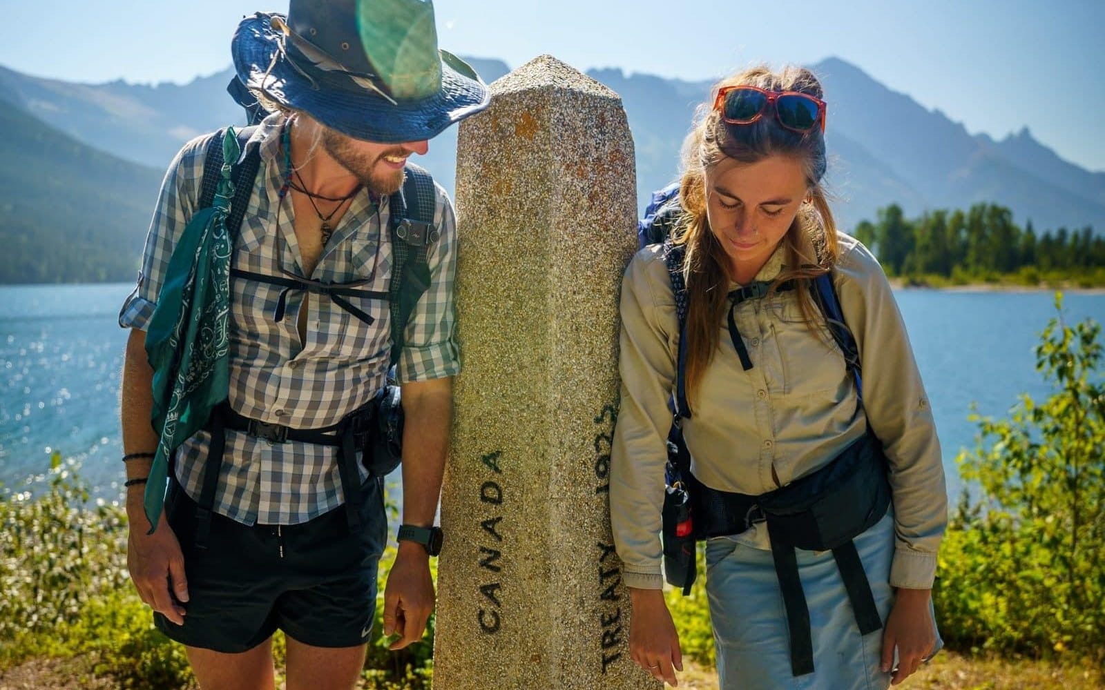
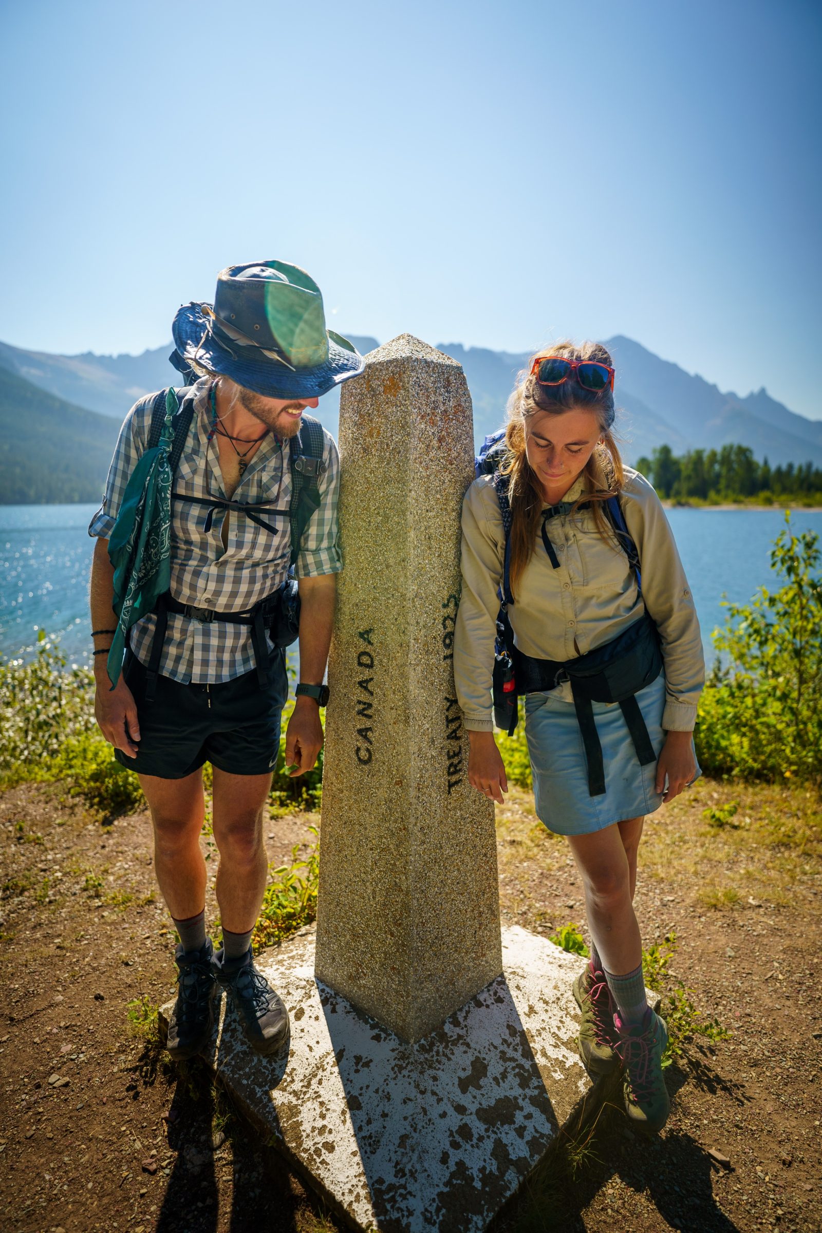
The next day, August 1, 2022, it was time! Our alarm went off at 6:30 am and we got ready for the first day of hiking. We put away our sleeping bags, mats and tent and take our first steps in a beautiful, misty morning. We walked by Upper Waterton Lake towards the United States border. There we found the official monument that symbolized the border crossing. So you see, borders are something strange after all…
And so our adventure began. We walked the same way back to Waterton village and so on to Alderson Lake, our first camping spot on the hike. We pitched our tent near the beautiful mountain lake and enjoyed our first day on the Great Divide Trail.
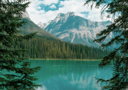
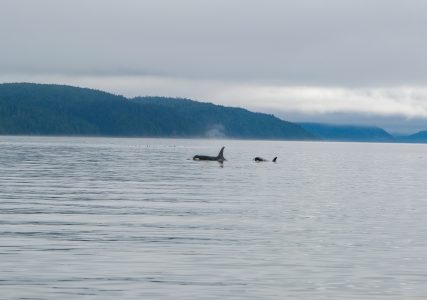
We walked for two months, through Waterton Lakes-, Banff-, Yoho-, Kootenay- and Jasper National Park. Outside of the Canadian National Parks, there were many provincial parks, wilderness areas, and forests. But we always walked in the presence of the towering Rocky Mountains, sometimes to the left, sometimes to the right of the famous mountain range.
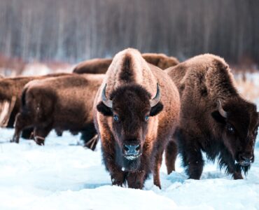
We saw black bears and grizzlies, caribou and moose, coyotes and bobcats. At night we listened in our tent to the cry of the screech owl and the blowing of the wind. The starry sky was of a different caliber: Far from cities and light pollution, the stars and planets twinkled and lit up the surroundings – so we didn't have to use our headlights much. The stars and the moon gave enough light.
The end of the GDT
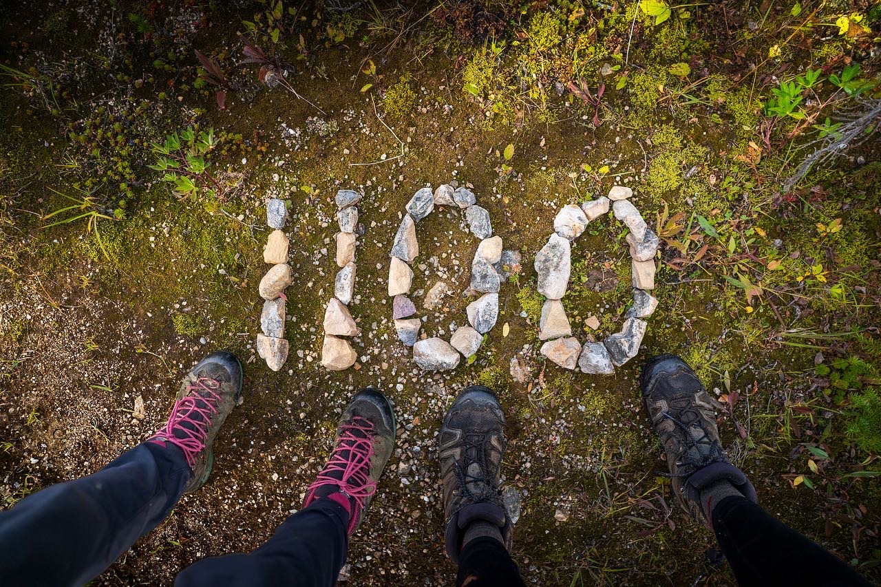
After two months and 1100 km we arrived in Kakwa Lake (Location here), the official end of the walk. Kakwa is a beauty of a park, which you can only enter on foot, on horseback or by bicycle. No motorized vehicles are allowed (in summer), so we were completely alone here.
The park rangers had already left and we celebrated the end of our walk in the public cabin. We said goodbye to the Rocky Mountains, lit a fire in the cabin's wood stove and fell into a wonderful sleep.
However, we were not yet back in civilization. It was still a good 100 km walk to the highway. For the next two days we walked as fast as our legs would carry us, heading for the highway. The end was bittersweet: On the one hand we don't want to go back to "civilization" and the crowds, on the other hand we were almost finished eating and we were starving.
And so, in the afternoon of September 24, we heard a faint sound in the distance. The first sign of society in two weeks. Slowly but steadily we said goodbye to the beautiful silence, the rustling of the leaves and the soft forest sounds. We crossed the railway, where the TransCanadian Railway occasionally rumbles over it, and soon ended up on Highway 16, between McBride en Prince George. The walk was definitely over.
we did it!
Ryan & Ilse
More unique hikes and trails
- Pacific Crest Trail (PCT) | United States
- Salkantay Trail (Machu Picchu) | Peru
- Peaks of the Balkans Trail | Albania and Montenegro
- The Great Divide Trail | Canada
- Plain of the Six Glaciers Trail | Canada
- Ice Lake Trail | Canada
- The Grand Canyon Trail | United States
- Acatenango Trail | Guatemala
- Roy's Peak Trail | New Zealand
- Olpererhütte – Schlegeis Stausee Trail | Austria
- Dolomites Trails | Italy
- Cinque Terre Hike | Italy
- The 8 most beautiful hikes in the world | Worldwide
Plan your vacation to Canada here
- Camper trips compare to Travelhome from ANWB.
- Itineraries : TUI, canada plus, sawadee.
- Winter sports in Canada book yourself OAD.nl.
- Flight tickets For Canada you can book via Skyscanner.
- Rental cars : Sunnycars, Alamo en rental cars.
- Tours and Activities in Canada you book through GetYourGuide.
- Campsites in National Parks you book on Park Canada.
- Hotels & Resorts in Canada you book with Booking.com.
- Travel insurance for Canada you close at Allianz.
- SIM cards en e-sims for Canada you buy at International sim.
- Parking at the airport you can arrange via Parkos, Central parking of iParking.
- travel items (you can order suitcases, world plug adapters, etc Bol.com.