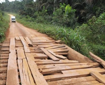
We continue our overland tour Africa in Namibia. We (Cor and Grietje from NoFear Travel), travel with our Toyota Hilux 4×4 camper. The African continent is the Mecca for 'overlanding' with many challenging routes and beautiful destinations. The first African country we visited during our trip to South Africa is Morocco, followed by Mauritania, Senegal, Mali, Guinea, Sierra Leone, Liberia, Ivory Coast en Ghana. After a stopover in the Netherlands, we continue our overland journey through Africa. We drove on Togo, Benin, Nigeria, Cameroon, Gabon, Congo-Brazzaville, Angola, Zambia en Botswana.
We have now arrived in Botswana's neighboring country: Namibia. In this article you can read about our experience overlanding in Namibia. As you are used to from us, you now start watching the video again.
Also read: Travel route Namibia 2 to 5 weeks | Sample routes and tips
First a small introduction to the country
Namibia, one of the most popular holiday destinations on the African continent. We heard from many people around us that they had ever been there or had the desire to go there. Countless books, travel stories and maps have already been made. What else do we add to it? Well, we will try that with our experiences in combination with our way of traveling...overlanding in our own house on four powerful wheels where time is no object!
In terms of area, Namibia is approximately 21 times as large as the Netherlands and has “only” 2,5 million inhabitants. Once again a country with a lot of space.
The country was first colonized by Dutch-speaking South Africans (19th century) and later by the Germans who called the area German South West Africa. Subsequently, present-day Namibia was conquered by South Africa during the First World War.
The South African apartheid policy was also implemented in Namibia and at the same time there was increasing resistance to colonization. Only in 1990 did the country become truly independent and was given the name Namibia. Since then it has been stable democratic.
The current official language is English, while German and Afrikaans were also official languages before independence. We notice that both German and Afrikaans are still widely spoken.
The country has diverse landscapes such as desert, semi-desert, steppes and wetlands. Together with the associated climate differences and vegetation differences, it is a varied country.
The Nabian dollar is pegged to the South African Rand and therefore has the same value.
Arable farming and horticulture are hardly possible due to the climate and soil conditions. Animal husbandry for meat, on the other hand, is. Diamond mines and tourism make up a large part of government revenue. More than a million tourists visit the country every year, most of whom are Germans and South Africans.
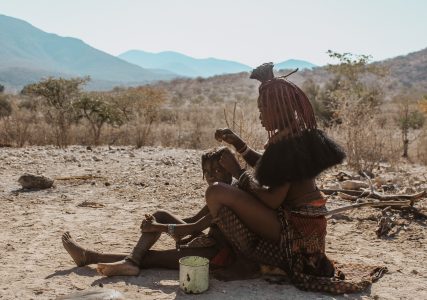
The difference between rich and poor is large in the country. The rich population is also said to be “rich” in the west, while about 43% of the population can be classified as poor and lives in corrugated iron houses with shared sanitary facilities and water pumps.
First big village: Gobabis
Inevitably we compare a country with our experiences in previous countries we visited. And for us, Botswana is the freshest in our memories. In Gobabis, the first large village after the border, we again see and experience many begging children, sometimes also adults. We were used to this in many places in West Africa, but not or hardly at all in Zambia and Botswana. We are asked several times by white people not to give anything. We try to close ourselves off from it, but as white strangers we are extra attractive to begging children. And they don't know how to stop.
It immediately shows the difference between rich and poor.
Furthermore, many modern shops, “no” is hardly for sale. We meet many friendly, helpful people.
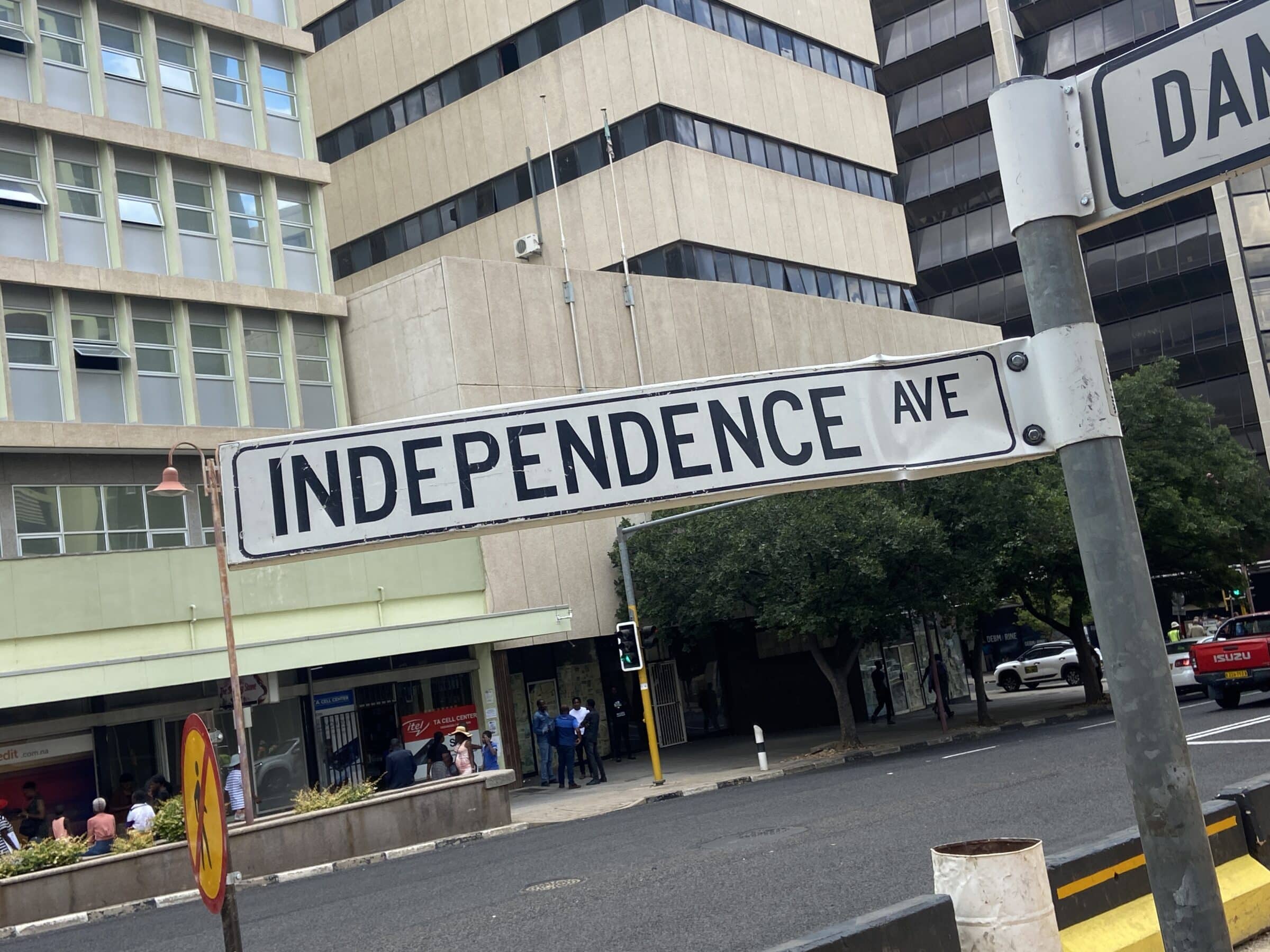
The texts in the streets, on shops and billboards immediately reveal the relationship with South Africa and Germany.
Names like Keetmanshoop, Buitepos and Mariental make you realize that you are “not far” from these countries.
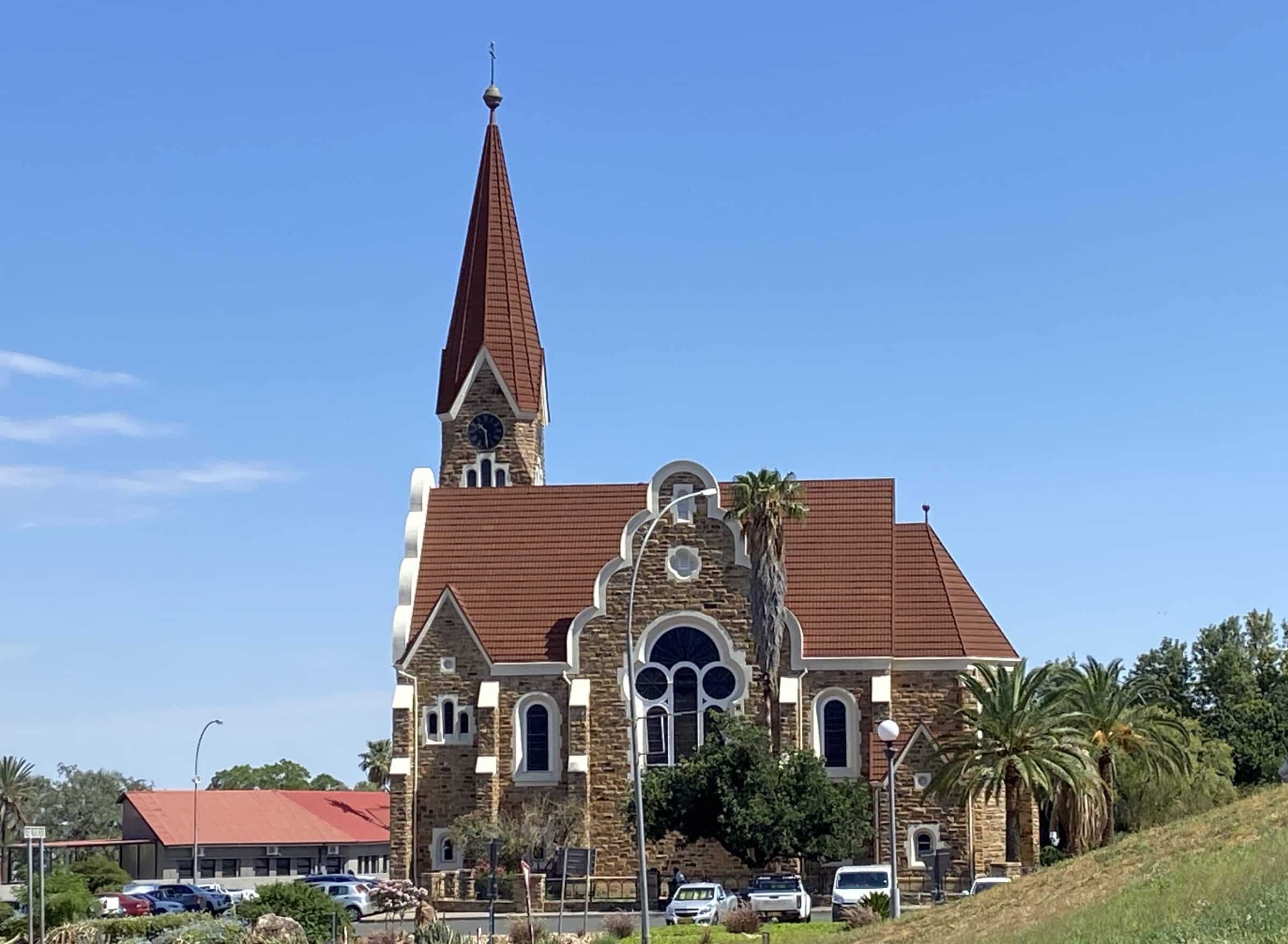
Windhoek
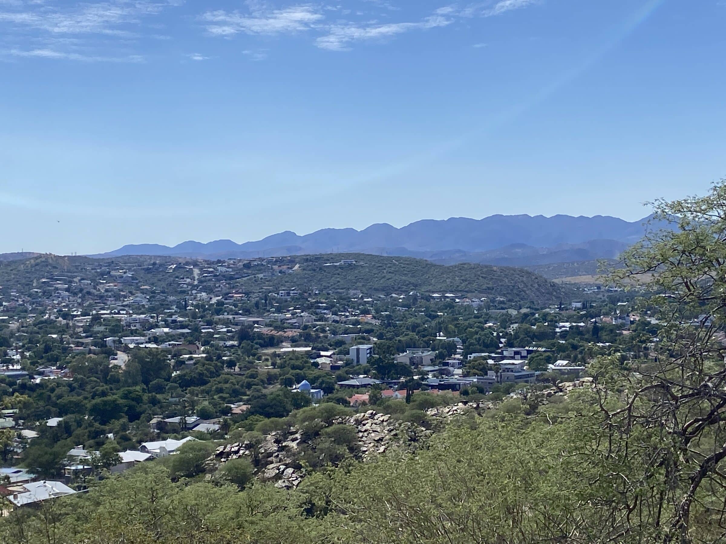
The capital Windhoek with around 350.000 inhabitants also confirms the division between rich and poor. The city is very neat, organized and clean. The wide roads with often larger cars and disciplined drivers are a joy to drive on.
The Urban Campsite is a surprise even for us. With beautiful paving, greenery and sanitary facilities that you say “You” to. Quietly located on the edge of the center with a very cozy bar and small swimming pool.
The range of shops in Windhoek is in no way inferior to that of a western city.
We do a few errands at the Grove Mall in the south of the city. The goods in the supermarket are so beautifully displayed and the atmosphere is so relaxed that it makes us greedy.
But here too you only see white consumers served by black employees.
Into nature
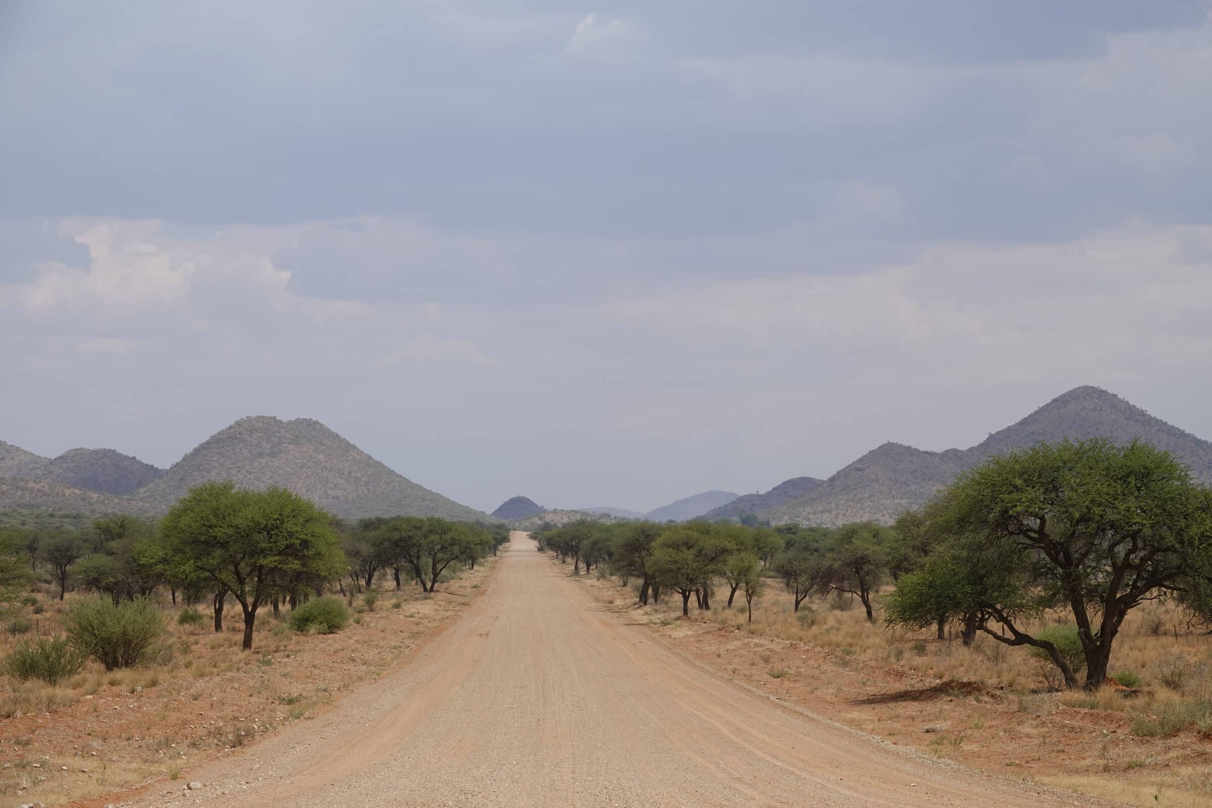
We leave Windhoek in a southerly direction. Actually, we don't really have a goal yet. We just want to enjoy everything around us in complete freedom. And we do! The landscape is changing quickly, away with the buildings! Mountainous, hilly, endless views and red sand dunes, we experience it all within a distance of about 200 kilometers.
The roads are partly asphalt and partly gravel, but there is not much traffic anywhere. We encounter fewer than twenty cars on the entire route. The gravel roads are of perfect quality, we have not seen them like this in the rest of Africa. We think back to Australia where the roads and landscapes are quite similar.
Dordabis
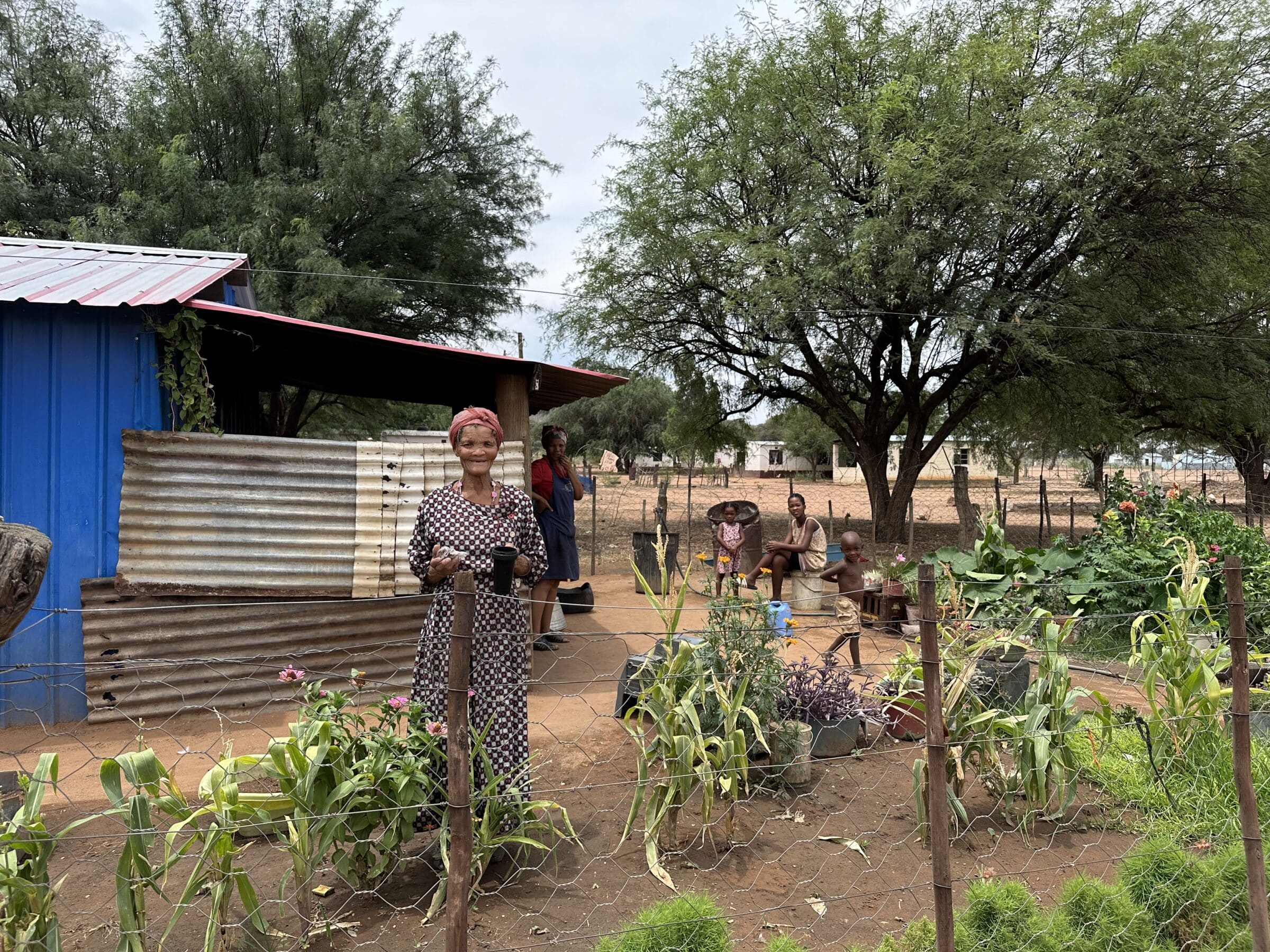
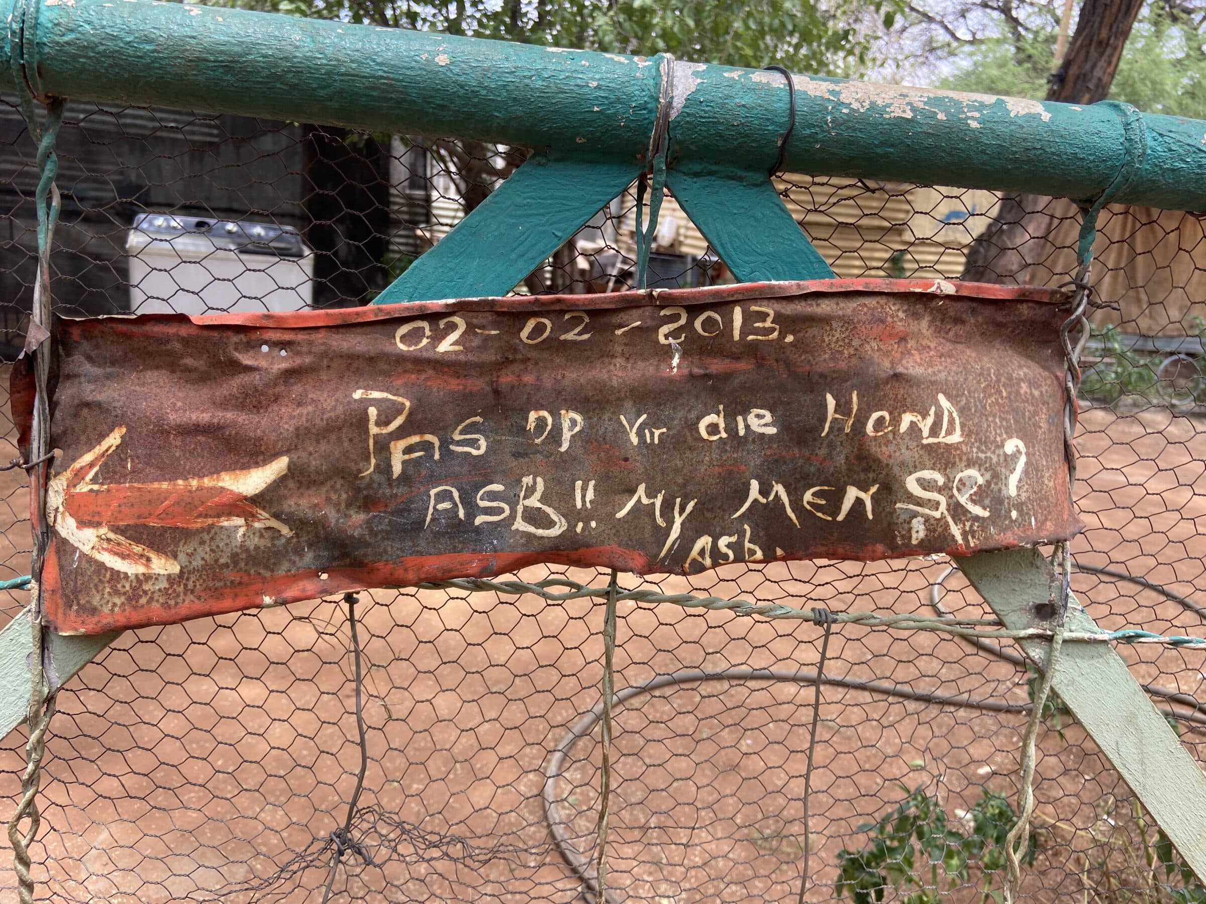
Along the way we see no buildings and hardly any people, until we come across a village called Dordabis. We decide to eat a sandwich here, just outside the village, under a tree.
Two children come walking by, begging for a moment, but then they quietly settle down with us under the tree. Probably waiting for…
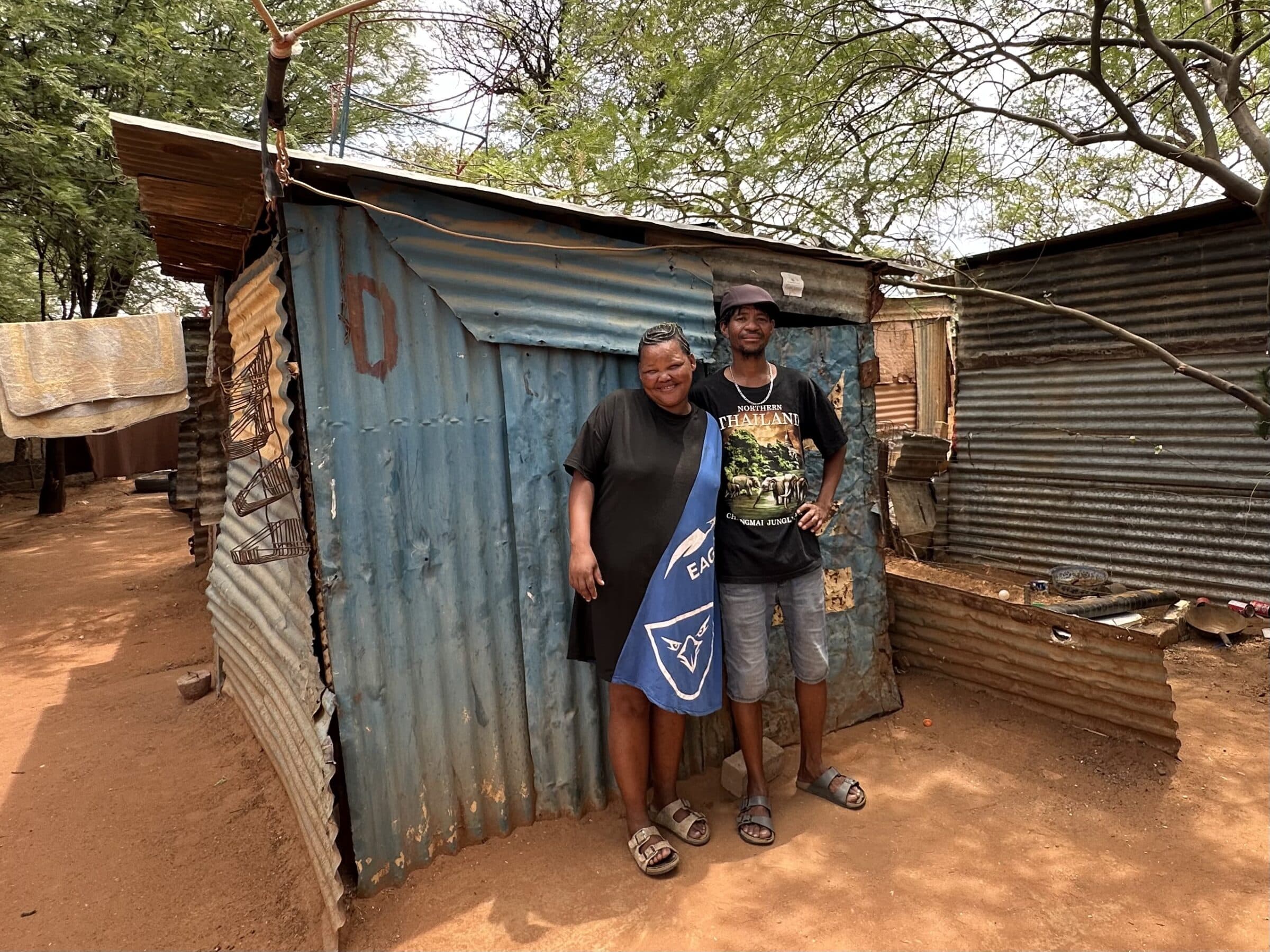
A man arrives, who turns out to be the father. He speaks reasonable English. He says he is hungry and thirsty, just like his children.
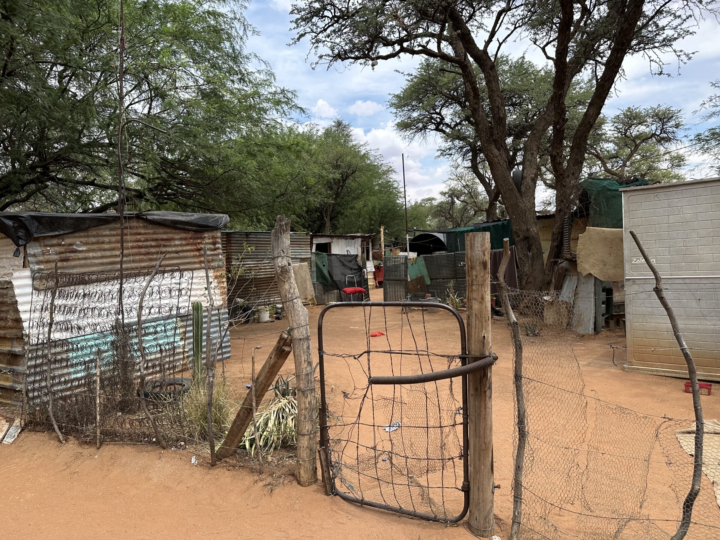
Because we think the whole village is pretty much hungry, we won't go into it. We start talking and propose that he give us a tour of the village. For a fee. He eagerly accepts that. And so a little later we walk through the village, which is made of old wood and zinc plates. “Charles”, that is the name of our villager who has just been promoted to guide, says: “The land around the village is all owned by one large farmer. A few villagers work there, but the vast majority are unemployed. We have nothing here, it is a struggle every day to feed the children.”
Indeed, the people in the village do nothing. They hang out together under trees and shelters to protect themselves from the heat.
Charles shows his own house. It is a roof plate hut measuring 2,5x2,5. It has a 2 by 2 bed. They sleep on the double bed together with the two children.
We walk further through the village and we notice how friendly the people are. No aversion to us as rich white people.
We give Charles a nice compensation and he beams from ear to ear.
Hardap Dam and visit dairy farm
Further south we come to the Hardap dam. A restaurant has been built here and some walking tours have been set out. The restaurant is open and provides a nice overview of the dam and the lake behind it.
The water is very low.
We are the only guests and we get a depressing feeling. No, not a place for us to stay longer.
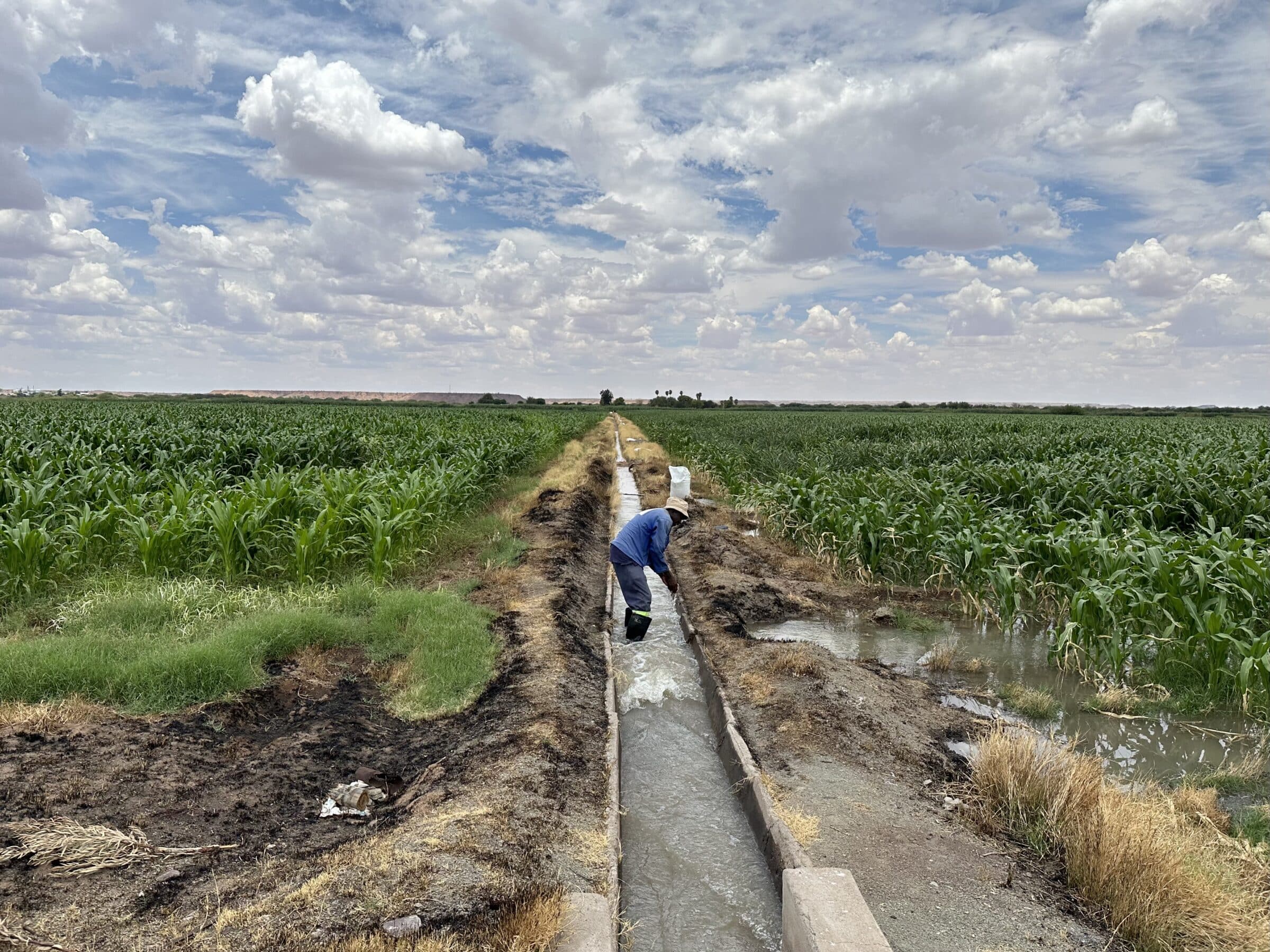
When we leave we drive through an area that is unusually green. We see many corn fields, all kept “alive” by an ingenious irrigation system fed by the water behind the dam.
It's strange to drive through an area where it is suddenly so green while the rest of the area is bone dry.
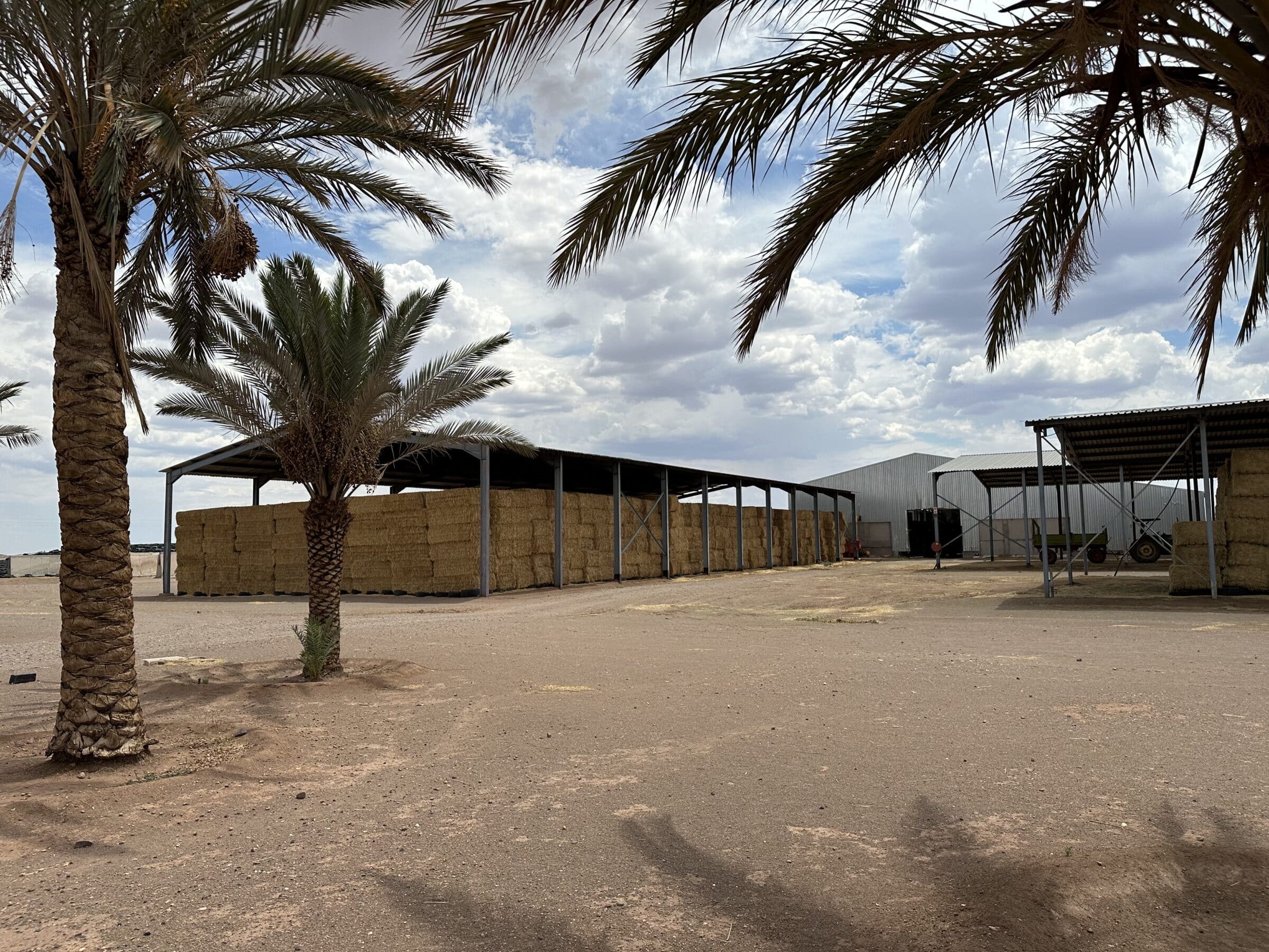
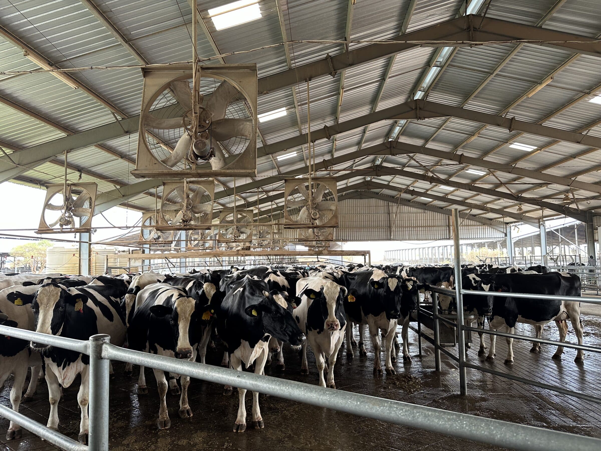
Suddenly our eyes are drawn to some enormous barns in the distance. We drive there and it turns out to be the stables of a large dairy farm.
Everything is tightly fenced and strictly guarded.
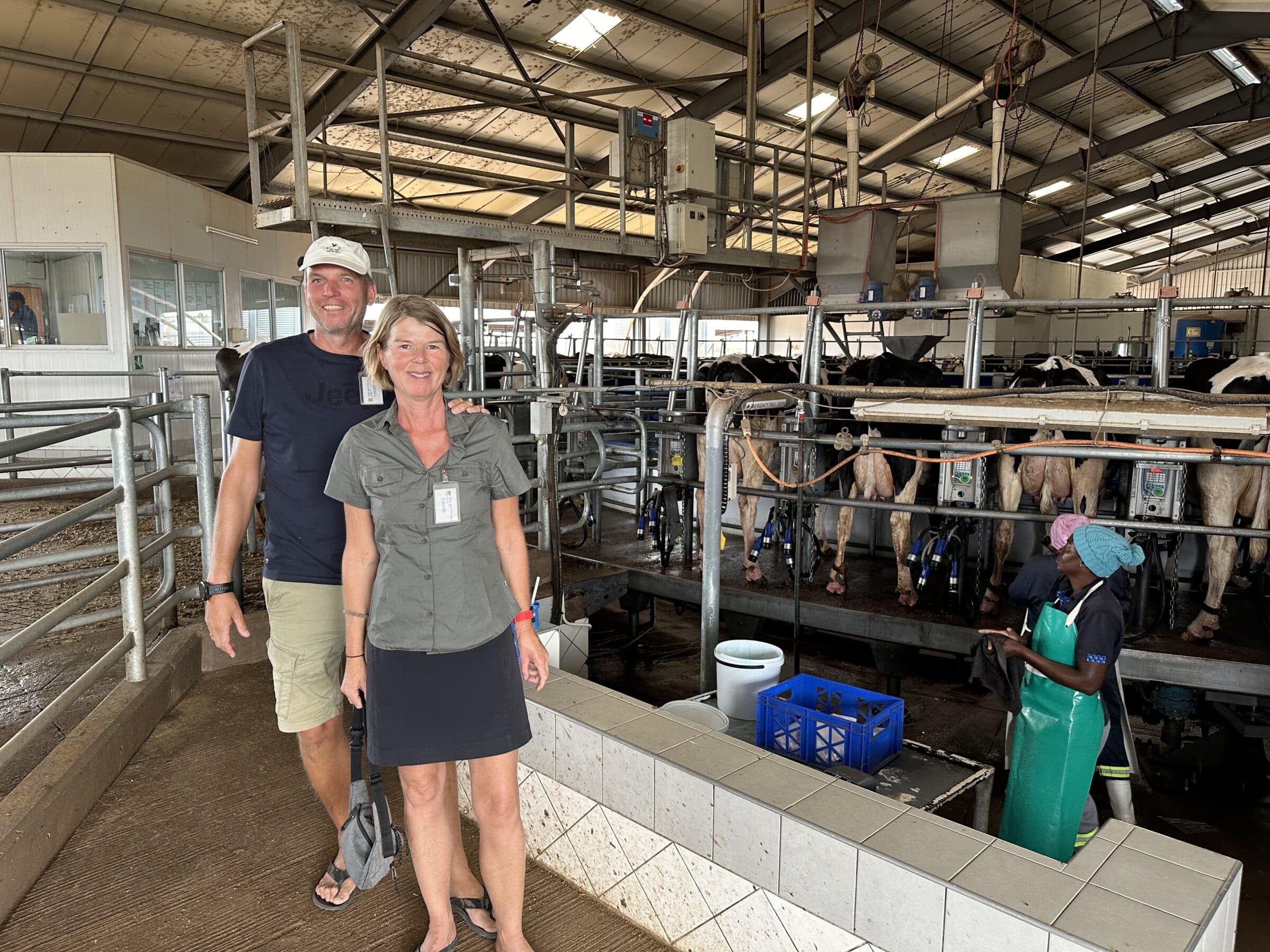
We take the plunge and ask at the entrance if we can look around. Such an opportunity makes our farmer's blood flow faster.
It's very official. A manager is called and shows up 10 minutes later.
We tell him that we are interested in a tour and he immediately comes with us.
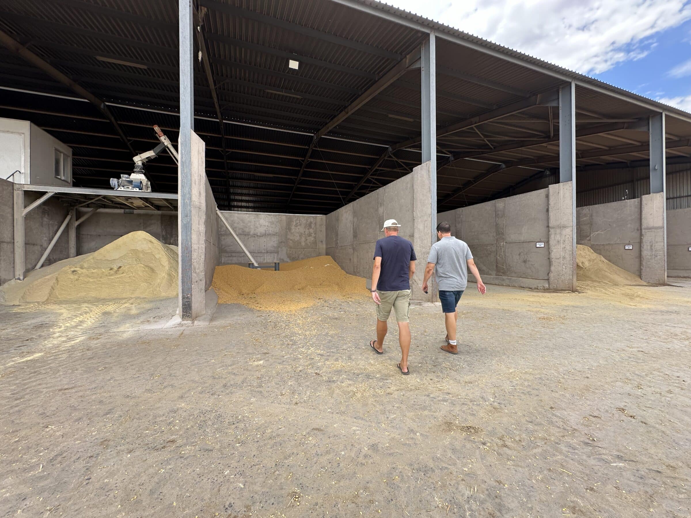
The manager shows how the feed is stored and explains its composition, with corn as the main ingredient.
They have 1200 hectares of land, 3000 cattle, including 2000 dairy cows, and 60 employees.
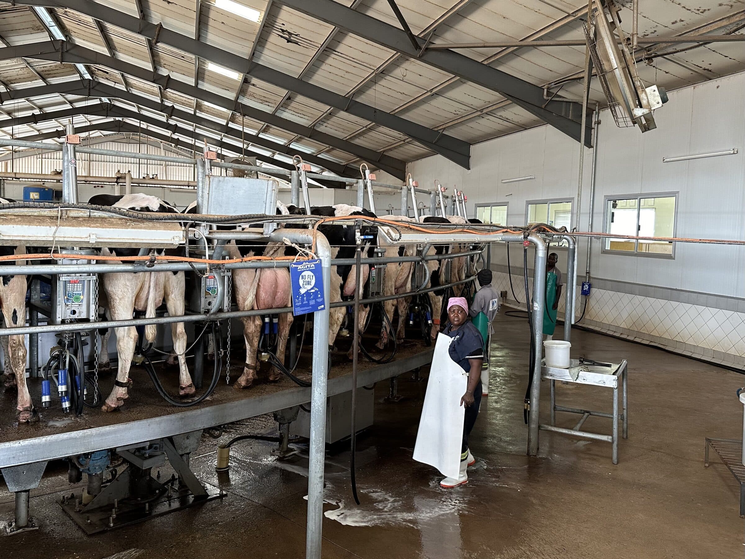
The dairy cows (Frisian and Holstein) are milked 3 times a day in a 68-stall carousel. No robots here, labor in Namibia is relatively cheap.
We are amazed, the manager tells us that they are the only milk producing company in Namibia and supply to the only dairy factory in Windhoek, where drinking milk and yoghurt are made. Our own tanker drives up and down twice every day between the farm and Windhoek.
The shed where the machines are located is also impressive. Many tractors, sowing and harvesting machines. They have their own corn chopper and combain.
Most machines are imported from Germany. They have a mechanic fly in from Germany for major maintenance.
The greatest threat is drought. If it does not rain soon and the lake behind the dam fills up with water again, the corn harvest is in danger of failing.
The only alternative is to import feed from South Africa, which will of course increase costs enormously.
In the meantime, they hope for a good amount of precipitation every day.
We thank the manager for a fantastic insight into their company and continue our way towards the Naukluft mountains.
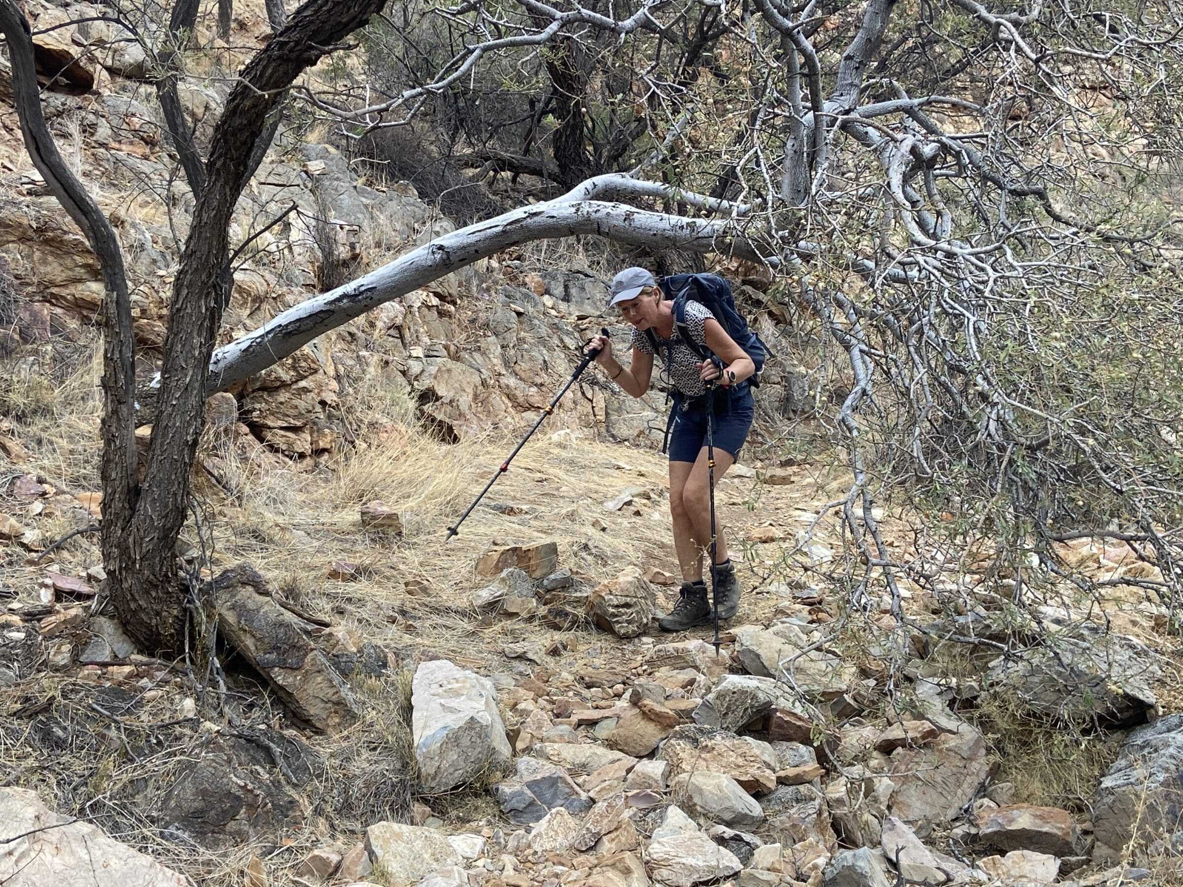
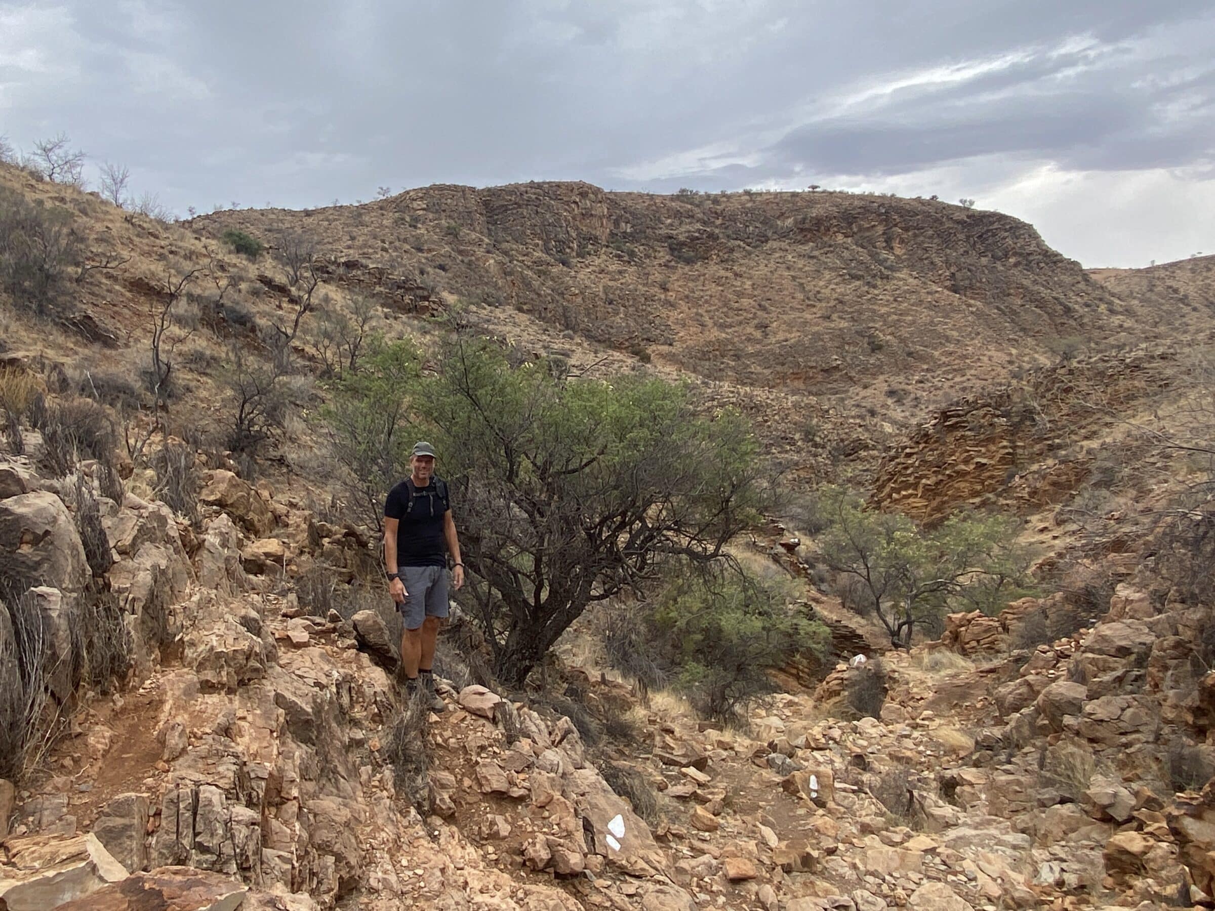
Hiking in the mountains of the Namib Naukluft NP
To the west lies Namib-Naukluft National Park, a protected nature reserve that partly consists of mountains.
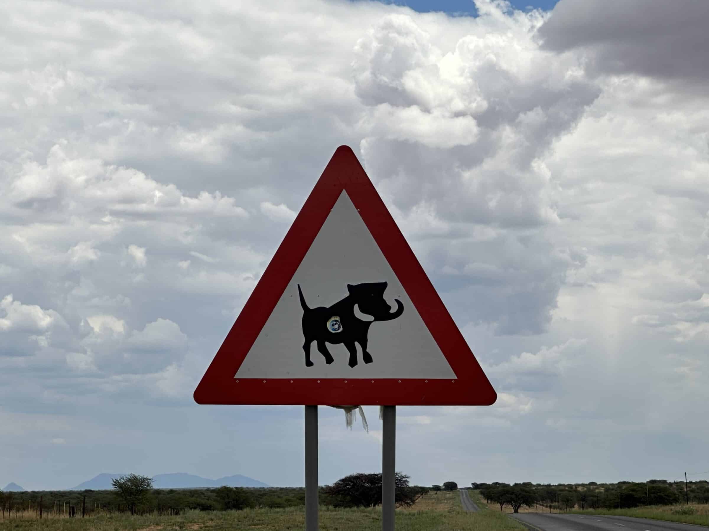
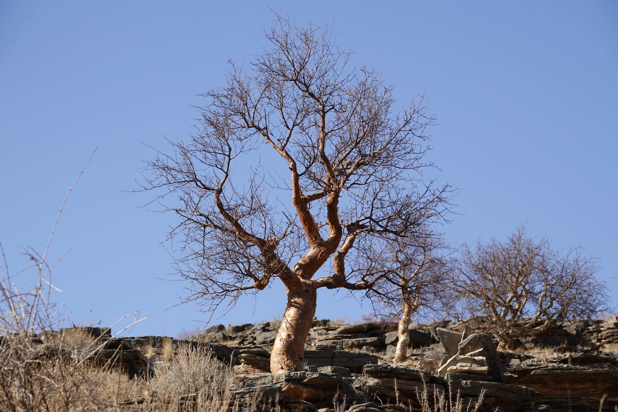
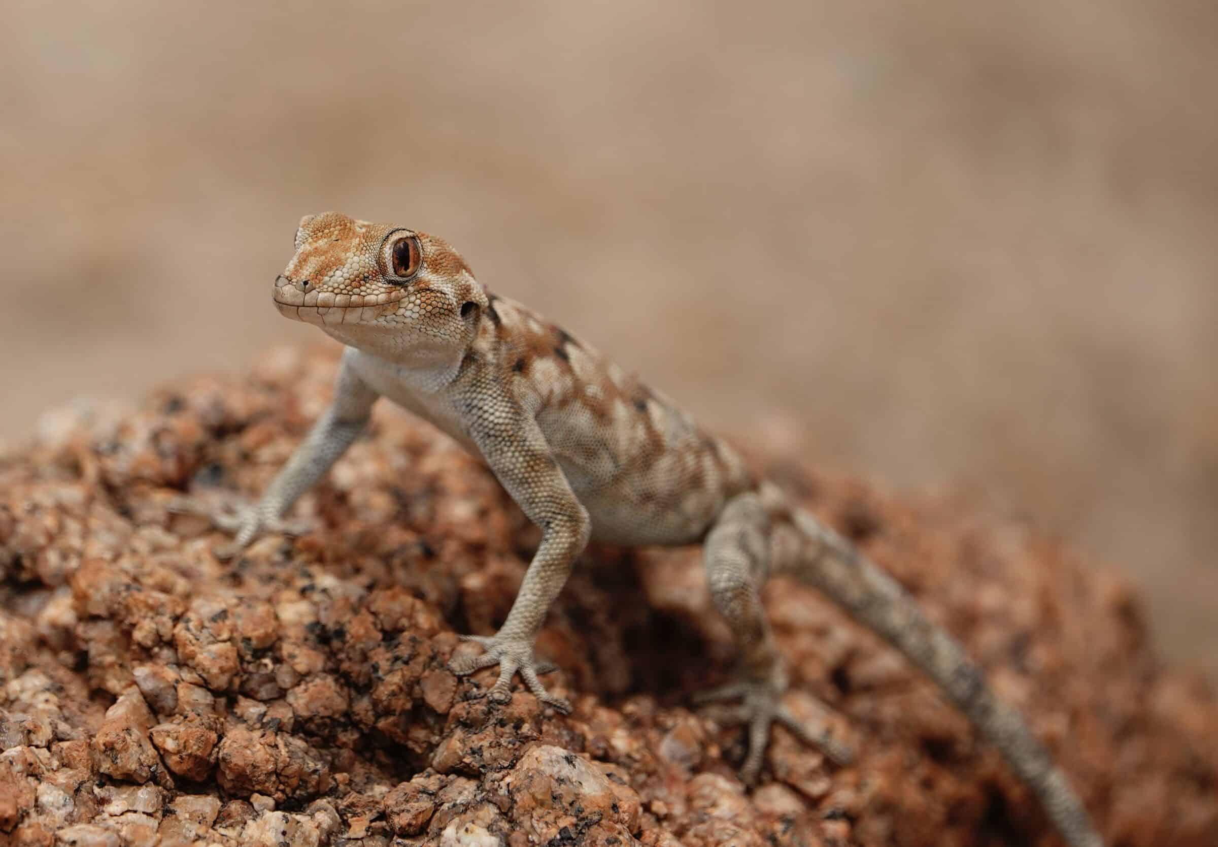
The environment is very dry. The mountains are beige-red-yellow. Rocky with hardly any vegetation. Yet a number of animal and plant species manage to survive here. Who sees zebras, kudus and some cute marmot-like animals anyway?
It is quite a challenge here for people and animals, with 36-38 degrees every day. Fortunately it cools down a bit at night.
Nevertheless, we put on our hiking boots a few times here, take a fair amount of water with us and go into the mountains. Also good for our sleeping condition.
In fact, here are the first seriously marked hiking trails since Morocco on our journey along the west African west coast.
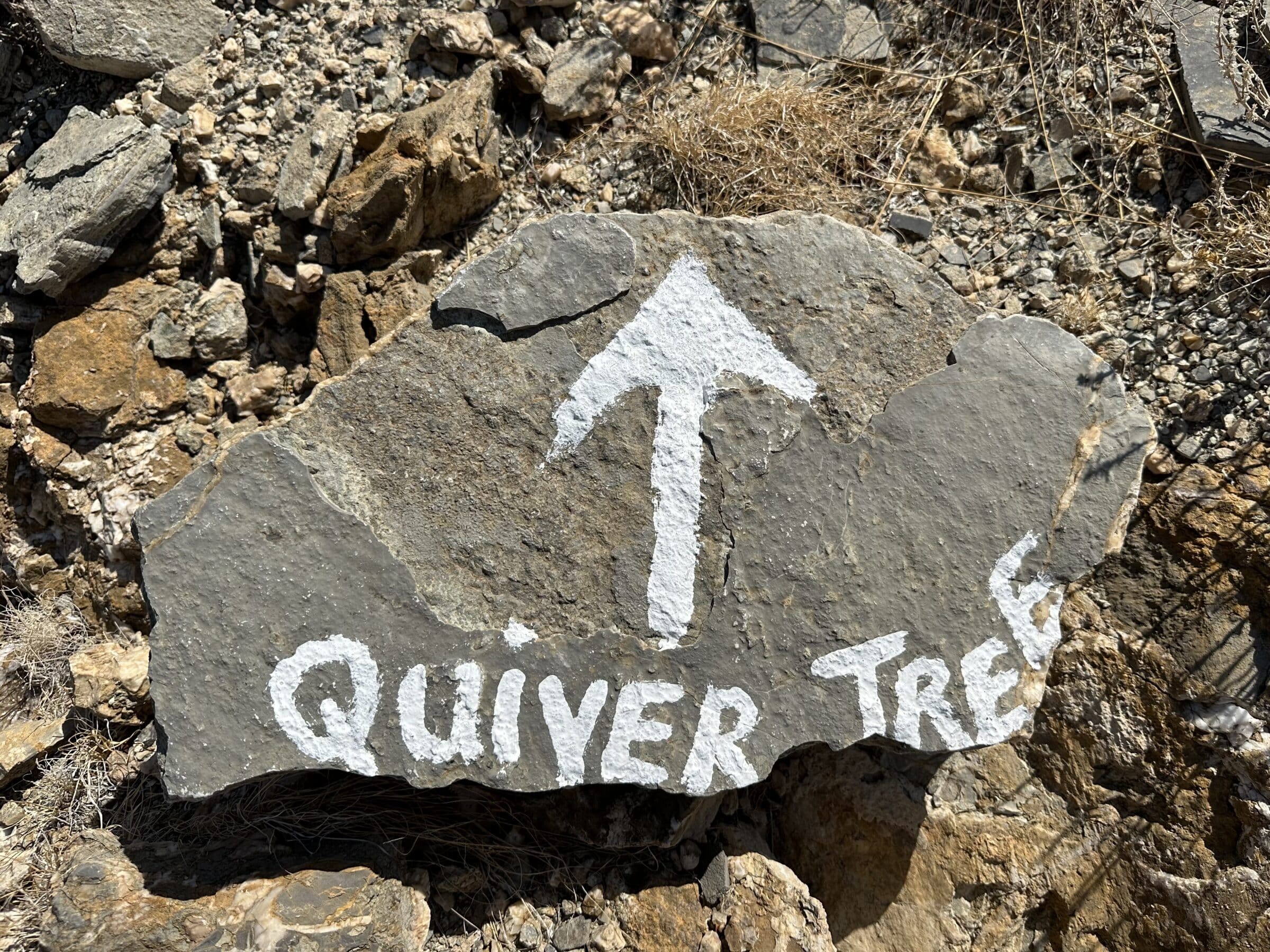
We walk various routes with names such as Olive Trail, Kudu Trail and Quiver Trail with distances between 7 and 14 kilometers. Moreover, we have to overcome some altitude meters, which has a considerable effect on our sweat production.
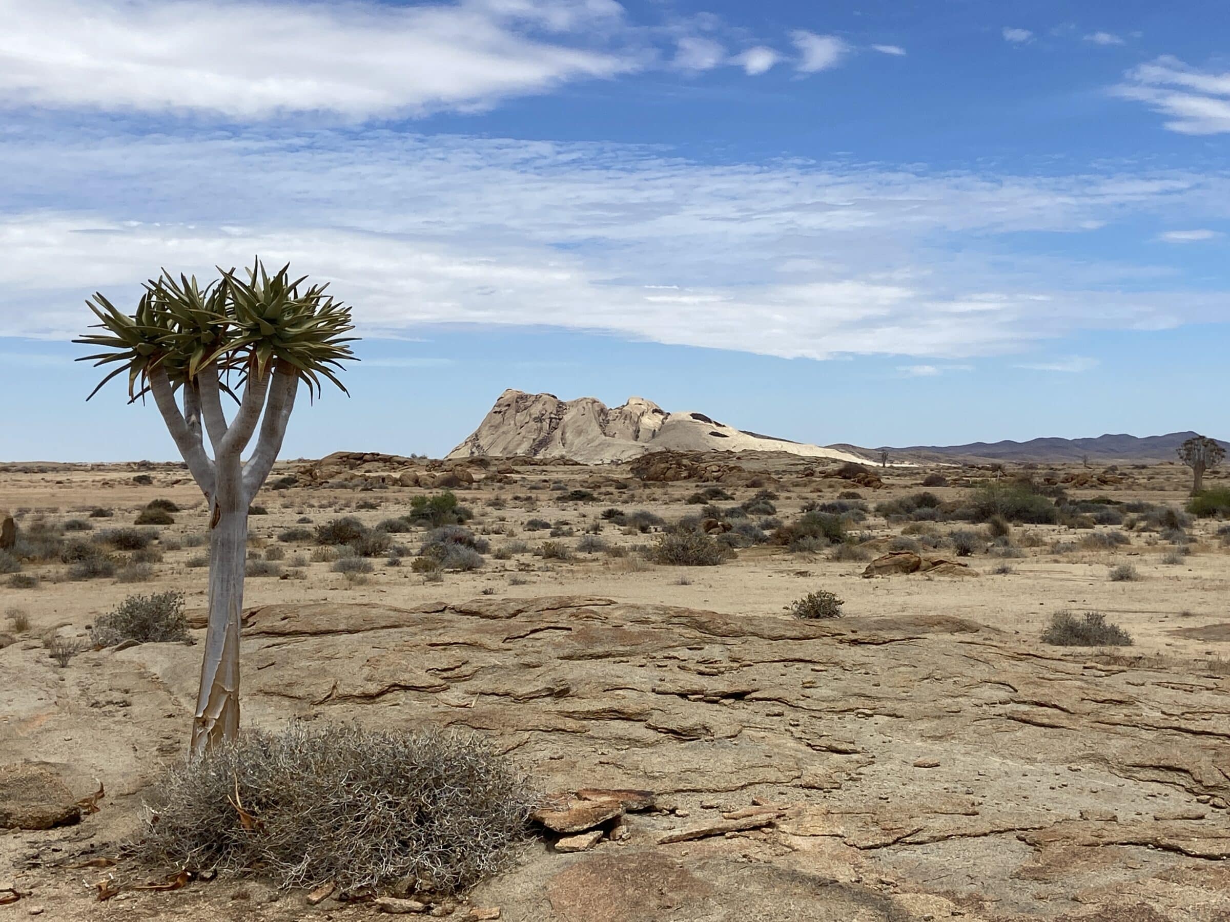
But the rewards are great, phenomenal views, especially at the highest points. The Quiver tree is very special with its thick trunk. You wonder how he can survive on the rocks with so little water.
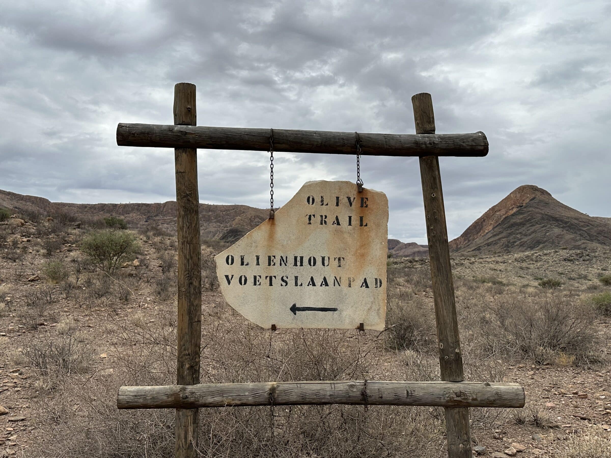
Olive trail
We were so impressed by the Olive trail that we are mentioning the walk separately here. The walk is within the park boundaries and you must therefore buy a permit (NAM$ 350, 2 persons and car)
The length is about 10 kilometers and there is about 400 meters of elevation gain.
But oh, what a special walk. The first three kilometers you climb slowly to the top, around 1800 meters. The path is easily walkable with beautiful views. On top of the plateau the world is so wide…amazing.
We are lucky with the weather, which means it is cloudy. Less beautiful for the photos, but much more pleasant for the temperature.
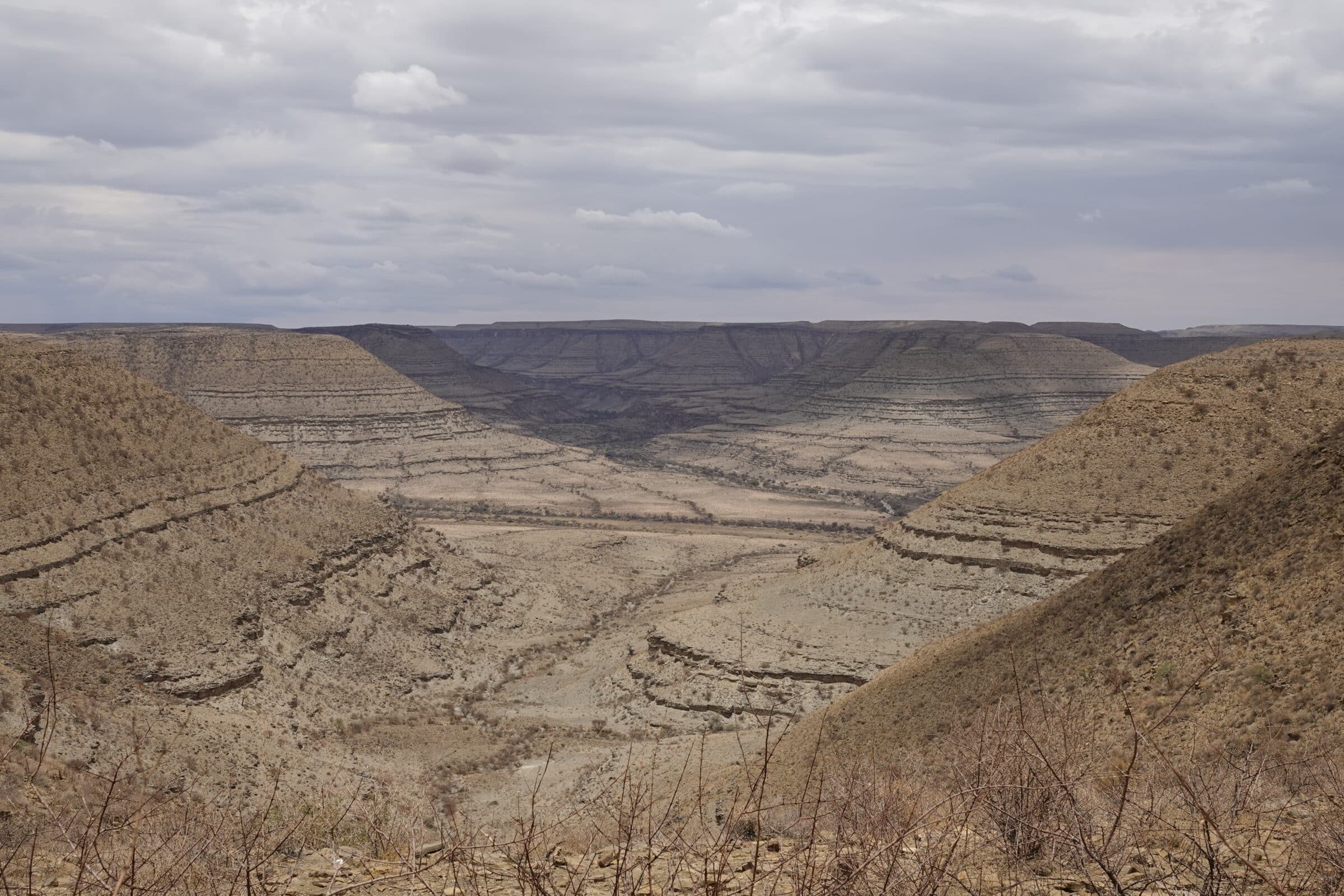
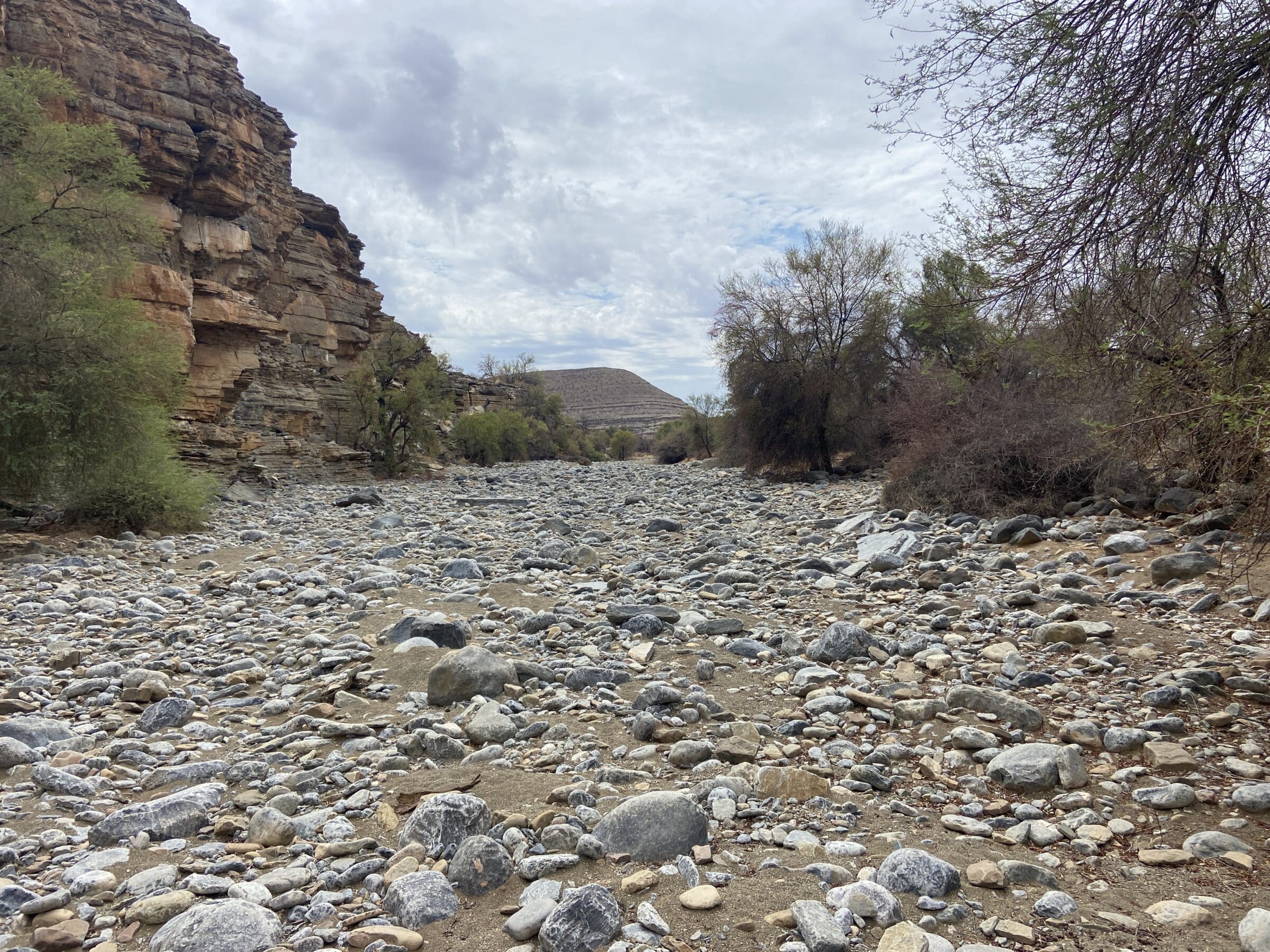
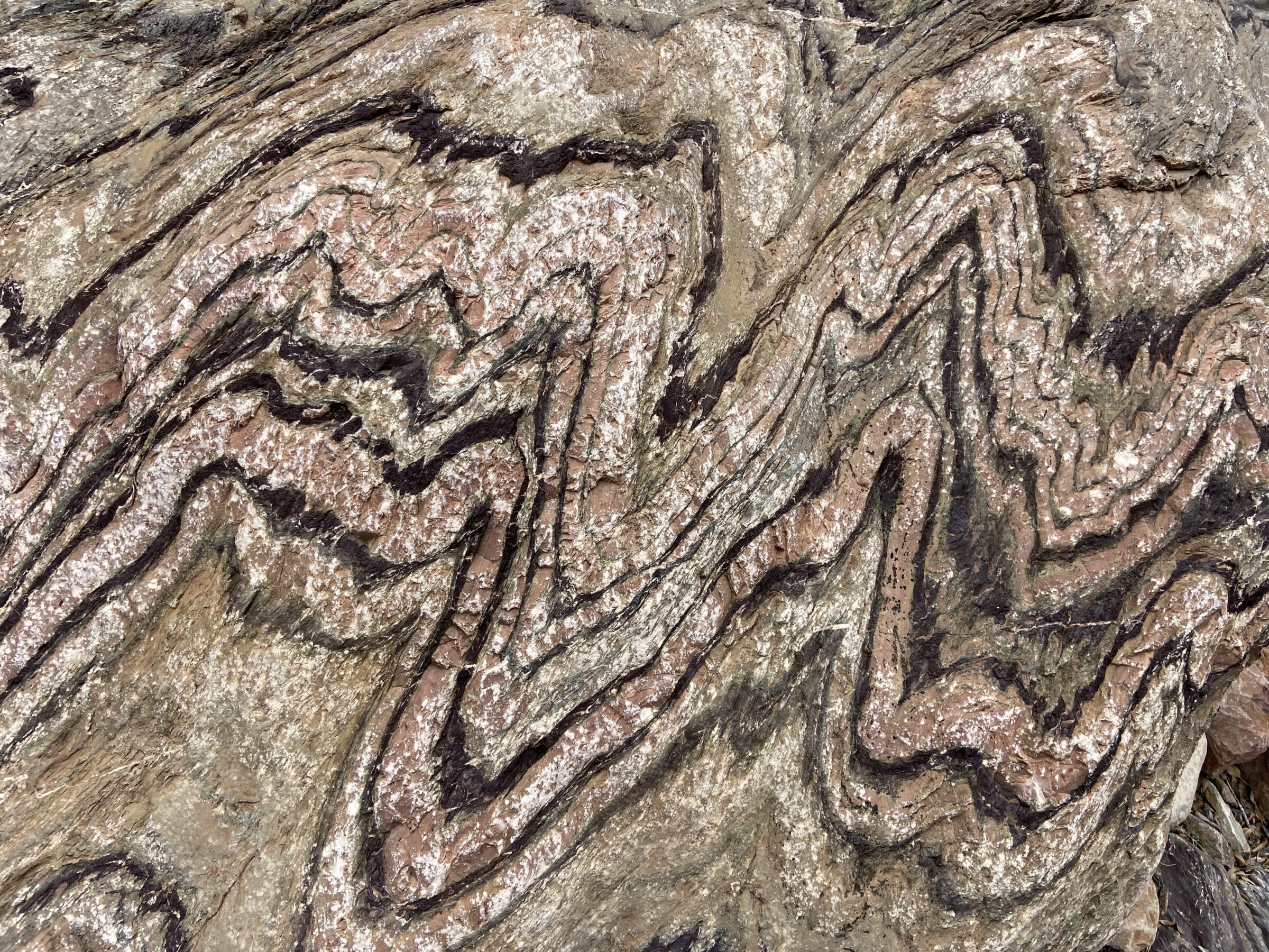
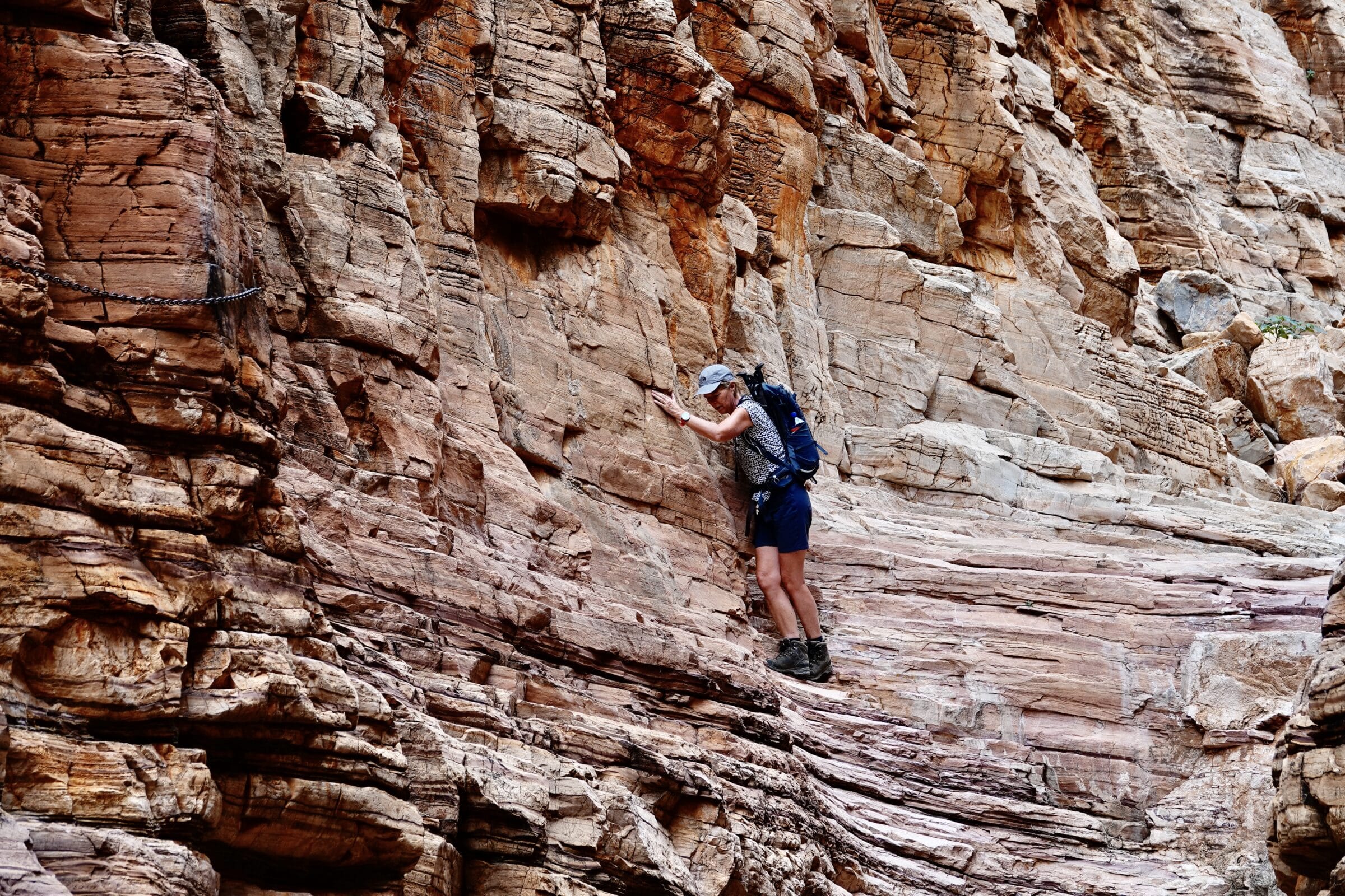
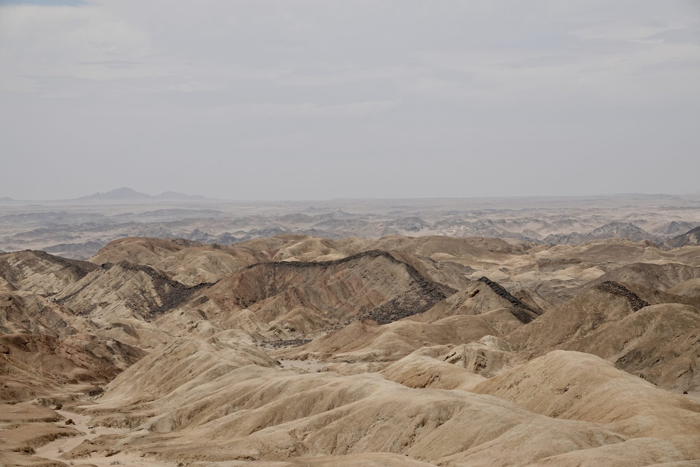
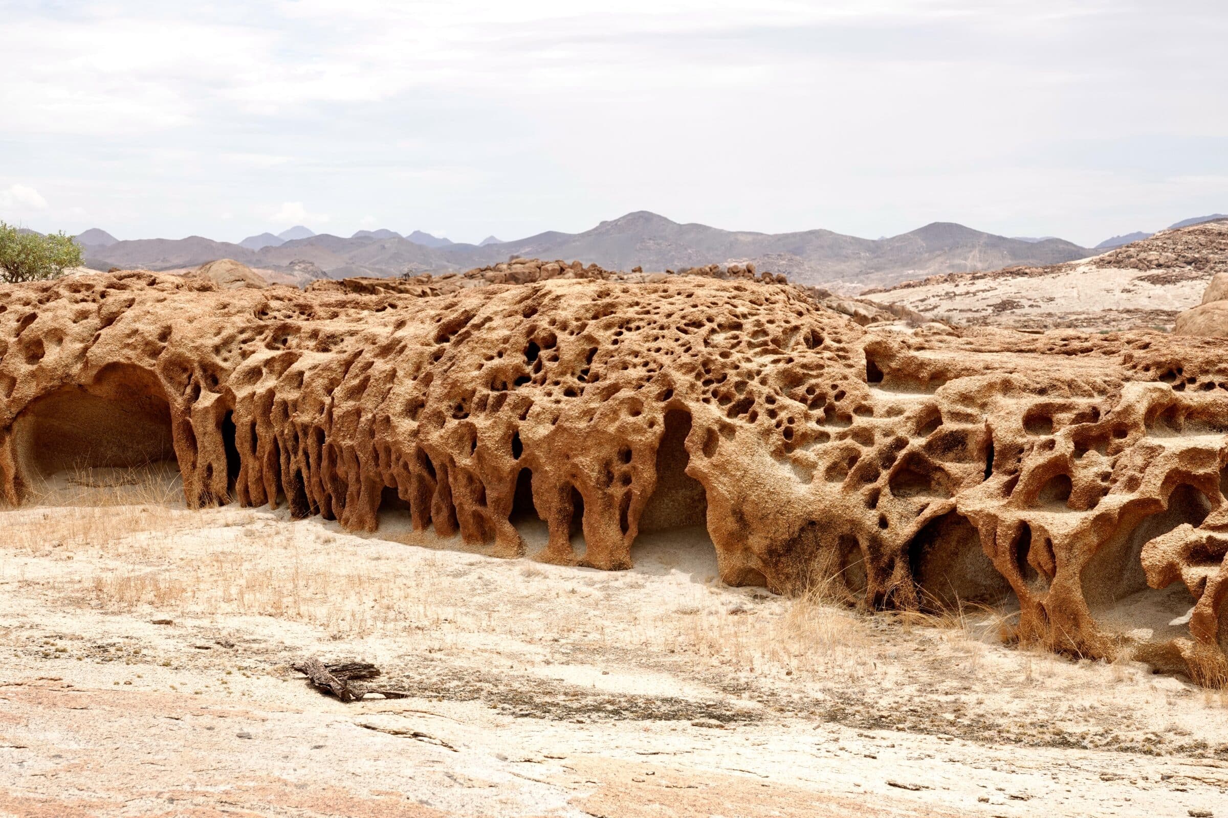
After the plateau we slowly descend into a gorge, which varies in width. Some olive trees grow in the gorge, as the name of the track already suggested. But as far as we are concerned, they could have better called the walk “1000 colors” or “rainbow track”. You will find so many different colors and shapes of rocks here. Breathtaking. Here, erosion and billions of years of time have left a fantastic legacy.
The highlights of this walk are clearly in the gorge.
The track is well signposted. In the gorge you occasionally have to use your hands to climb over some rocks. In one spot there is a small area of overhanging rock where a chain has been mounted for some support.
After the gorge, which produces many ooohs and aaahs, the path returns to the parking lot.
This walk is in our top 10!
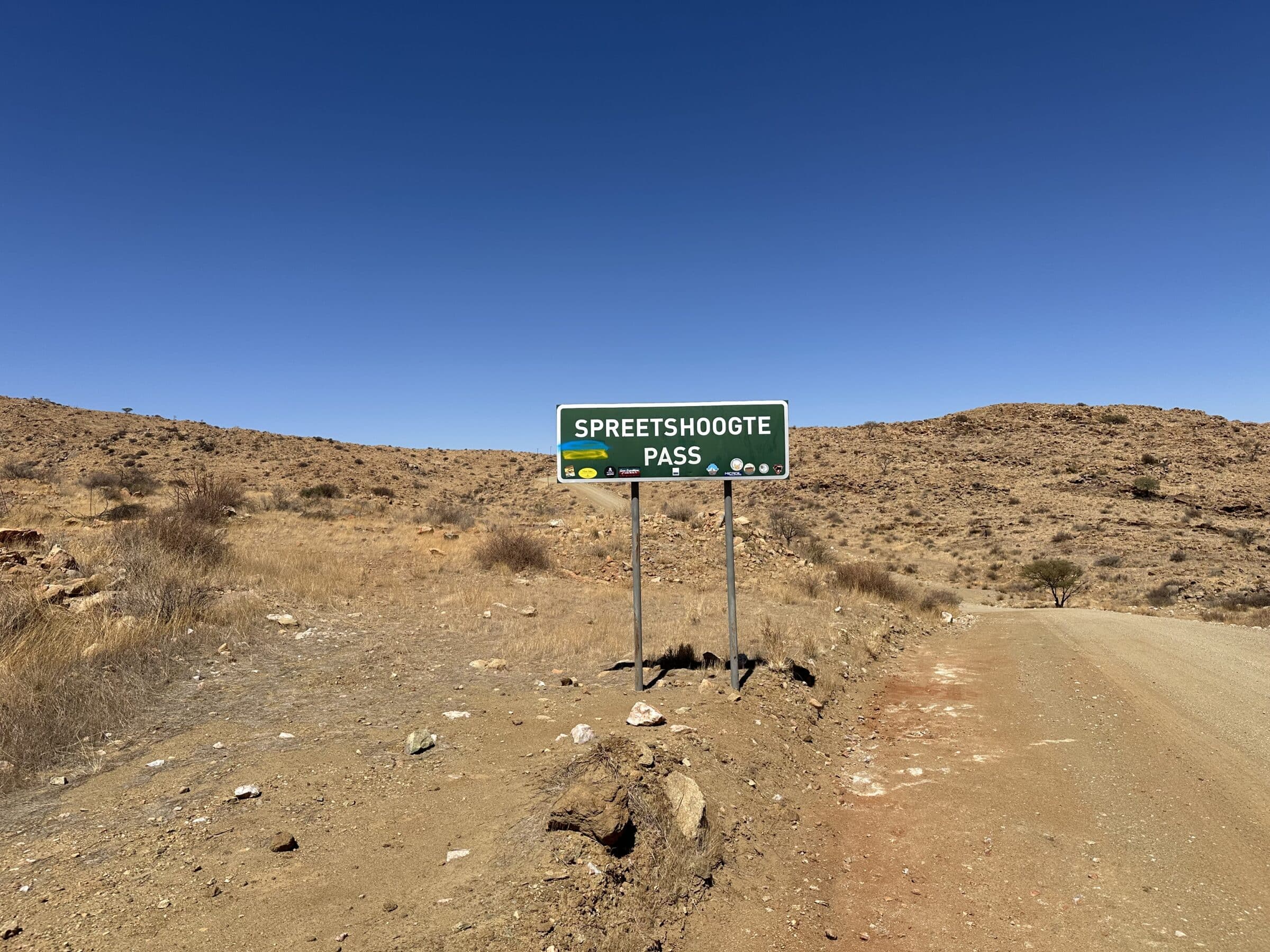
The C14 from Solitaire to Walvis Bay
“The C14 is a road you must have driven.” It is a true experience. But before we leave from our lodge - where we had a fantastic stay - the owner advises us to drive a bit further. We then go via the “Spreedshoogte Pass”, which we should certainly not miss.
The pass in question is indeed a special experience. In fact, we didn't even notice a bit of climbing until we arrived at the top of the pass. My goodness, what a view over the partly flat land with protruding mountains here and there. Breathtaking! And again luck with the weather. Clear and dry today. How far can you see?
We shoot one photo and film after another.
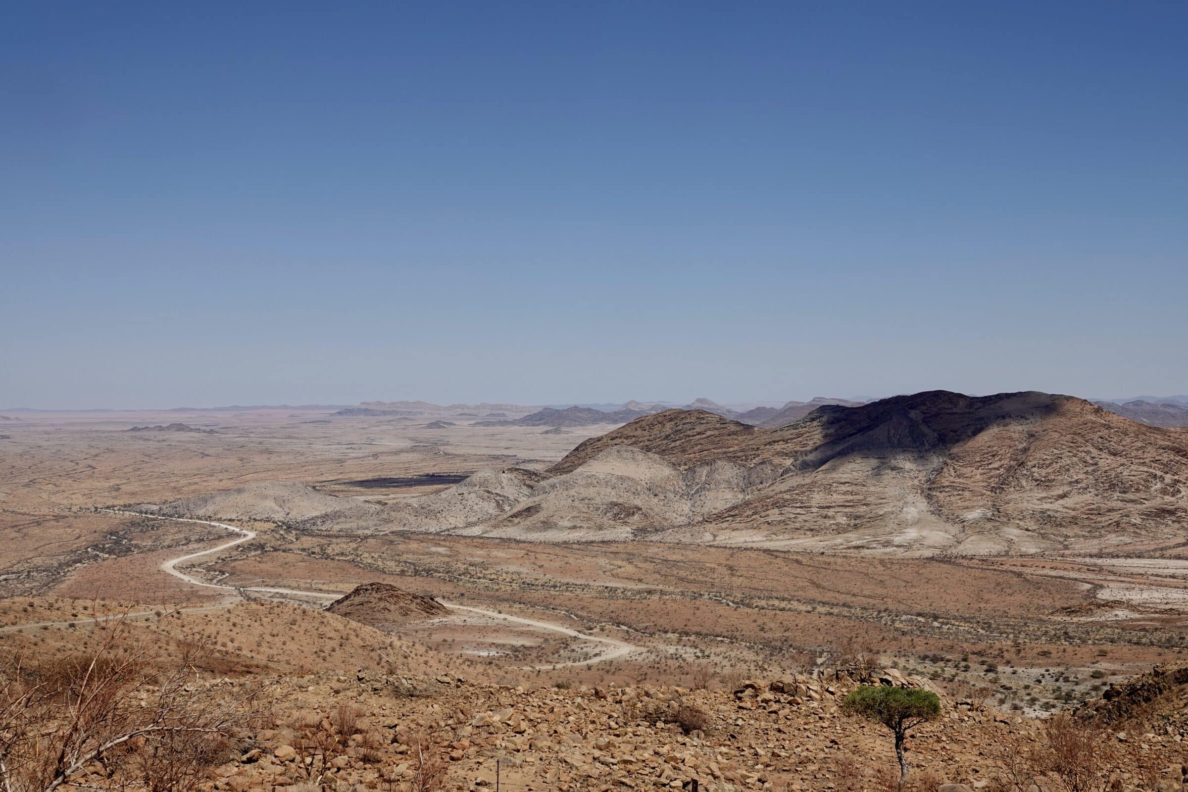
We gradually descend back to the “ground floor”, which is quite steep by the way. To prevent our 3,5 ton camper from running away, our brakes are having a hard time.
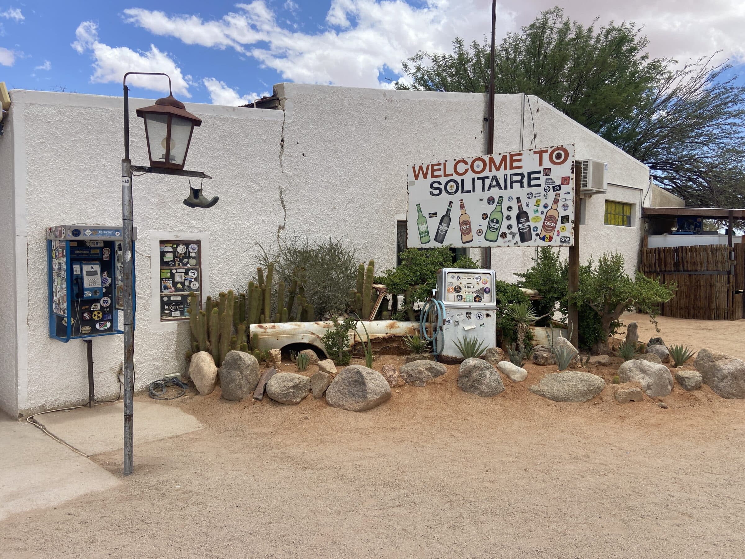
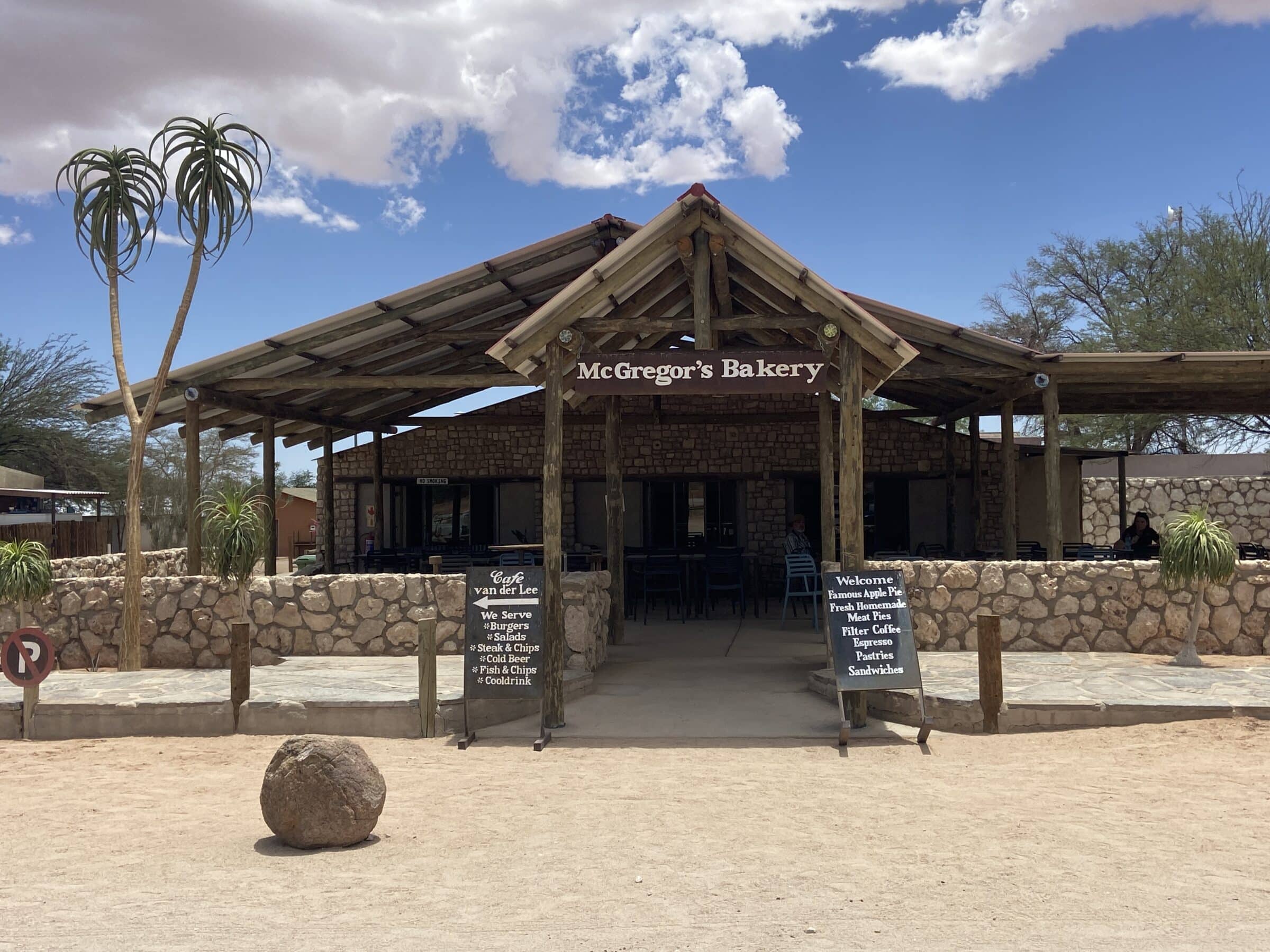
Then we turn onto the C14, back to Solitaire, a small settlement with a gas station, lodge and a cafe with delicious apple pie. The place, in the middle of nowhere, has become extremely popular among tourists because of a Dutchman who introduced apple pie there. It actually tastes delicious!
Then continue on the C14 towards Walvis Bay.
The gravel road is easy to drive on, yes, a bit corrugated here and there, but that shouldn't spoil the fun.
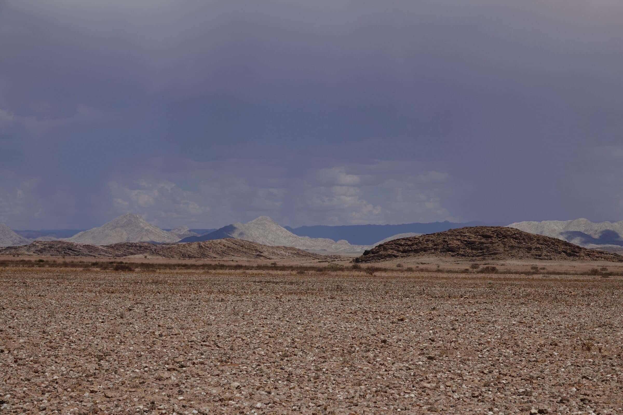
The mountains in the background are impressive. Different shapes, different colors…beautiful!
We ascend again and drive over a pass called “Gaub pass”. And take pictures again...
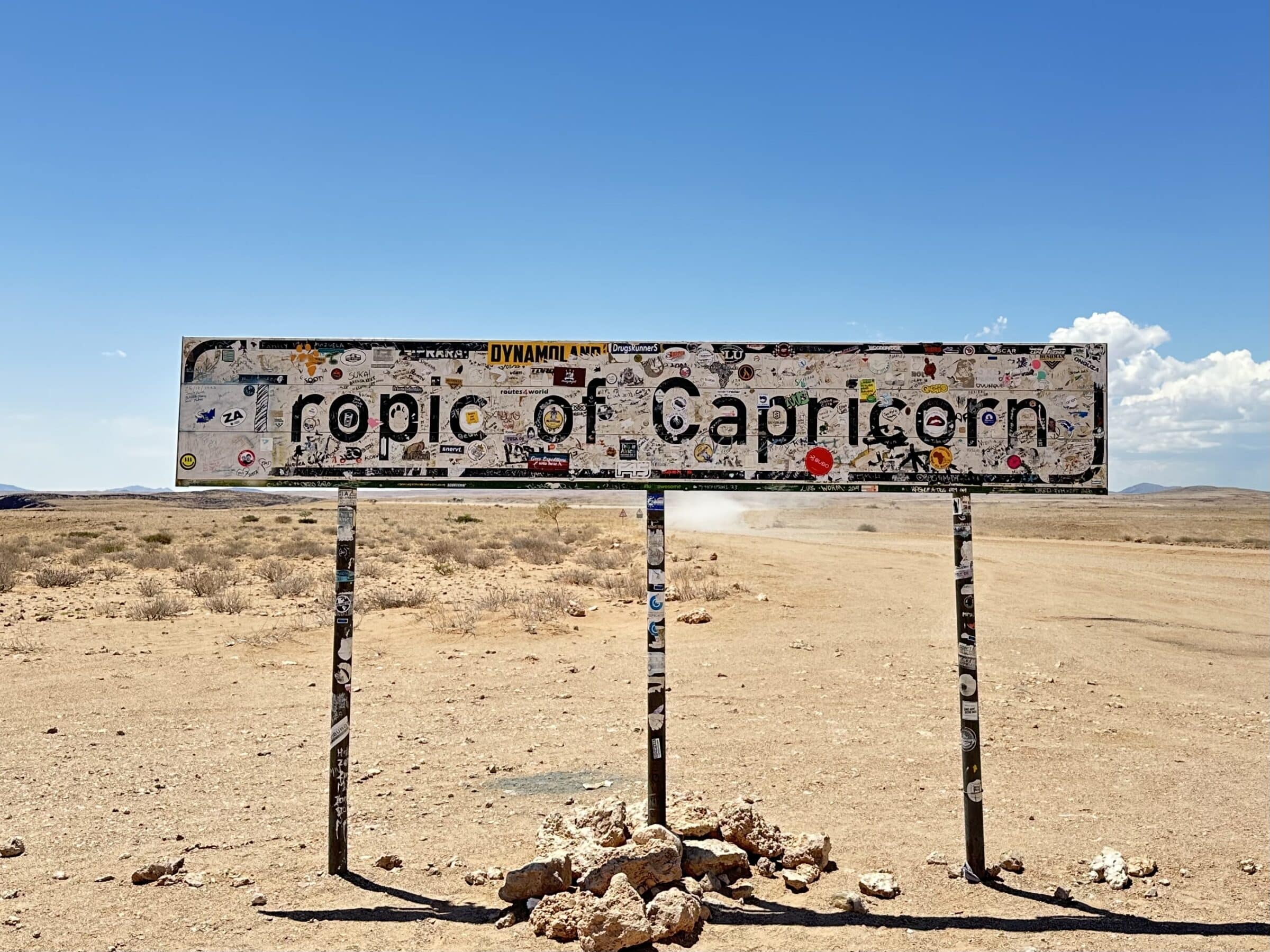
We pass the “Tropic of Capricorn”, the Tropic of Capricorn. This is the sun's maximum southern position, when it is the shortest day in the Northern Hemisphere.
Gradually the area becomes flatter with here and there protruding mountains against which dunes with red sand have formed.
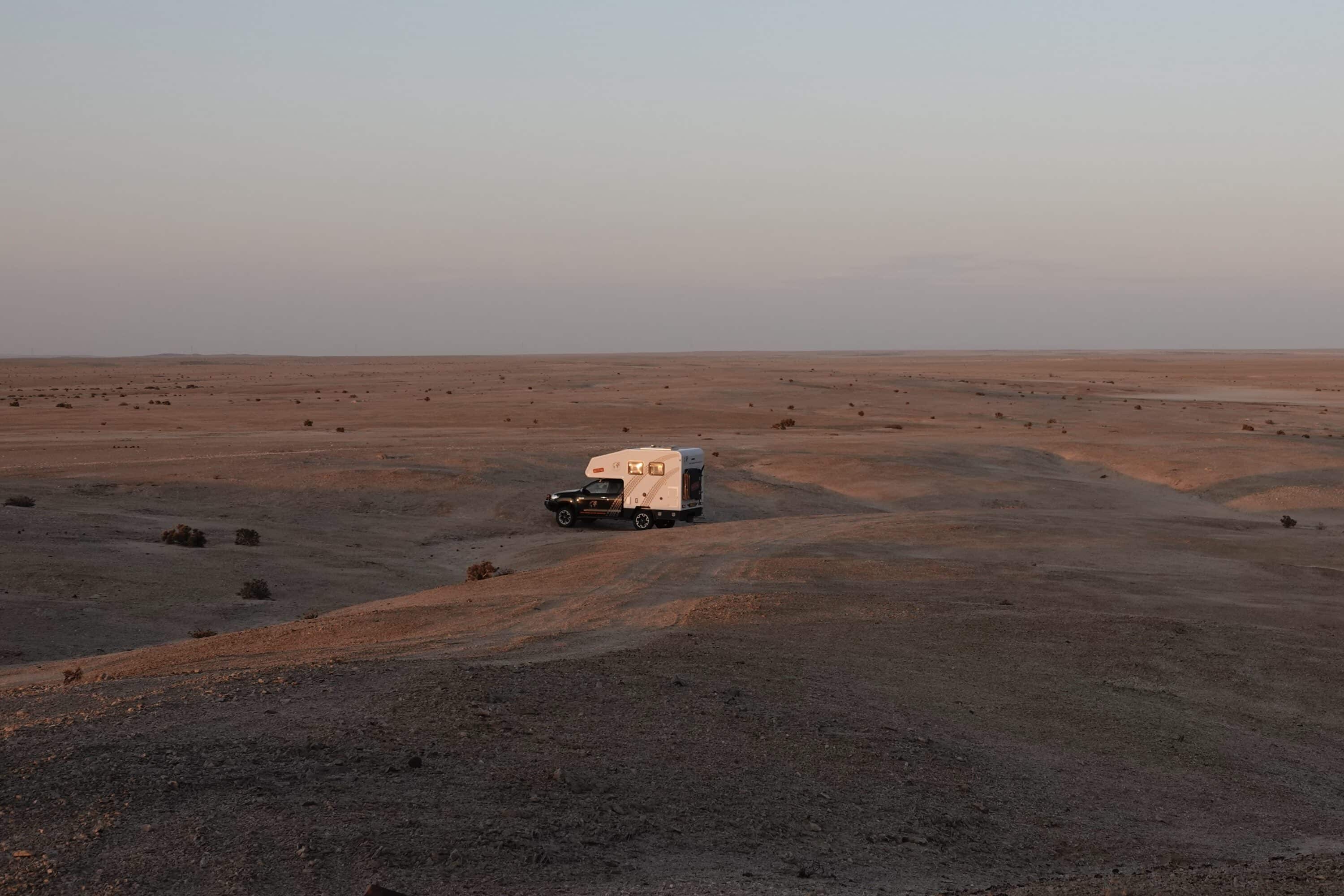
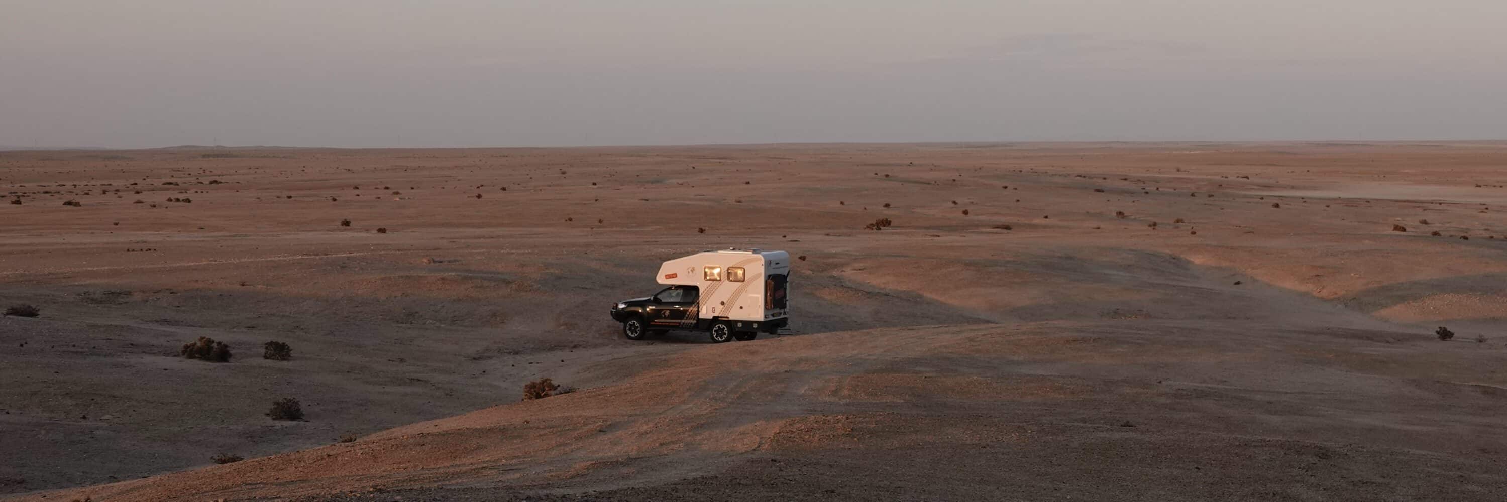
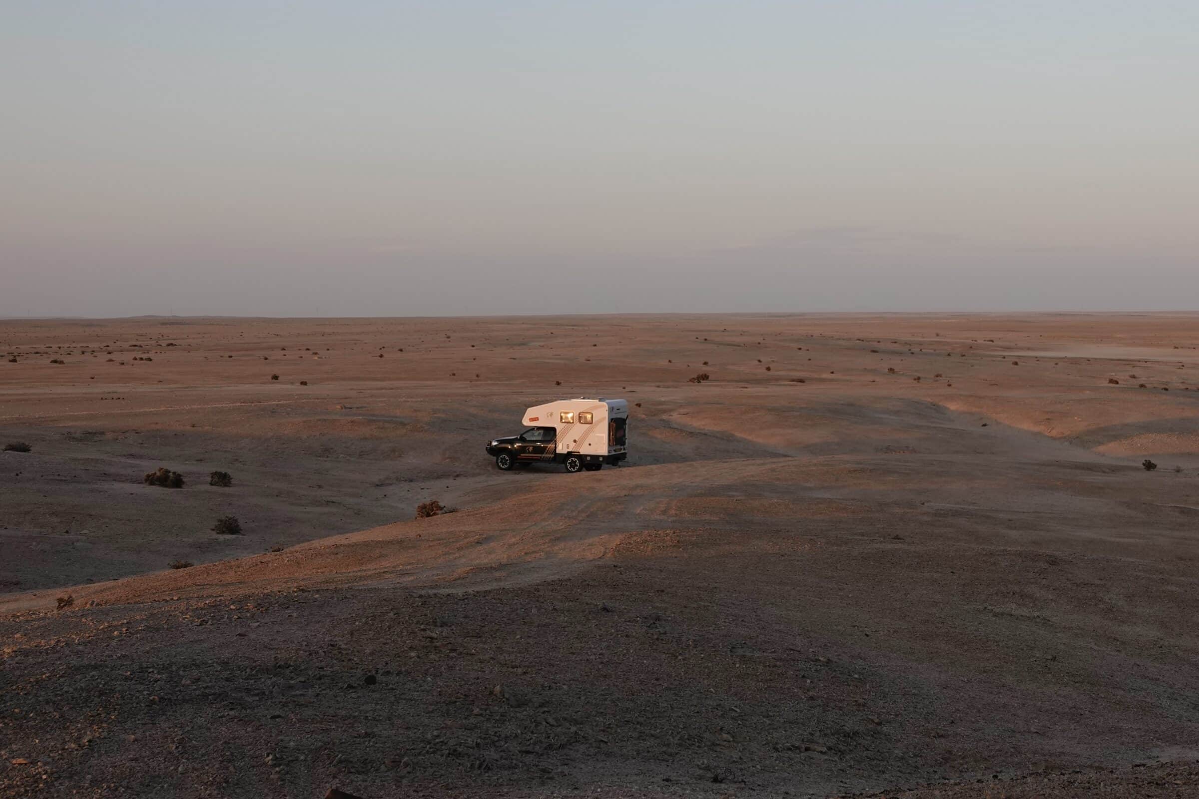
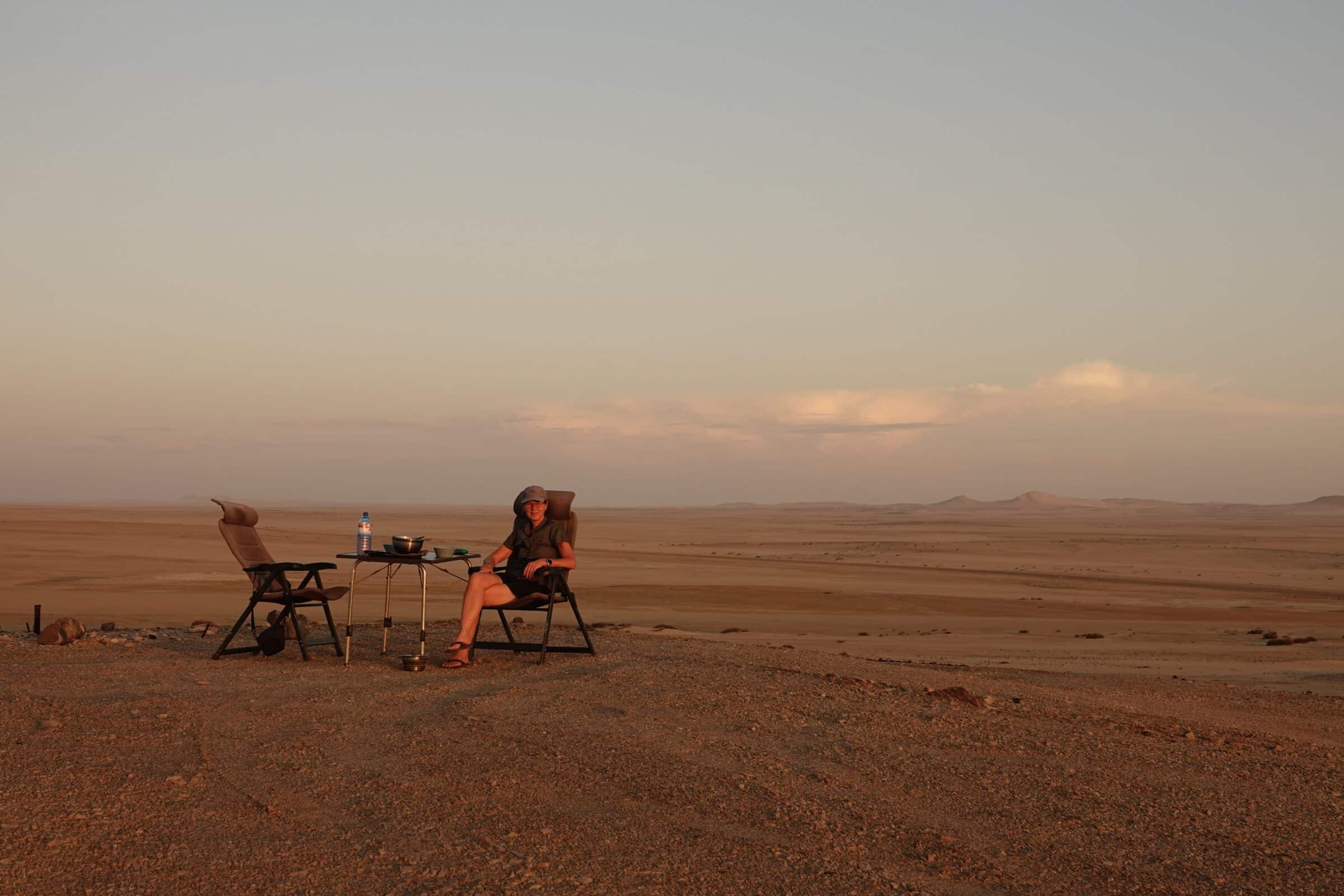
It takes us a little too long to reach Walvis Bay, so we turn right somewhere into the sand where, after a kilometer, we find a spot behind a hill in the middle of the desert for the night.
A beautiful place, on top of the hill we have a beautiful view and enjoy the sunset.
And when it is really dark, millions of stars appear in the sky. No light pollution here, seats in the reclined position!
Walvis Bay
We already knew that Namibia is popular among Germans. The coastal towns of Walvis Bay and Swakopmund are excellent examples of this. In Walvis Bay we spend the night at a campsite which is located in the middle of the residential area near the lagoon.
The straight numbered streets are called “roads” and the streets at right angles to them are called “streets”, following the American example.
The villas are straight and tightly plastered. German solidity is close by here.
Anyway, we enjoy the thousands of flamingos that line the boulevard in the shallow water. What a beautiful sight.
From the boulevard you have a view of the deep sea port where several large ships moor and there is even a cruise ship.
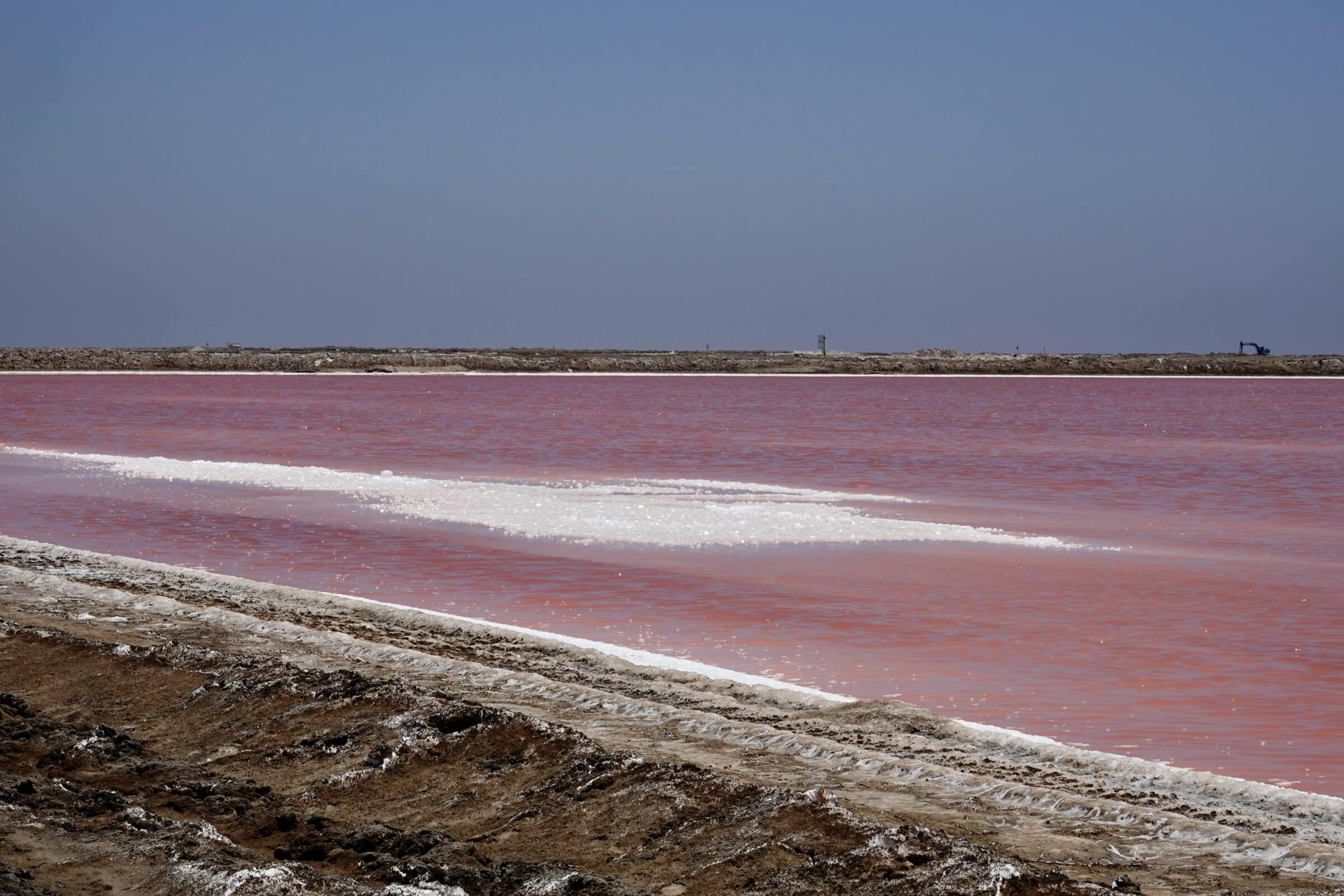
South of the city it is the salt industry that determines the horizon. Salt lakes that turn beautiful pink and salt humps that are as high as a church tower. Huge trucks full of salt drive back and forth.
Most tourists take a tour to Sandwich Harbour, which is about 50 kilometers south of Walvis Bay.
We definitely want to go there too, but will wait until a second visit here. We come back!
From Walvis Bay to Windhoek via the C28
From Walvis Bay we drive back to Windhoek. It will take us about 3 days. There are actually 3 routes you can take. We take the route with the most beautiful landscapes.
First we pass an area that looks a lot like a moon landscape, although we have not been there yet. Very special. Tourists from Swakopmund and their tour guides have also found this place. They all get out here and stand in line for a photo.
There is no one else a little further away, so we take our pictures there in peace.
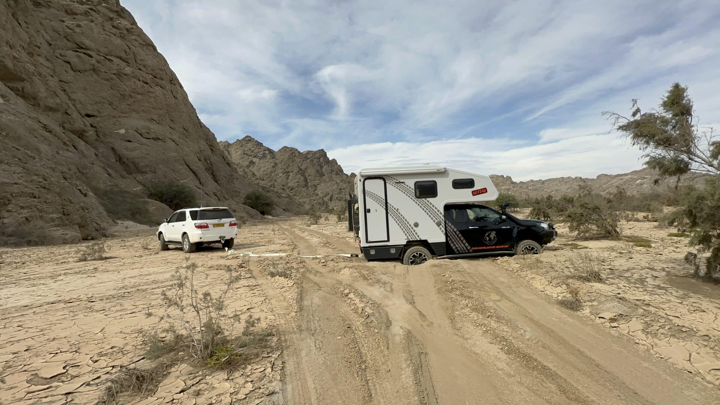
Stuck again
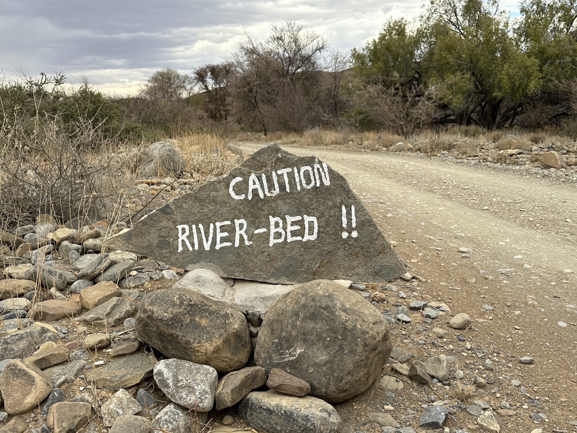
The landscapes sometimes change very quickly here. We get stuck in the sand near the “Flintstone caves”. The used paths are quite hard. But to turn around we had to go off the track for a while. That also seemed dried up and rock hard…
But that was the top, underneath there was only deep, loose sand.
Surprise, rock solid!
A passerby tried to help, but his car turned out to be too light. After half an hour of digging and with the help of our sand plates, we got loose again. A little further on we discovered a beautiful place for the night.
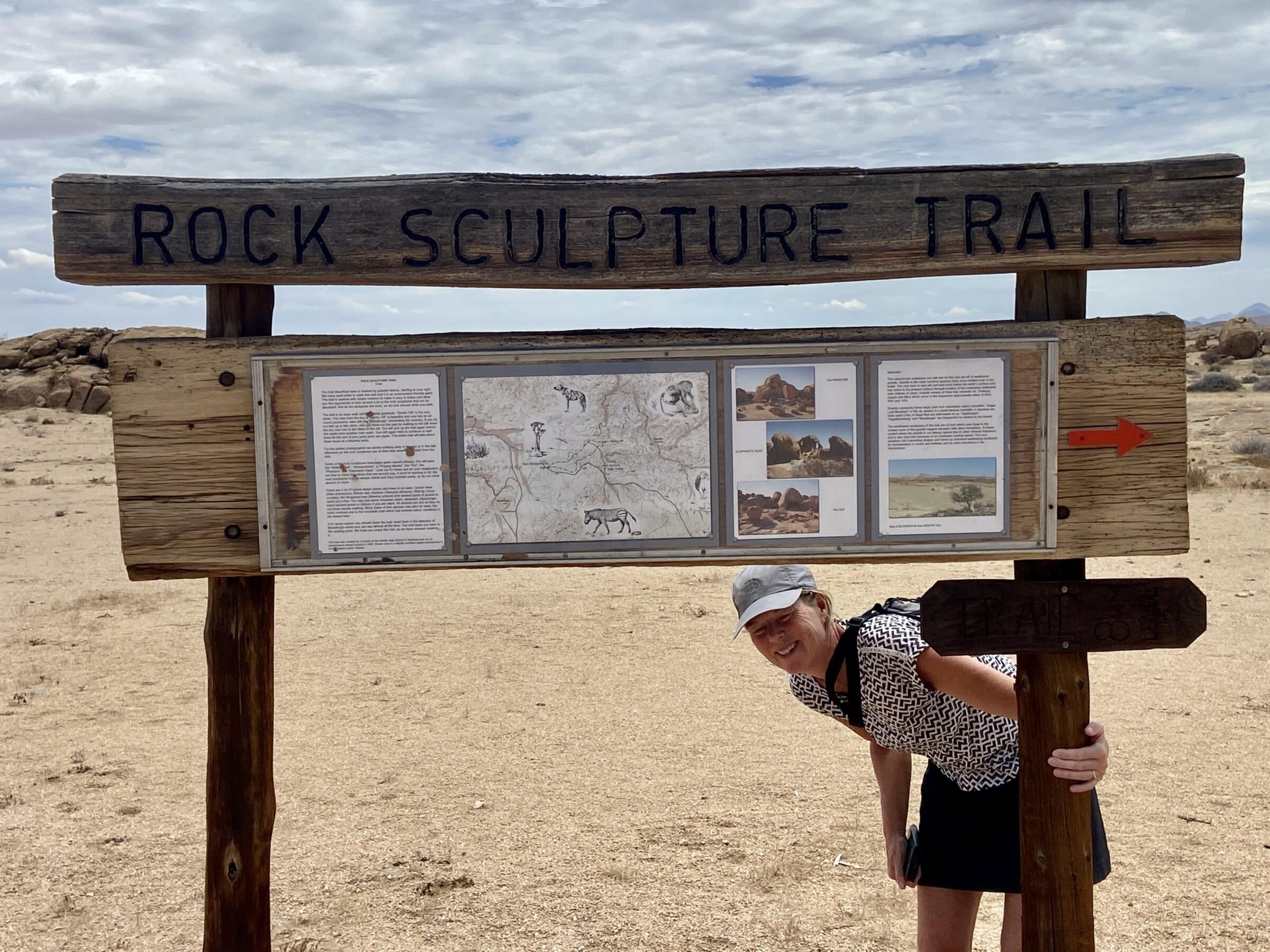
Rock Sculptures
The next morning we continue on the C28 to the starting point of a walk called “Rock Sculptures”. A beautiful walk where we once again see how erosion has left its mark.
By the way, it is hot, scorching hot, so to speak.
Fortunately, we have an outdoor shower at the camper so we can rinse off before continuing.
Walk: Rock Sculptures, 8 kilometers, a bit of climbing, easy to do. Officially you need a “permit” which you can get in Windhoek or Swakomund, we were naughty.
Bosua Pass
We continue our way again with breathtaking views towards Windhoek. For this we have to cross the Bosua Pass. And that is no punishment, once again we are rewarded with the most beautiful landscapes and views. At the highest point there is a viewpoint where we can also spend the night.
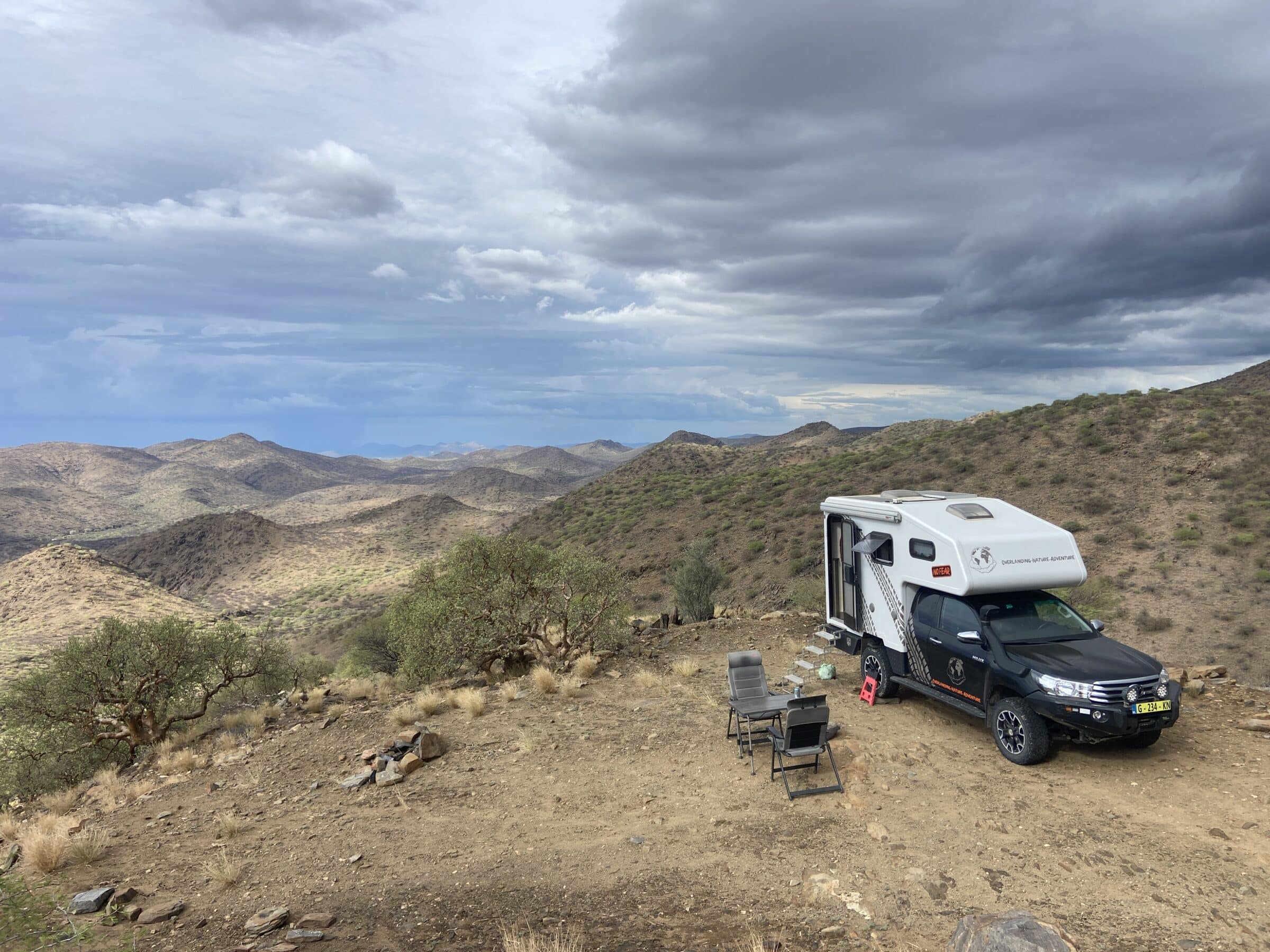
A great place with first-class views over the surrounding mountains. And so we reach Windhoek, where we meet Ben and Erna (previously met travel friends) and have a nice time with them.
In Windhoek we pick up our two sons and girlfriend Lisa from the airport and start part two of our trip through Namibia together. More about that later.
Also read: Preparation trip to Namibia | Best travel time, packing list and more
Are you thinking of following our footsteps and renting a 4x4 with roof tent or a camper with friends, partner or family? Then ask free of charge and without obligation submit a quote to Travelhome from ANWB. Travelhome offers both 4x4s with roof tents and full-fledged family campers.
- Best way to discover Namibia
- Independent or Customized
- Expert advice from specialists
- Full quote with no hidden costs