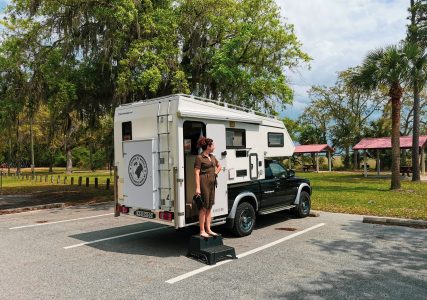
In the previous blogs you could read how I had to find out how we RV shipping to America, how I try a US visa for one year and what huge hurdles we had to overcome to get our motorhome in the US† Now that that is largely over, I can finally continue with the fun preparations! It is now time to think carefully about the route we are going to drive, taking into account the different climates and seasons and of course all the beautiful places and sights we would like to see. This is my attempt at the ultimate roadtrip route for America and Canada and yes, everyone can and should do it use for free!
Get help
You would think that a roadtrip preparing a route through America is a matter of what cities tick, let Google determine a route and hoppa! Go with that banana… This is how I usually do it, don't plan too much and just outline something. We'll see for the rest!
Unfortunately that is not possible for this trip, there are simply too many factors to take into account. In order to fully enjoy this trip, I have to put in the time. That is why I enlisted the help of experienced experts. People who have already done it, or even live there.
Dutch Overlanders
For example, in recent months I have spoken extensively with experienced travelers from the 'Dutch Overlanders' Facebook group. There are many here Dutch en Belgian overlanders with mostly well equipped 4×4 vehicles who have experience traveling in the US and Canada. They know the ropes when it comes to arranging paperwork, but also when it comes to safety, logical routes and things to see or do. Many useful and practical tips have already emerged from this, for which I am enormously grateful to everyone in the group?
Overland = traveling overland with a vehicle. With the primary goal of discovering places that are not always easily accessible.
Chris – Wereldreizigers.nl
Usually these are 4×4 / off-road vehicles that can handle any terrain and can continue where the roads stop.
Overland USA
Planning really gained momentum when I became a member of the 'Overland USA' Facebook group. This is a group of almost exclusively Americans who take 'overlanding' in their own country really seriously. Most of them have a 4×4 vehicle like me and love off-roading and off-grid camping.
I placed two calls in this group and I received many hundreds of responses to both calls with practical tips, scenic routes, off-road tracks, places to camp off-grid, places to avoid and yes, countless invitations to people's homes. Awesome!
Off-grid camping = Camping in the open air, often in (natural) areas far away from the crowd and without facilities.
Chris – Wereldreizigers.nl
You provide water, food, heat and electricity yourself, so you are not dependent on anyone.
Off-grid, completely off the grid.
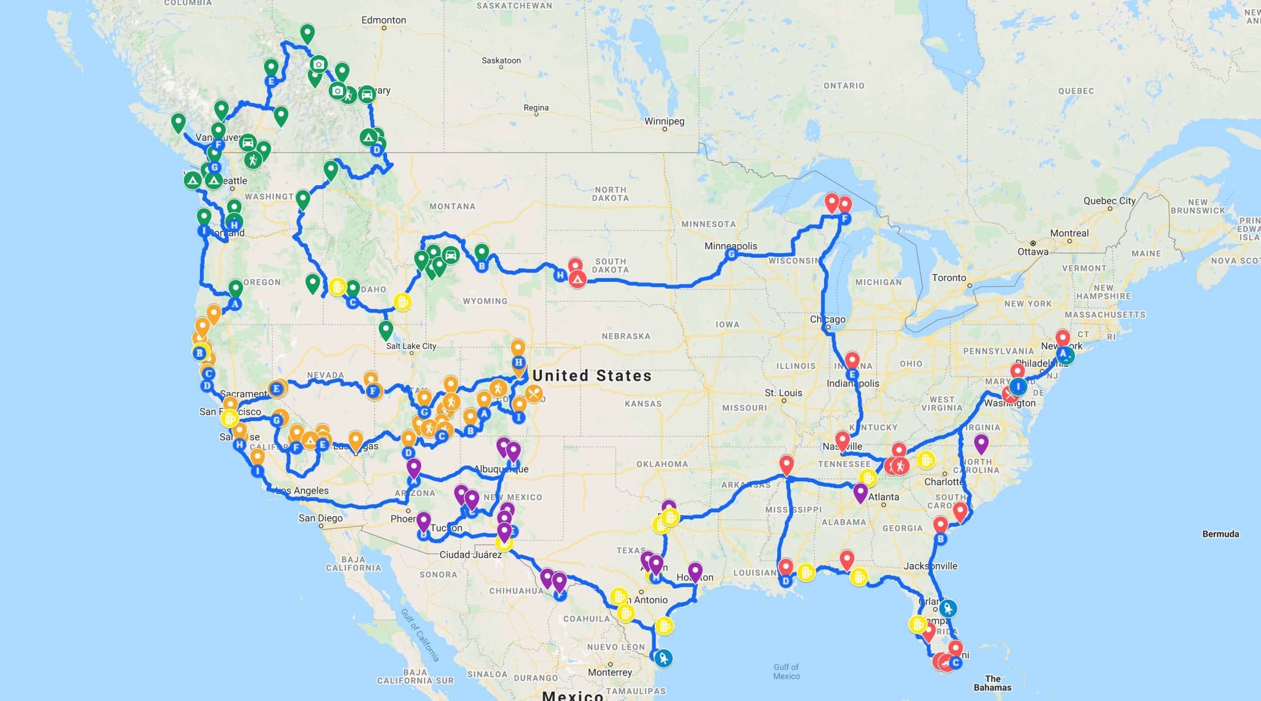
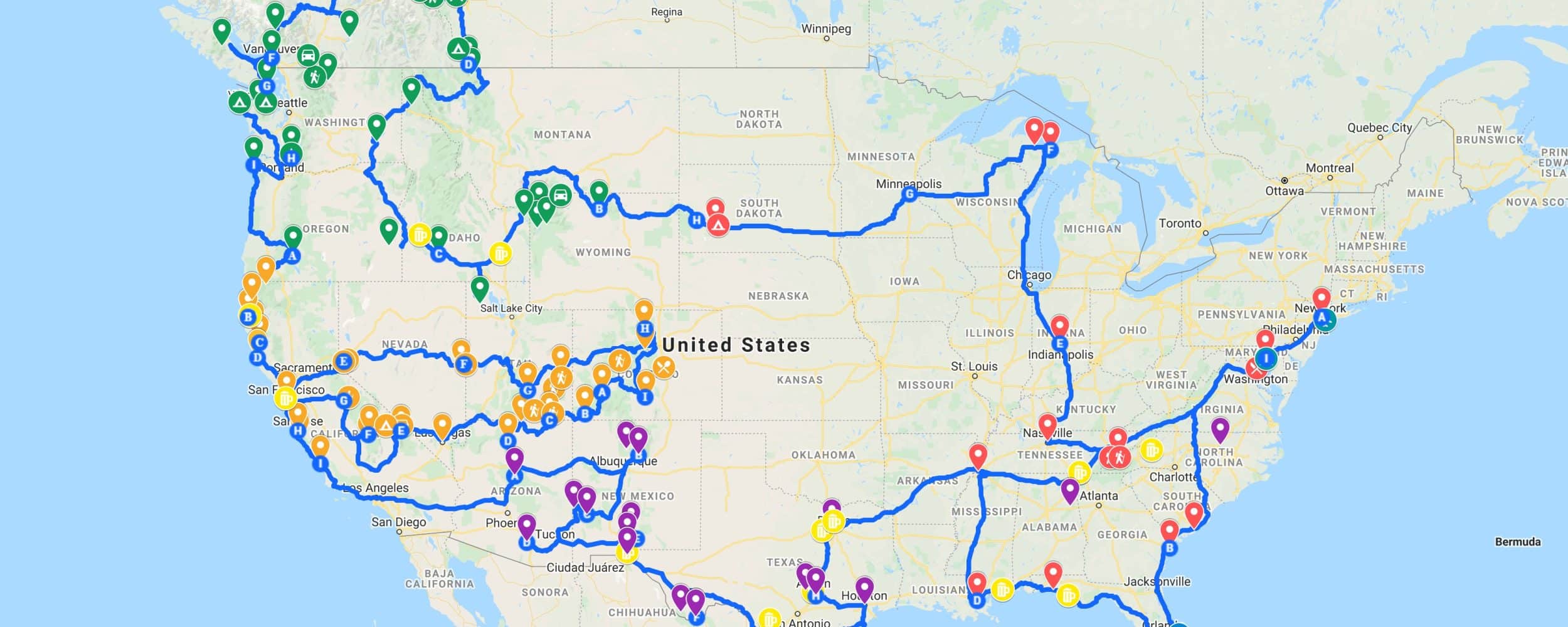
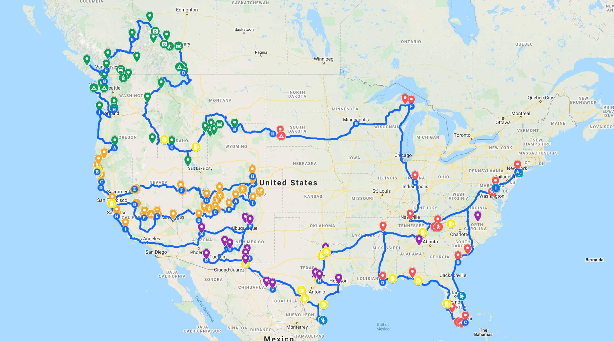
Below you can read the initial call back and below that the route that I had previously put together in a week. In 48 hours I received almost 500 responses to my message, I didn't see that coming!
People think it's great that a Dutchman takes on this crazy adventure in their beautiful country and they reacted really enthusiastically and helpfully.
So I decided to take all the tips & tricks of these experienced Americans for granted and started working with them. Believe it or not, it took me more than a full-time work week to process everyone's comments, personal messages, and tips into a logical roadtrip road.
In 5 days I processed everything in my self-made Google Map and planned routes. By the way, I made the card public for everyone to free to use† More info about that later in this article!
What to consider when planning
Just stand there, cross the whole US with your own 4×4 motorhome† Of course we have a year, but time and distance are not the only things we have to take into account. After I had read and saved all the tips, three important recurring topics came up…
- De gigantic distances that will be covered in this journey.
- Unemployment and (drugs)crime in certain areas.
- The climate in combination with the best travel time by state or region.
1. Gigantic distances
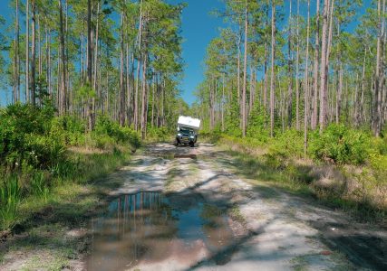
Let's start with the distances we're going to cover. Have you ever been to the south of France drove? Unpleasant Croatia or even to the south of Spain† Then you know how long it takes to drive 1000 or 1500 kilometers in 1 or 2 days. With a motorhome or caravan you may even spend 3 to 4 days. Those are tough rides.
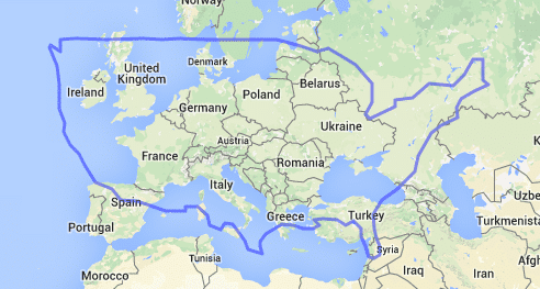
This kind of spicy rides can only bridge 1 or 2 states in the US. For example, the state of Texas already covers several European countries (photo below).
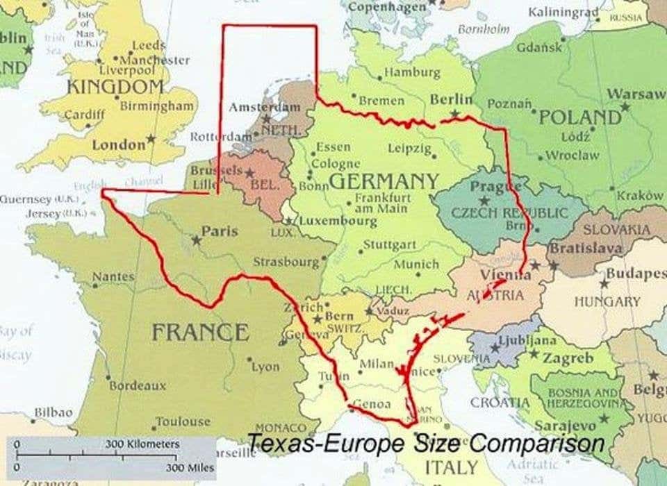
We Europeans just don't understand what we are dealing with! Fortunately, I've already traveled through Western America for a month in a camper, so I know a bit what to expect.
So the tone has been set. We're going to make miles! And that is why the route planning of our roadtrip flexible too – I've included a lot of tips in it, but I already know that I'm going to skip some parts because I don't want to be in the car 24/7. It's nice to always have a choice, every morning. That is why I have put together the route as completely as possible with all the trimmings. I simply grab the interactive map, see which hotspots are nearby and make a choice for that day. Delicious!
2. Unemployment and (drugs)crime
Another important, frequently recurring topic was the current situation in the US. Partly due to Covid-19, a lot of people have become unemployed in the past two years. Facilities in the United States are not as we are used to here in the Netherlands. Hundreds of thousands of people unexpectedly ended up on the streets in the past year with all the consequences that entails.
Crime rates have soared in the past two years. Especially in the big cities like Memphis, San Francisco, Chicago, Houston, Philadelphia, Washington and many others, many new bad neighborhoods have arisen. Many cities are also struggling with a new phenomenon, the so-called 'meth streets'. Several news channels have extensive reports with confrontational figures written about it, but unfortunately it doesn't stop there. Also in the Overlanding USA Facebook group I was warned by dozens of local people here.
What it really comes down to is that I am being urged to avoid the big cities as much as possible. So we are going to be extra careful this time…
3. Best time to visit | Weather, climate and seasons
The third and most discussed point in the call I made was about the weather, climate and seasons. Because America en Canada Being so gigantic and the weather and climate can vary enormously by state or region, the trip really has to be adapted to the different seasons. If you don't, there is a chance that you will be completely snowed in and that you will have to deal with a lot of natural disasters, misery and closed roads due to the bizarre winter conditions. You have to pay extra attention to this, especially in the north of America and in Canada.
People also gave countless tips for sights which I have added to the map. With the hundreds of tips I got, I started planning again and shared the route with the Overlanding USA group again.
Again there were countless reactions, but this time it was mainly praise for the complexity and completeness of the route. Many of them are now inspired to start using my route… I couldn't wish for a nicer compliment! ?
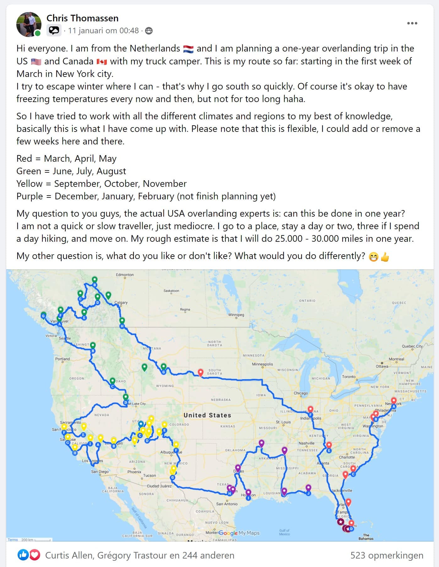
This is how I've planned it now, with a clear route that travels with the seasons as much as possible.
Red = March – April – May
Green = June – July – August
Orange = September – October – November
Violet = December – January – February
March April May
We start on March 1 in New York, because we arrive there by plane. This is definitely not the best travel time for this region, but about 10 days later we pick up our camper in the port of Baltimore near Washington. It just came out like this…
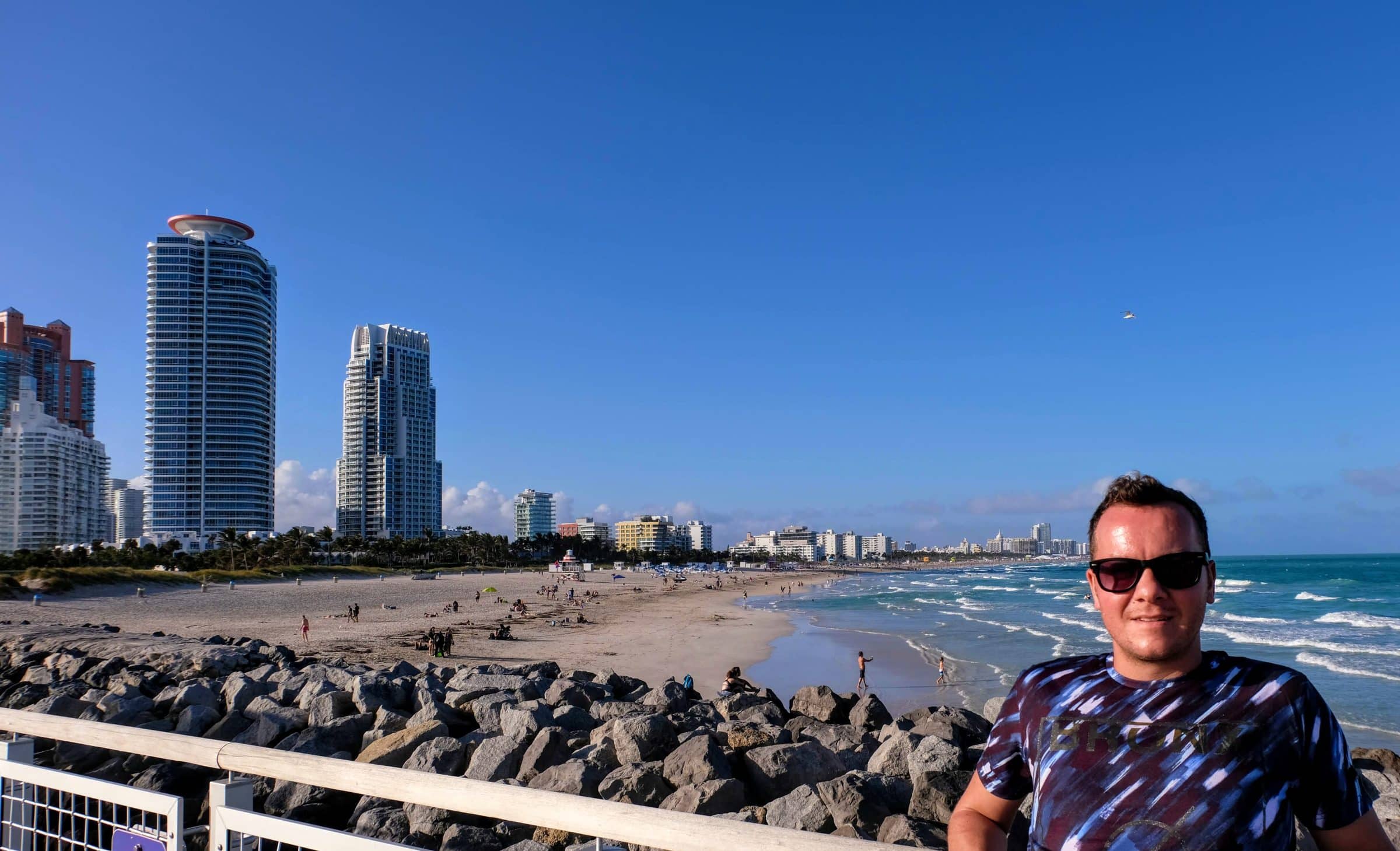
We then drive our RV (probably in a few days, weather permitting) all the way to Florida and Miami to escape the winter. The best time to travel to Florida and Miami are the cold months, because it is a wonderful place to stay. We have been there once in Florida earlier in February and it was excellent.
We then head west to New Orleans at the beginning of spring. From New Orleans we drive north through Mississippi, Alabama and Tennesee in May because it is already starting to get warmer in this region and nature is in full bloom.
Unfortunately, there is also a duller part: especially the last part of the red part will be a lot of mileage. We want to start on the green part in June so that we can fully enjoy all the beautiful nature parks in the north in the summer months.
If necessary, we can skip the big detour to the Great Lakes near Chicago and Boston by taking a shorter route. However, this was discouraged by many Americans because according to the experts Illinois, Iowa, Missouri and Nebraska are literally thousands and thousands of boring miles with the occasional large corn or wheat plantation. They say that if you have the time, better drive a thousand miles through Wisconsin and Minnesota, which they say are beautiful.
June July August
Last time we had to skip Yellowstone National Park due to heavy snowfall in November, this time we want to make sure it's passable for us. The best time to travel to Yellowstone is May to September. That is why we are starting the green part in June. After Yellowstone and the surrounding area we drive into Canada to discover western Canada during the summer months.
After visiting the various national parks, we also want to spend a week or two on Vancouver Island to go whale watching. There too, whale watching, especially the Orca's / Killer Whales, is restricted to certain months (April to October). So it all has to fit exactly into the planning with the best travel time per region in mind. By the way, there are many other whales to see in this region, do you remember this video from our facebook page?
September October November
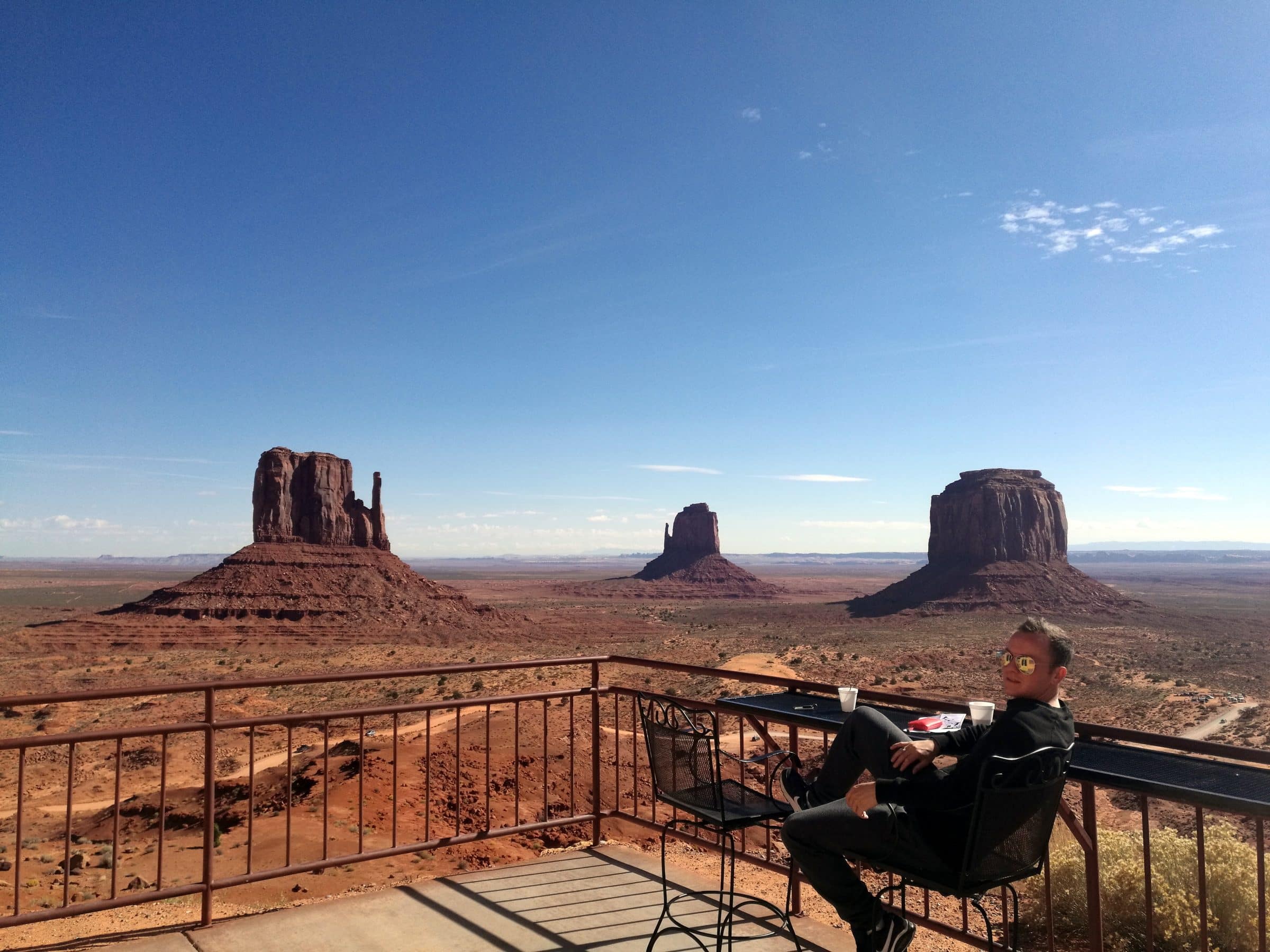
When fall arrives, we drive south from Canada via the famed North Pacific Ocean Road / Highway 1, to the orange section. This is the most touristy part of America. San Francisco, Los Angeles, Las Vegas and of course the mega-popular natural parks like the Grand Canyon, Yosemite, Death Valley and more.
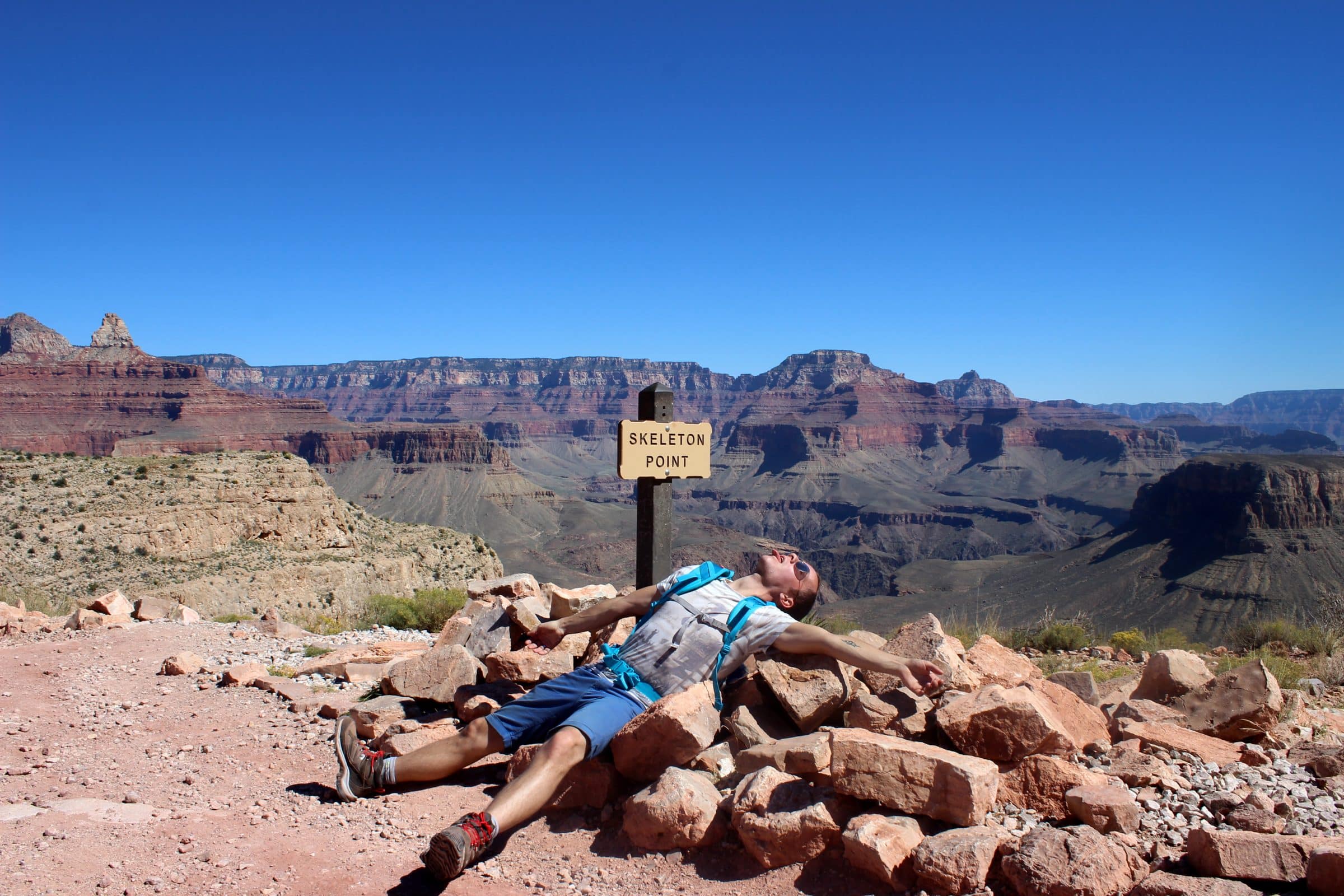
September and October are the best travel months for this region as it is not extremely hot. We have been there before and in our opinion this is really the best travel time for this area. During the day you can count on a lot of sun, with temperatures between 15 and 25 degrees. at night it can cool down considerably, especially in the higher areas and in the deserts. The mercury regularly dropped to just below 0 so make sure to dress appropriately!
September, October and November are also the best travel times for this region (Western America), because it is a lot less crowded compared to the summer ... During the summer holidays, take into account extreme crowds, hundreds of tour buses, full parking spaces and large waiting times at the national parks.
The joker for this region is the state of Colorado. Whether we can still properly discover the state of Colorado in the months of October and November remains to be seen. Large parts of this state are at a considerable height and winter can strike early there. The best time to travel to Colorado is the late summer months. The orange part of this trip will therefore be extra flexible because we have already seen most of it and because we are highly dependent on the weather. Time will tell!
December – January – February
Winter is coming so we move on to the south. Overlanders USA gave me a lot of tips to discover Arizona, New Mexico and Texas. These areas are generally easy to travel with with comfortable winter temperatures, with exceptions of course. Texas is really huge and we actually want to use the whole month of January for this state. We will also decide during this period whether we want to continue traveling longer – who knows… We can then decide to drive into Mexico from here or perhaps to sell our camper to someone who wants to make a similar trip. Or we'll drive it back to the East Coast in February to ship it back home. We'll see!
Interactive Roadtrip Route Map – USA & Canada
Earlier in this article you saw some screenshots of my work on the Google Map, but you can also work with it yourself! Because I have been helped by so many different people and received countless tips from everyone, I also want to give something back. You can use the interactive roadtrip view, copy and adjust the card yourself. You can also just use a small portion for your own trip!
Tip # 1: Below is again the map legend.
Tip # 2: Use the full-screen mode, then you can view everything much better.
Tip # 3: It's still a work in progress! So many things will be added, for example nice places to camp, restaurants, hiking trails, etc. etc.
Tip # 4: If you want to make a copy for your own use, follow this link (only works on laptop or PC)
Red = March – April – May
Green = June – July – August
Orange = September – October – November
Violet = December – January – February
? beer icon = invitation at people's homes or invitation for fun
? ♂️ walking icon = National park or hiking route
? car icon = Scenic drive – mostly off-road
? Knife and fork = Recommended restaurant
? Rocket ship = NASA or SpaceX base (I want to see a launch! Bucket list thingy…)
(I.e. Tent = Place for (wild) camping
It should be noted that the whole planning is quite loose. After all, we are traveling and depending on the weather or whatever, we could just stay somewhere for a few weeks shorter or longer. It is therefore more intended as the common thread of the journey. We want to do a round in one year and the mapped out route will help us stay somewhat on schedule.
Footnote: especially the first three months (the red part) we will drive relatively much because we have to travel from South to North and from East to West. After that it will be a bit quieter and especially visiting many parks, hiking, wild camping in nature, etc.
Articles we wrote about this trip:
The preparation:
- Tour America | Ship camper
- Tour America | Insure motorhome
- Tour America | Apply for ESTA
- Tour America | Visa (6-12 months)
- Tour America | Prepare itinerary
Highlights and itineraries:
- Tour America | East coast
- Tour America | West coast
- Tour America | East Coast vs. West coast
- Tour America | Highlights of the West
- Tour America | Million Dollar Highway
- Tour America | 100 days of traveling in a motorhome
- Tour America | 250 days of traveling in a motorhome
Cities and sights (AZ):
- Tour America | Amelia City
- Tour America | Amelia Island
- Tour America | Annapolis
- Tour America | Ice Lake Trail
- Tour America | Kennedy Space Centre
- Tour America | KeyWest
- Tour America | Miami
- Tour America | New York City
- Tour America | Ouray
- Tour America | Salt Lake City
- Tour America | Savannah
- Tour America | Seattle
- Tour America | Silverton
- Tour America | St Augustine
- Tour America | Starbase SpaceX complex in Texas
- Tour America | Washington DC
- Tour America | Wynwood
National Parks and Monuments (AZ):
- Tour America | All National Parks (list)
- Tour America | Black Canyon of the Gunnison
- Tour America | Death Valley
- Tour America | Dinosaur
- Tour America | Everglades
- Tour America | Glacier
- Tour America | Grand Canyon (helicopter tour)
- Tour America | Grand Teton
- Tour America | Great Sand Dunes
- Tour America | Mesa Verde
- Tour America | Rock Mountain
- Tour America | Yellowstone
- Tour America | Yosemite
Closing comments
What do you think of our route? Or have you been inspired to drive (part of) our route yourself? Feel free to use our example and if you have any questions feel free to ask in the comments. Until the next blog!